STS033-79-25
| NASA Photo ID | STS033-79-25 |
| Focal Length | 250mm |
| Date taken | 1989.11.24 |
| Time taken | 01:51:32 GMT |

Cloud masks available for this image:
Spacecraft nadir point: 20.2° S, 118.7° E
Photo center point: 20.0° S, 119.5° E
Photo center point by machine learning:
Photo center point: 20.0° S, 119.5° E
Photo center point by machine learning:
Nadir to Photo Center: East
Spacecraft Altitude: 230 nautical miles (426km)
Country or Geographic Name: | AUSTRALIA-WA |
Features: | POISSONNIER POINT |
| Features Found Using Machine Learning: | |
Cloud Cover Percentage: | 10 (1-10)% |
Sun Elevation Angle: | 62° |
Sun Azimuth: | 96° |
Camera: | Hasselblad |
Focal Length: | 250mm |
Camera Tilt: | 12 degrees |
Format: | 5017: Kodak, natural color positive, Ektachrome, X Professional, ASA 64, standard base |
Film Exposure: | Normal |
| Additional Information | |
| Width | Height | Annotated | Cropped | Purpose | Links |
|---|---|---|---|---|---|
| 5700 pixels | 5900 pixels | No | No | Download Image | |
| 500 pixels | 518 pixels | No | No | Download Image | |
| 640 pixels | 480 pixels | No | No | Download Image |
Download Packaged File
Download a Google Earth KML for this Image
View photo footprint information
Download a GeoTIFF for this photo
Image Caption:
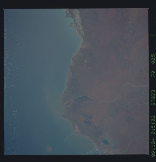
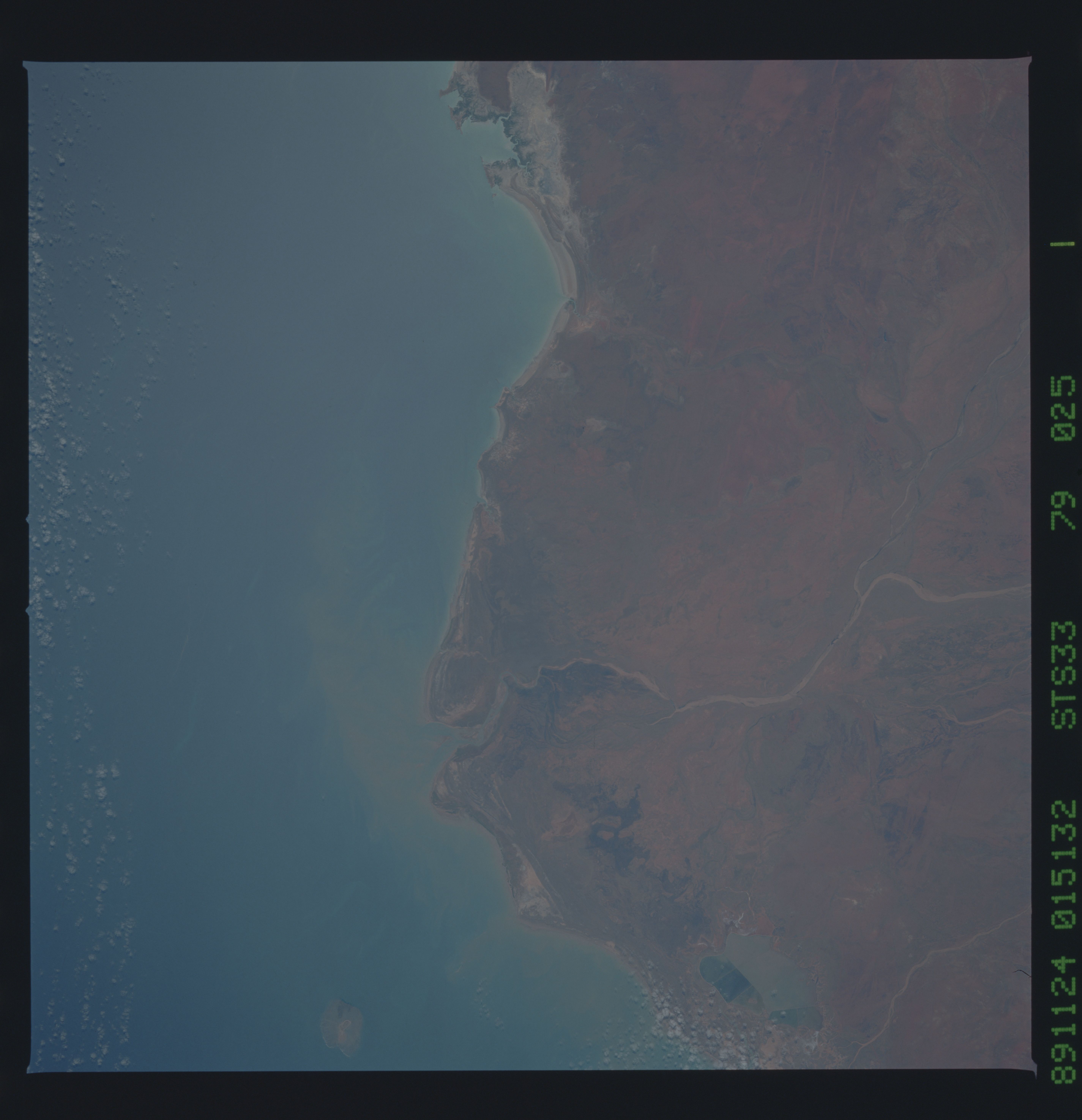
Poissonnier Point
Poissonnier Point is shown on this near-vertical view taken in
November 1989. This stretch of the western Australian coast can
be used as a good landmark on approach to the northeastern por-
tion of the Hamersley/Pilbara site. The sediment load of the De-
Grey River (1), is building a delta out into the small estuary
and the Indian Ocean. Likewise, Poissonnier Point is the end of
an old delta. The remnants of the Ord Ranges (2) can be seen to
the west of the DeGrey River. Cape Keraudren (3) is visible at
the right center of the view. (S33-79-025)
