STS033-79-18
| NASA Photo ID | STS033-79-18 |
| Focal Length | 250mm |
| Date taken | 1989.11.24 |
| Time taken | 01:49:37 GMT |
Resolutions offered for this image:
5266 x 5266 pixels 639 x 639 pixels 5700 x 5900 pixels 500 x 518 pixels 640 x 480 pixels
5266 x 5266 pixels 639 x 639 pixels 5700 x 5900 pixels 500 x 518 pixels 640 x 480 pixels


Cloud masks available for this image:
Spacecraft nadir point: 22.7° S, 111.7° E
Photo center point: 24.0° S, 113.5° E
Photo center point by machine learning:
Photo center point: 24.0° S, 113.5° E
Photo center point by machine learning:
Nadir to Photo Center: Southeast
Spacecraft Altitude: 241 nautical miles (446km)
Country or Geographic Name: | AUSTRALIA-WA |
Features: | LAKE MCLEOD |
| Features Found Using Machine Learning: | |
Cloud Cover Percentage: | 0 (no clouds present) |
Sun Elevation Angle: | 55° |
Sun Azimuth: | 94° |
Camera: | Hasselblad |
Focal Length: | 250mm |
Camera Tilt: | 29 degrees |
Format: | 5017: Kodak, natural color positive, Ektachrome, X Professional, ASA 64, standard base |
Film Exposure: | Normal |
| Additional Information | |
| Width | Height | Annotated | Cropped | Purpose | Links |
|---|---|---|---|---|---|
| 5266 pixels | 5266 pixels | No | No | Earth From Space collection | Download Image |
| 639 pixels | 639 pixels | No | No | Earth From Space collection | Download Image |
| 5700 pixels | 5900 pixels | No | No | Download Image | |
| 500 pixels | 518 pixels | No | No | Download Image | |
| 640 pixels | 480 pixels | No | No | Download Image |
Download Packaged File
Download a Google Earth KML for this Image
View photo footprint information
Download a GeoTIFF for this photo
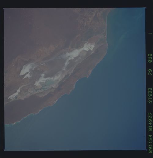
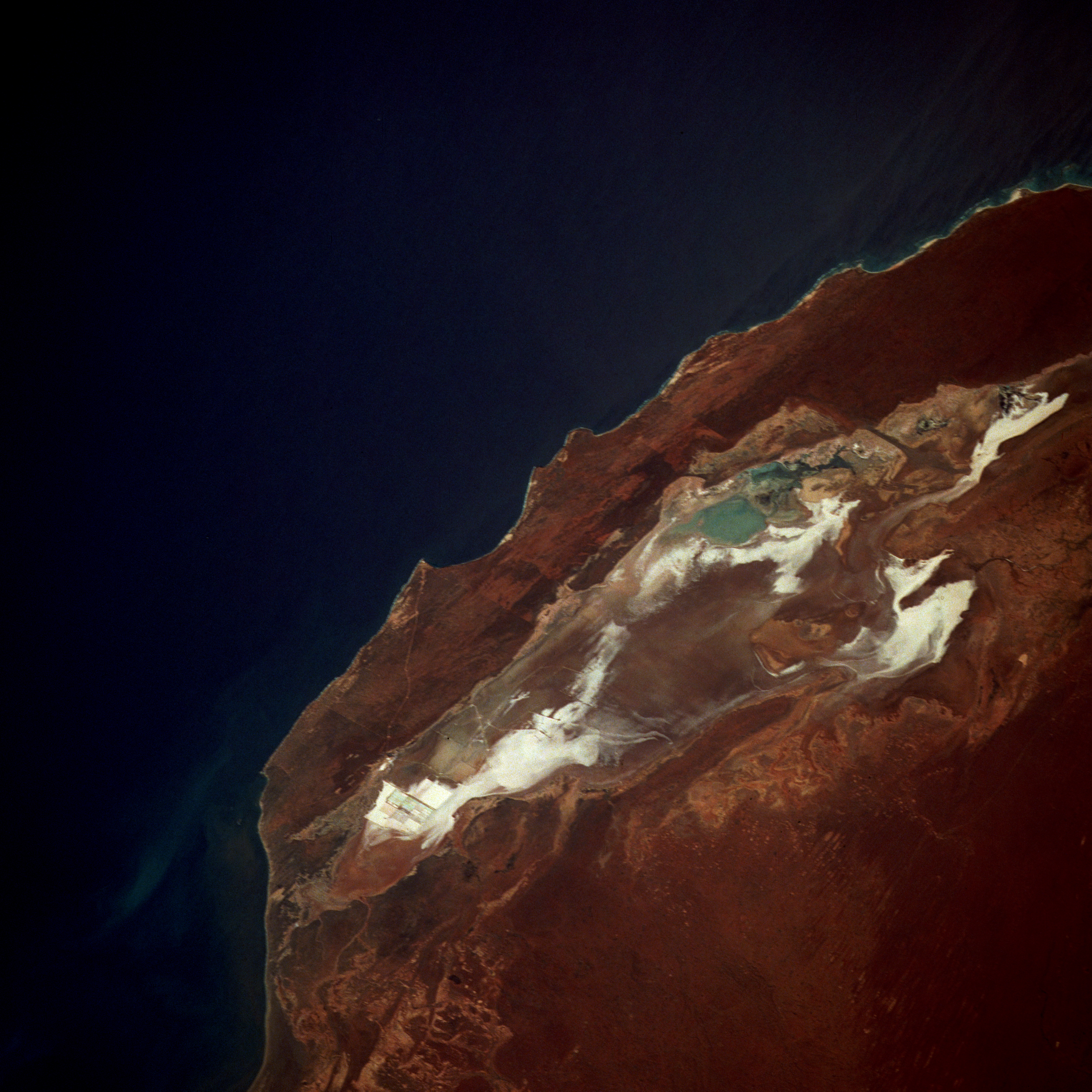
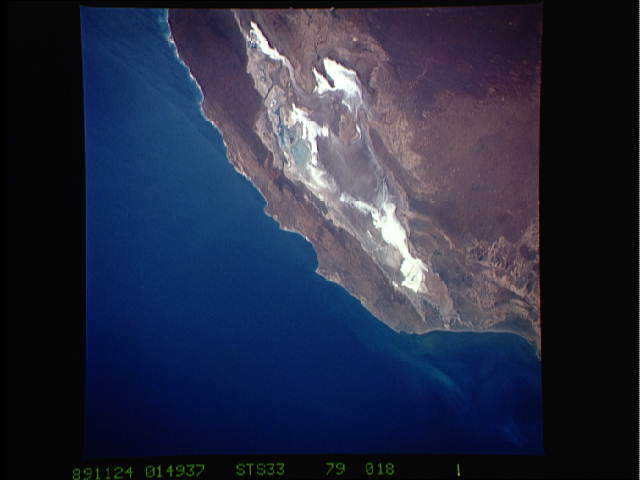
Image Caption: STS033-079-018 Lake Macleod, Western Australia, Australia November 1989
Located north of the small coastal city of Carnarvon, estimated population 7200, Lake Macleod is the westernmost lake in Western Australia. Climatically, this part of Western Australia is greatly influenced by the north-flowing Western Australian current that brings cool water northward from Antarctica, which is not conducive to producing inland precipitation. This cool offshore current, coupled with a very flat coastal plain, contributes to the near-desert-like conditions along the coastal region as evidenced by the brown landscape around the lake and the highly reflective salt beds within the lake. The low point in the lake appears to be near the northern end where the light blues indicate some standing water. Close inspection discloses very faint lines at the southernmost end of Lake Macleod where large evaporation beds are used for the production of high-quality salt. Dirk Hartog, a Dutchman, made the first authenticated landing by a European along this coastline in 1616. Early explorers recorded phenomenal tidal ranges along this coastal area.
Located north of the small coastal city of Carnarvon, estimated population 7200, Lake Macleod is the westernmost lake in Western Australia. Climatically, this part of Western Australia is greatly influenced by the north-flowing Western Australian current that brings cool water northward from Antarctica, which is not conducive to producing inland precipitation. This cool offshore current, coupled with a very flat coastal plain, contributes to the near-desert-like conditions along the coastal region as evidenced by the brown landscape around the lake and the highly reflective salt beds within the lake. The low point in the lake appears to be near the northern end where the light blues indicate some standing water. Close inspection discloses very faint lines at the southernmost end of Lake Macleod where large evaporation beds are used for the production of high-quality salt. Dirk Hartog, a Dutchman, made the first authenticated landing by a European along this coastline in 1616. Early explorers recorded phenomenal tidal ranges along this coastal area.
