STS033-73-97
| NASA Photo ID | STS033-73-97 |
| Focal Length | 250mm |
| Date taken | 1989.11.24 |
| Time taken | 00:15:27 GMT |
Resolutions offered for this image:
5266 x 5266 pixels 639 x 639 pixels 5700 x 5900 pixels 500 x 518 pixels 640 x 480 pixels
5266 x 5266 pixels 639 x 639 pixels 5700 x 5900 pixels 500 x 518 pixels 640 x 480 pixels


Cloud masks available for this image:
Spacecraft nadir point: 24.7° S, 128.1° E
Photo center point: 22.5° S, 128.5° E
Photo center point by machine learning:
Photo center point: 22.5° S, 128.5° E
Photo center point by machine learning:
Nadir to Photo Center: North
Spacecraft Altitude: 251 nautical miles (465km)
Country or Geographic Name: | AUSTRALIA-WA |
Features: | LAKE MACKAY |
| Features Found Using Machine Learning: | |
Cloud Cover Percentage: | 0 (no clouds present) |
Sun Elevation Angle: | 49° |
Sun Azimuth: | 94° |
Camera: | Hasselblad |
Focal Length: | 250mm |
Camera Tilt: | 28 degrees |
Format: | 5017: Kodak, natural color positive, Ektachrome, X Professional, ASA 64, standard base |
Film Exposure: | Normal |
| Additional Information | |
| Width | Height | Annotated | Cropped | Purpose | Links |
|---|---|---|---|---|---|
| 5266 pixels | 5266 pixels | No | No | Earth From Space collection | Download Image |
| 639 pixels | 639 pixels | No | No | Earth From Space collection | Download Image |
| 5700 pixels | 5900 pixels | No | No | Download Image | |
| 500 pixels | 518 pixels | No | No | Download Image | |
| 640 pixels | 480 pixels | No | No | Download Image |
Download Packaged File
Download a Google Earth KML for this Image
View photo footprint information
Download a GeoTIFF for this photo
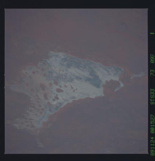
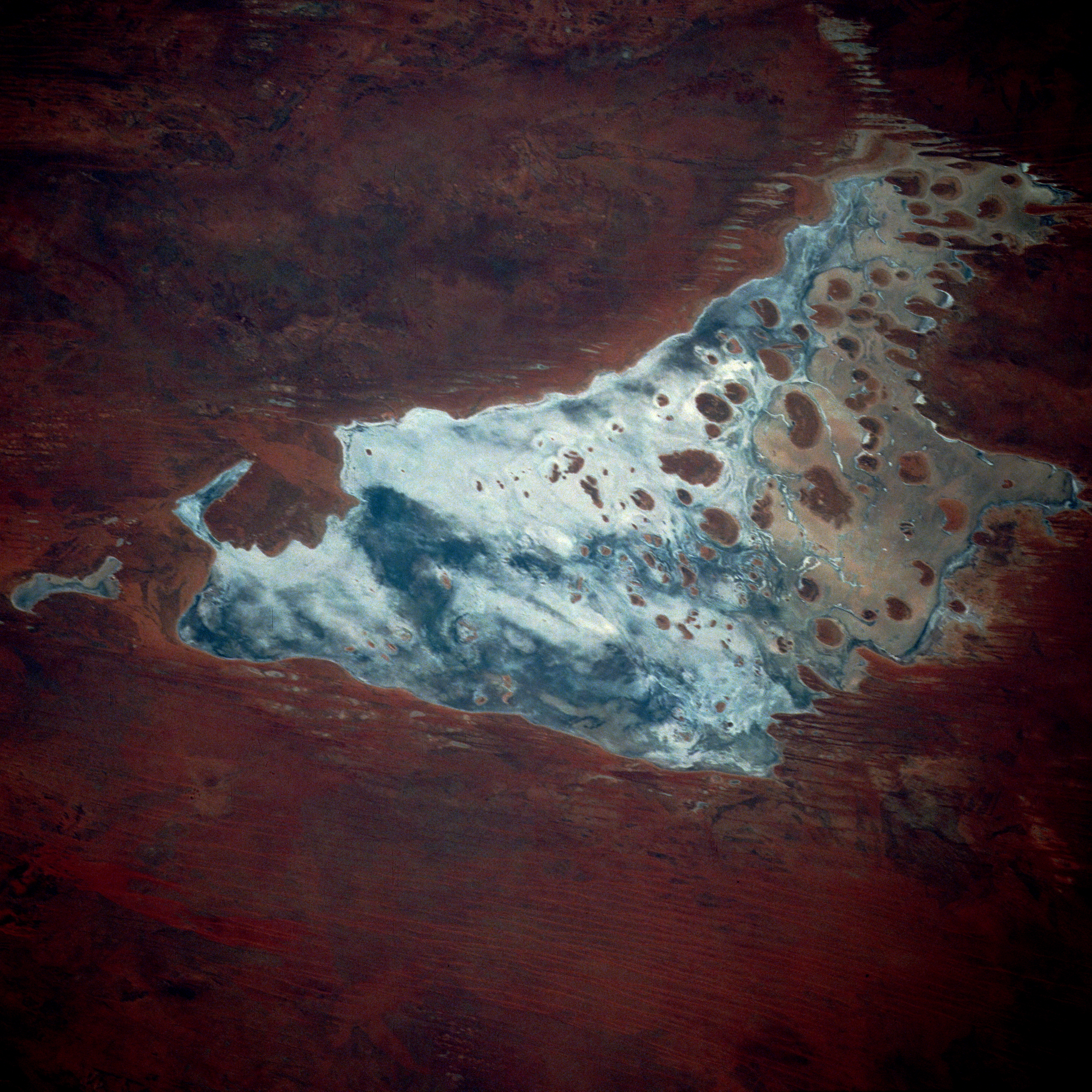
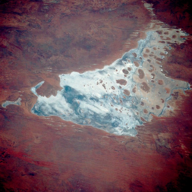
Image Caption: STS033-073-097 Lake Mackay, Western Australia, Australia November 1989
Lake Mackay is one of hundreds of dry lakebeds scattered throughout Western Australia and the Northern Territory. The photograph documents the appearance of the dry parts of Western Australia's Great Sandy Desert, Gibson Desert, and Tanami Desert. Lake Mackay measures approximately 60 miles (100 kilometers) east-west and north-south. The darker areas of the lakebed are indicative of some form of desert vegetation or algae, some moisture within the soils of the dry lake, and the lowest elevations where pooling of water occurs. In this arid environment, salts and other minerals are carried to the surface through capillary action caused by evaporation, thereby producing the white reflective surface. Visible are various brown hills scattered across the eastern half of the lake and east-west-oriented sand ridges south of the lake.
Lake Mackay is one of hundreds of dry lakebeds scattered throughout Western Australia and the Northern Territory. The photograph documents the appearance of the dry parts of Western Australia's Great Sandy Desert, Gibson Desert, and Tanami Desert. Lake Mackay measures approximately 60 miles (100 kilometers) east-west and north-south. The darker areas of the lakebed are indicative of some form of desert vegetation or algae, some moisture within the soils of the dry lake, and the lowest elevations where pooling of water occurs. In this arid environment, salts and other minerals are carried to the surface through capillary action caused by evaporation, thereby producing the white reflective surface. Visible are various brown hills scattered across the eastern half of the lake and east-west-oriented sand ridges south of the lake.
