STS032-99-24
| NASA Photo ID | STS032-99-24 |
| Focal Length | 50mm |
| Date taken | 1990.01.15 |
| Time taken | 13:21:39 GMT |

Cloud masks available for this image:
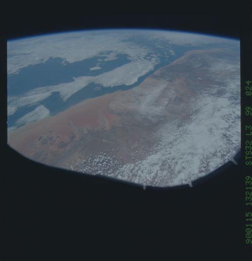
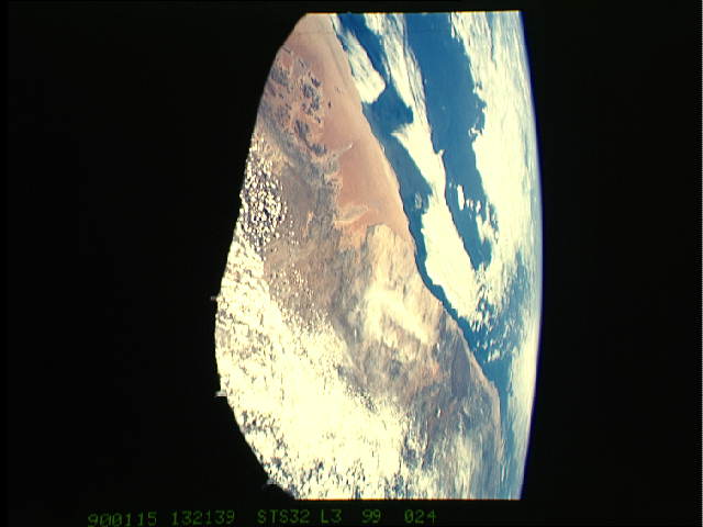
Spacecraft nadir point: 24.7° S, 19.1° E
Photo center point: 23.0° S, 15.0° E
Photo center point by machine learning:
Photo center point: 23.0° S, 15.0° E
Photo center point by machine learning:
Nadir to Photo Center: West
Spacecraft Altitude: 181 nautical miles (335km)
Country or Geographic Name: | NAMIBIA |
Features: | NAMIB DESERT |
| Features Found Using Machine Learning: | |
Cloud Cover Percentage: | 60 (51-75)% |
Sun Elevation Angle: | 55° |
Sun Azimuth: | 268° |
Camera: | Hasselblad |
Focal Length: | 50mm |
Camera Tilt: | High Oblique |
Format: | 5017: Kodak, natural color positive, Ektachrome, X Professional, ASA 64, standard base |
Film Exposure: | Normal |
| Additional Information | |
| Width | Height | Annotated | Cropped | Purpose | Links |
|---|---|---|---|---|---|
| 5700 pixels | 5900 pixels | No | No | Download Image | |
| 500 pixels | 518 pixels | No | No | Download Image | |
| 640 pixels | 480 pixels | No | No | Download Image |
Download Packaged File
Download a Google Earth KML for this Image
View photo footprint information
Download a GeoTIFF for this photo
Image Caption: One of the driest regions on Earth, the Namib Desert, Namibia, Africa (23.0N, 15.0E) lies adjacent to the Atlantic coast but upwelling oceanic water causes a very stable rainless atmosphere. The few local inland rivers do not reach the sea but instead appear as long indentations where rivers penetrate the dune fields and end as small dry lakes. The vast dune fields are the result of sands deposited over millions of years by the stream flow.
