STS032-97-64
| NASA Photo ID | STS032-97-64 |
| Focal Length | 250mm |
| Date taken | 1990.01.16 |
| Time taken | 07:11:19 GMT |
Cloud masks available for this image:
Spacecraft nadir point: 8.7° N, 31.1° E
Photo center point: 13.0° N, 24.5° E
Photo center point by machine learning:
Photo center point: 13.0° N, 24.5° E
Photo center point by machine learning:
Nadir to Photo Center: Northwest
Spacecraft Altitude: 176 nautical miles (326km)
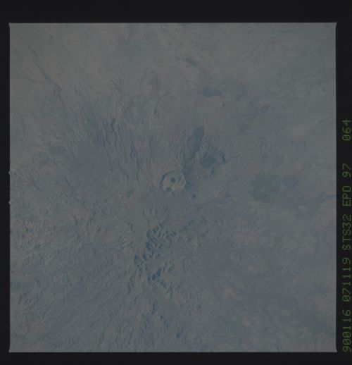
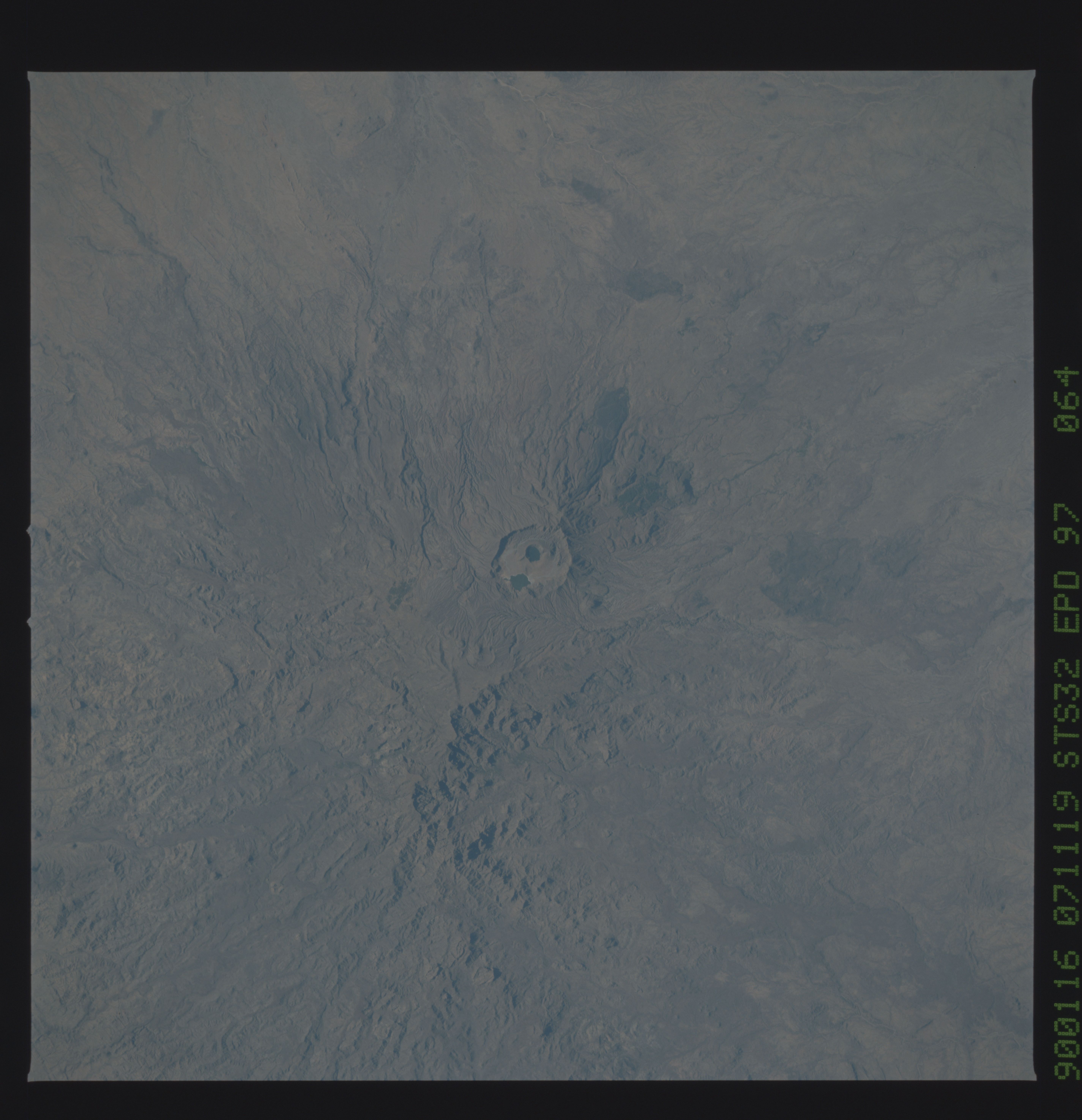
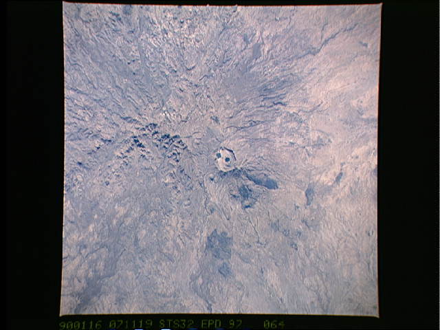
Country or Geographic Name: | SUDAN |
Features: | JEBEL MARRA |
| Features Found Using Machine Learning: | |
Cloud Cover Percentage: | 0 (no clouds present) |
Sun Elevation Angle: | 38° |
Sun Azimuth: | 125° |
Camera: | Hasselblad |
Focal Length: | 250mm |
Camera Tilt: | Near Vertical |
Format: | 5036: Kodak, natural color positive, Ektachrome 5036,200 Professional, ASA 200, stand |
Film Exposure: | Normal |
| Additional Information | |
| Width | Height | Annotated | Cropped | Purpose | Links |
|---|---|---|---|---|---|
| 5700 pixels | 5900 pixels | No | No | Download Image | |
| 500 pixels | 518 pixels | No | No | Download Image | |
| 640 pixels | 480 pixels | No | No | Download Image |
Download Packaged File
Download a Google Earth KML for this Image
View photo footprint information
Download a GeoTIFF for this photo
Image Caption: This excellent view of Jebel Marra Volcano Caldera, Sudan, Africa (13.0N, 24.5E) shows the collapsed mouth of this ancient volcano withh two smaller calderas now acting as lakes. As one of the highest regions of the eastern Sahara Desert, the Jebel Marra receives more rainfall than the surrounding desert. The radial pattern of streams flowing away from the highest points of the calderas is accenuated by a large dark colored lava flow.
