STS032-72-61

| NASA Photo ID | STS032-72-61 |
| Focal Length | 250mm |
| Date taken | 1990.01.11 |
| Time taken | 05:51:41 GMT |
Resolutions offered for this image:
5276 x 5223 pixels 640 x 633 pixels 5700 x 5900 pixels 500 x 518 pixels 640 x 480 pixels
5276 x 5223 pixels 640 x 633 pixels 5700 x 5900 pixels 500 x 518 pixels 640 x 480 pixels

Cloud masks available for this image:
Spacecraft nadir point: 14.4° N, 81.8° E
Photo center point: 16.0° N, 81.0° E
Photo center point by machine learning:
Photo center point: 16.0° N, 81.0° E
Photo center point by machine learning:
Nadir to Photo Center: North
Spacecraft Altitude: 175 nautical miles (324km)
Country or Geographic Name: | INDIA |
Features: | KRISHNA R/DELTA, COAST |
| Features Found Using Machine Learning: | |
Cloud Cover Percentage: | 10 (1-10)% |
Sun Elevation Angle: | 51° |
Sun Azimuth: | 161° |
Camera: | Hasselblad |
Focal Length: | 250mm |
Camera Tilt: | 31 degrees |
Format: | 5017: Kodak, natural color positive, Ektachrome, X Professional, ASA 64, standard base |
Film Exposure: | Normal |
| Additional Information | |
| Width | Height | Annotated | Cropped | Purpose | Links |
|---|---|---|---|---|---|
| 5276 pixels | 5223 pixels | No | No | Earth From Space collection | Download Image |
| 640 pixels | 633 pixels | No | No | Earth From Space collection | Download Image |
| 5700 pixels | 5900 pixels | No | No | Download Image | |
| 500 pixels | 518 pixels | No | No | Download Image | |
| 640 pixels | 480 pixels | No | No | Download Image |
Download Packaged File
Download a Google Earth KML for this Image
View photo footprint information
Download a GeoTIFF for this photo
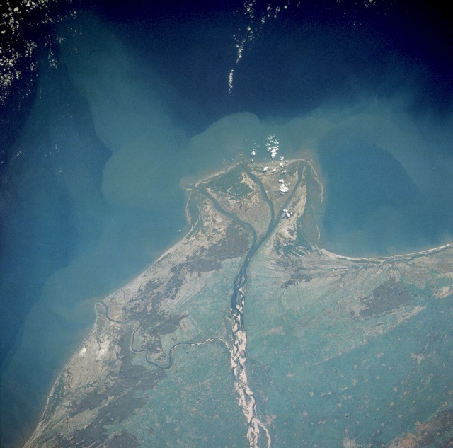
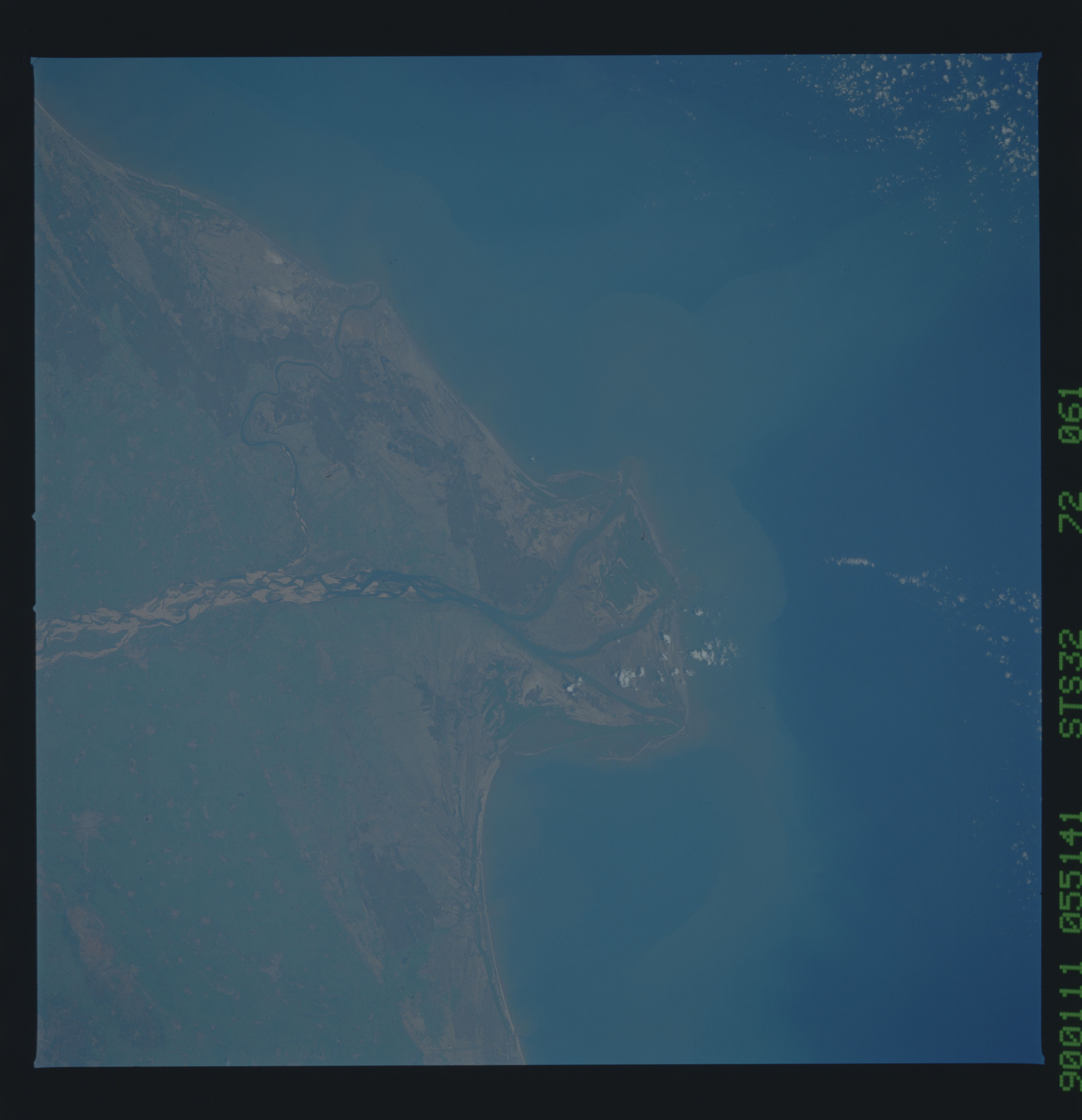
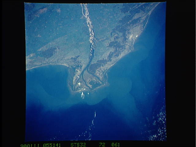
Image Caption: STS032-72-61 Krishna River, India
The Krishna River flows eastward across the Deccan Plateau of southern India until it empties through four major distributaries into the Bay of Bengal. The river, with its headwaters in the eastern slopes of the Western Ghats, flows eastward for approximately 800 miles (1300 kilometers) until it bends southward for the last 50 miles (80 kilometers). The Krishna River delta is typical of the wider deltas along the southeast coast of India (also known as the Coromandel Coast). The braided stream channels, broad floodplain, and extensive sandbars suggest that this part of the Krishna River flows through relatively flat terrain and carries substantial amounts of sediment, especially during the monsoon season. The outline of the city of Guntur and nearby, smaller rice-producing towns are visible near the northwest edge of the photograph.
The Krishna River flows eastward across the Deccan Plateau of southern India until it empties through four major distributaries into the Bay of Bengal. The river, with its headwaters in the eastern slopes of the Western Ghats, flows eastward for approximately 800 miles (1300 kilometers) until it bends southward for the last 50 miles (80 kilometers). The Krishna River delta is typical of the wider deltas along the southeast coast of India (also known as the Coromandel Coast). The braided stream channels, broad floodplain, and extensive sandbars suggest that this part of the Krishna River flows through relatively flat terrain and carries substantial amounts of sediment, especially during the monsoon season. The outline of the city of Guntur and nearby, smaller rice-producing towns are visible near the northwest edge of the photograph.
