STS032-71-39
| NASA Photo ID | STS032-71-39 |
| Focal Length | 100mm |
| Date taken | 1990.01.11 |
| Time taken | 16:30:10 GMT |
Resolutions offered for this image:
4072 x 4072 pixels 639 x 639 pixels 5700 x 5900 pixels 500 x 518 pixels 640 x 480 pixels
4072 x 4072 pixels 639 x 639 pixels 5700 x 5900 pixels 500 x 518 pixels 640 x 480 pixels

Cloud masks available for this image:
Spacecraft nadir point: 10.7° N, 73.5° W
Photo center point: 11.0° N, 73.5° W
Photo center point by machine learning:
Photo center point: 11.0° N, 73.5° W
Photo center point by machine learning:
Nadir to Photo Center: North
Spacecraft Altitude: 175 nautical miles (324km)
Country or Geographic Name: | COLOMBIA |
Features: | SANTA MARTA MTNS, COAST |
| Features Found Using Machine Learning: | |
Cloud Cover Percentage: | 25 (11-25)% |
Sun Elevation Angle: | 56° |
Sun Azimuth: | 166° |
Camera: | Hasselblad |
Focal Length: | 100mm |
Camera Tilt: | 6 degrees |
Format: | 5017: Kodak, natural color positive, Ektachrome, X Professional, ASA 64, standard base |
Film Exposure: | Normal |
| Additional Information | |
| Width | Height | Annotated | Cropped | Purpose | Links |
|---|---|---|---|---|---|
| 4072 pixels | 4072 pixels | No | No | Earth From Space collection | Download Image |
| 639 pixels | 639 pixels | No | No | Earth From Space collection | Download Image |
| 5700 pixels | 5900 pixels | No | No | Download Image | |
| 500 pixels | 518 pixels | No | No | Download Image | |
| 640 pixels | 480 pixels | No | No | Download Image |
Download Packaged File
Download a Google Earth KML for this Image
View photo footprint information
Download a GeoTIFF for this photo
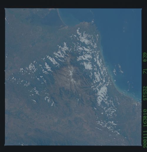
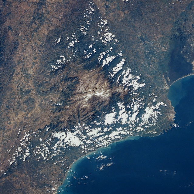
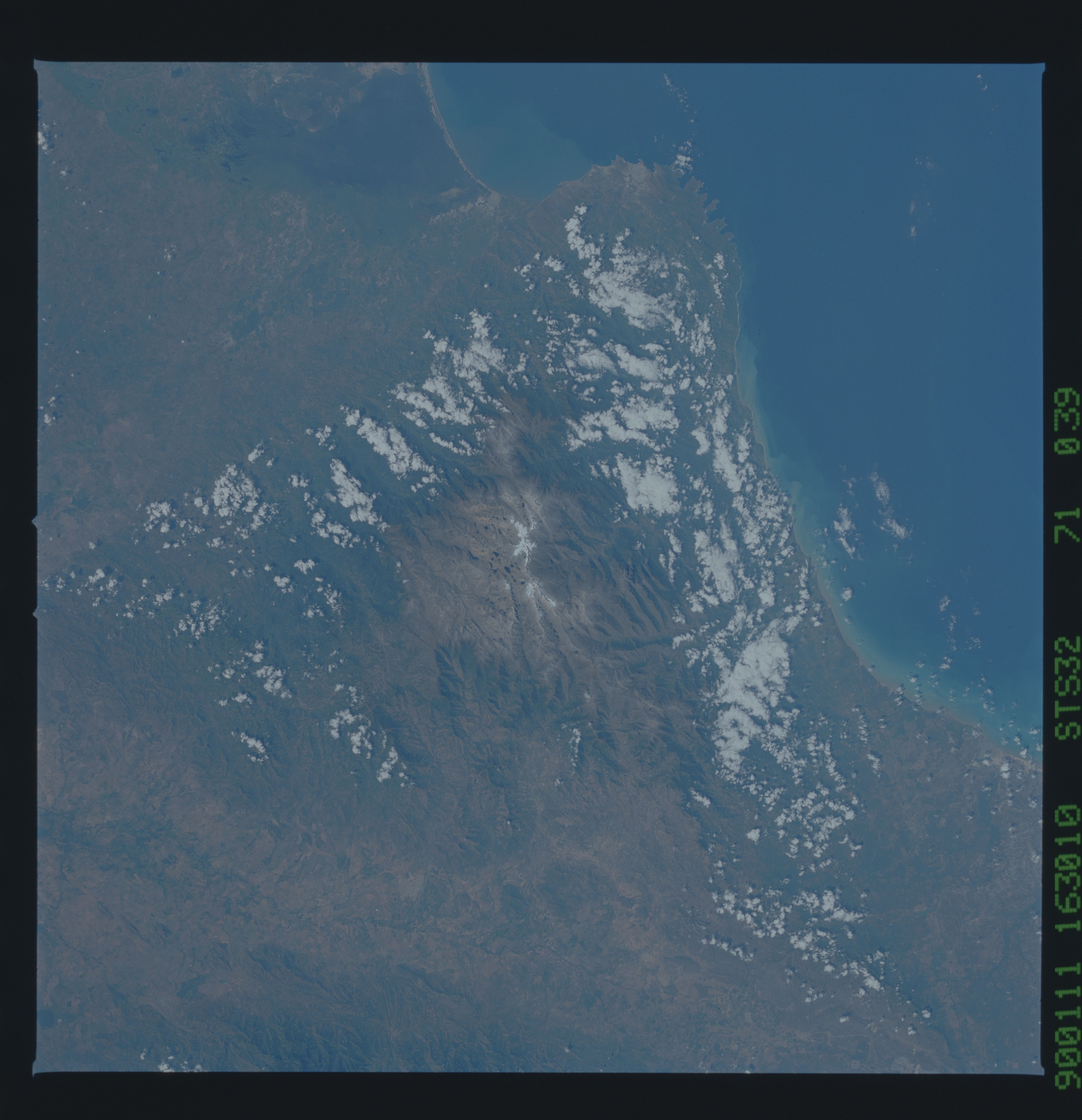
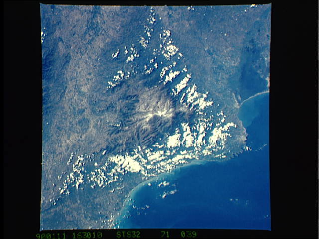
Image Caption: STS032-071-039 Sierra Nevada de Santa Marta, Colombia January 1990
The highest coastal mountain range in the world, the Sierra Nevada de Santa Marta is visible in this east-southeast-looking view. The Sierra Nevada de Santa Marta includes several climatic zones across a strip only 25 miles (40 km) from the sea. These zones include a tropical climate at the coast to a perpetual snow line above 16,000 feet (4880 meters) and a cold Alpine climate. The two highest peaks in the Santa Marta Range are Cristobal Colon Peak (named after Christopher Colombus) 19029 feet (5800 meters) and Simon Bolivar Peak (named after the famous South American liberator) 18947 feet (5775 meters). Small glacier fields at the top of the range cover an area of 6 sq. miles (16 sq. km). The Sierra Nevada de Santa Marta serves as the source of 36 streams and rivers. To the west of the Santa Marta Range just to the right of the bottom center of the image, is a swamp-like feature, the Cienaga Grande. To the left of the Cienaga Grande swamps near the bottom center of the scene is the city of Santa Marta, the oldest city of European origin in South America.
The highest coastal mountain range in the world, the Sierra Nevada de Santa Marta is visible in this east-southeast-looking view. The Sierra Nevada de Santa Marta includes several climatic zones across a strip only 25 miles (40 km) from the sea. These zones include a tropical climate at the coast to a perpetual snow line above 16,000 feet (4880 meters) and a cold Alpine climate. The two highest peaks in the Santa Marta Range are Cristobal Colon Peak (named after Christopher Colombus) 19029 feet (5800 meters) and Simon Bolivar Peak (named after the famous South American liberator) 18947 feet (5775 meters). Small glacier fields at the top of the range cover an area of 6 sq. miles (16 sq. km). The Sierra Nevada de Santa Marta serves as the source of 36 streams and rivers. To the west of the Santa Marta Range just to the right of the bottom center of the image, is a swamp-like feature, the Cienaga Grande. To the left of the Cienaga Grande swamps near the bottom center of the scene is the city of Santa Marta, the oldest city of European origin in South America.
