STS031-86-10
| NASA Photo ID | STS031-86-10 |
| Focal Length | 40mm |
| Date taken | 1990.04.29 |
| Time taken | 07:27:23 GMT |
Cloud masks available for this image:
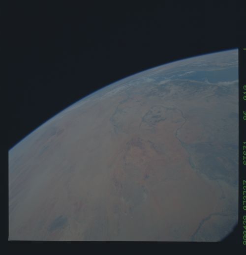
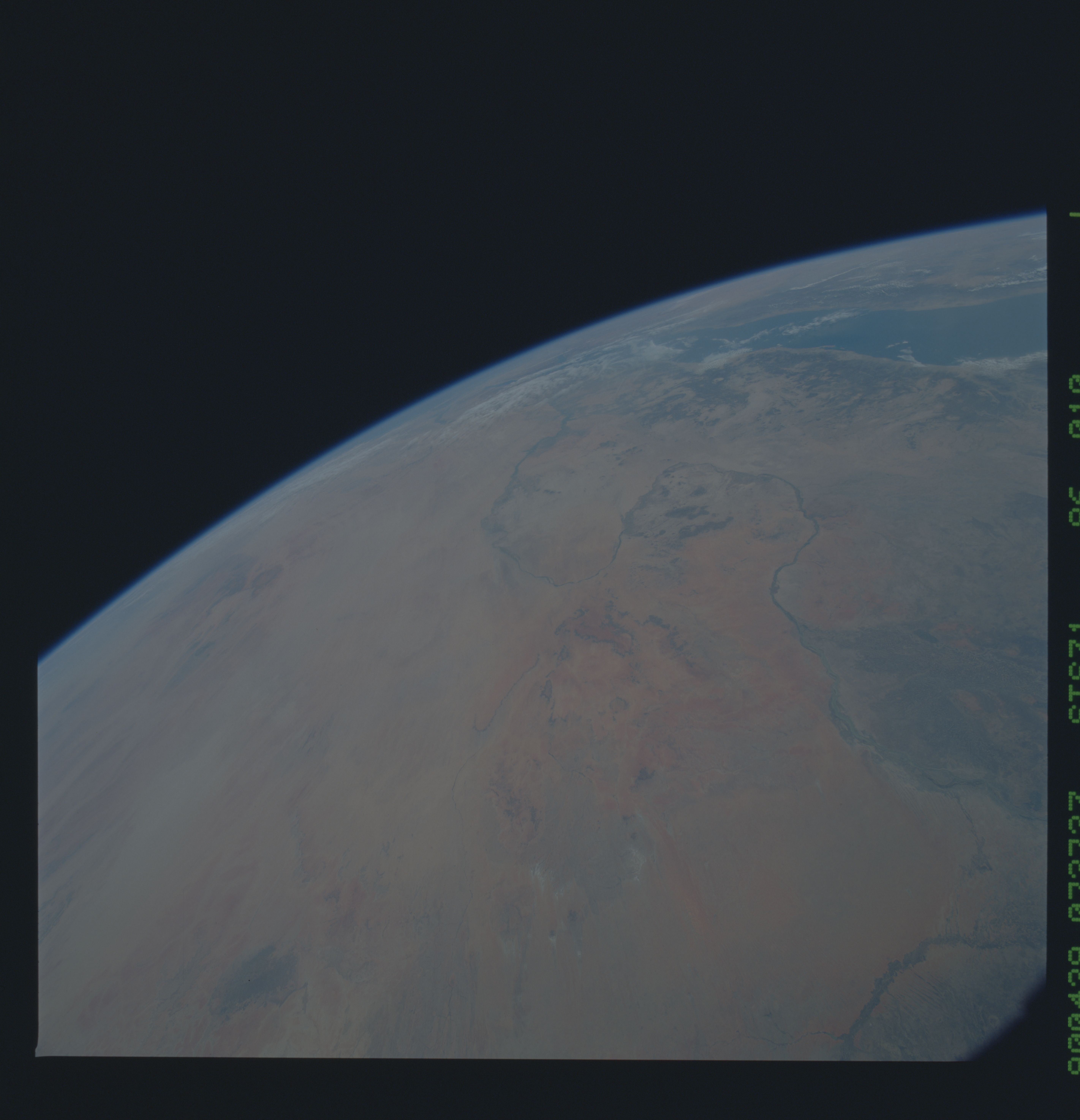
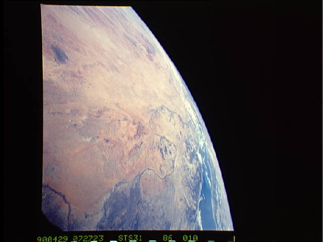
Spacecraft nadir point: 11.2° N, 30.1° E
Photo center point: 21.0° N, 30.0° E
Photo center point by machine learning:
Photo center point: 21.0° N, 30.0° E
Photo center point by machine learning:
Nadir to Photo Center: North
Spacecraft Altitude: 332 nautical miles (615km)
Country or Geographic Name: | SUDAN |
Features: | NILE RIVER, LIBYA, EGYPT |
| Features Found Using Machine Learning: | |
Cloud Cover Percentage: | 10 (1-10)% |
Sun Elevation Angle: | 53° |
Sun Azimuth: | 80° |
Camera: | Hasselblad |
Focal Length: | 40mm |
Camera Tilt: | High Oblique |
Format: | 5017: Kodak, natural color positive, Ektachrome, X Professional, ASA 64, standard base |
Film Exposure: | Normal |
| Additional Information | |
| Width | Height | Annotated | Cropped | Purpose | Links |
|---|---|---|---|---|---|
| 5686 pixels | 5900 pixels | No | No | Download Image | |
| 500 pixels | 519 pixels | No | No | Download Image | |
| 640 pixels | 480 pixels | No | No | Download Image |
Download Packaged File
Download a Google Earth KML for this Image
View photo footprint information
Download a GeoTIFF for this photo
Image Caption: From their orbital altitude of 332 nautical miles, the Space Shuttle DISCOVERY's crew could easily recognize land features more than a thousand kilometers distant from its ground track. In this view of Egypt and northern Sudan (21.0N, 30.0E), ground features such as the Nile River, Lake Nassar and the Nile Delta as well as the coast of the Mediterranean Sea can be easily seen near theEarth's limb.
