STS031-77-87
| NASA Photo ID | STS031-77-87 |
| Focal Length | 40mm |
| Date taken | 1990.04.__ |
| Time taken | GMT |
Cloud masks available for this image:
Spacecraft nadir point:
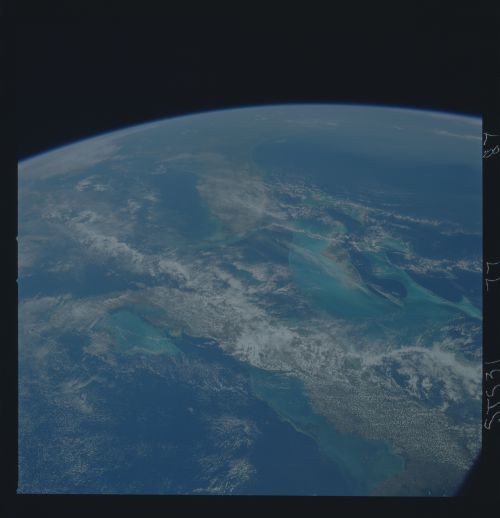
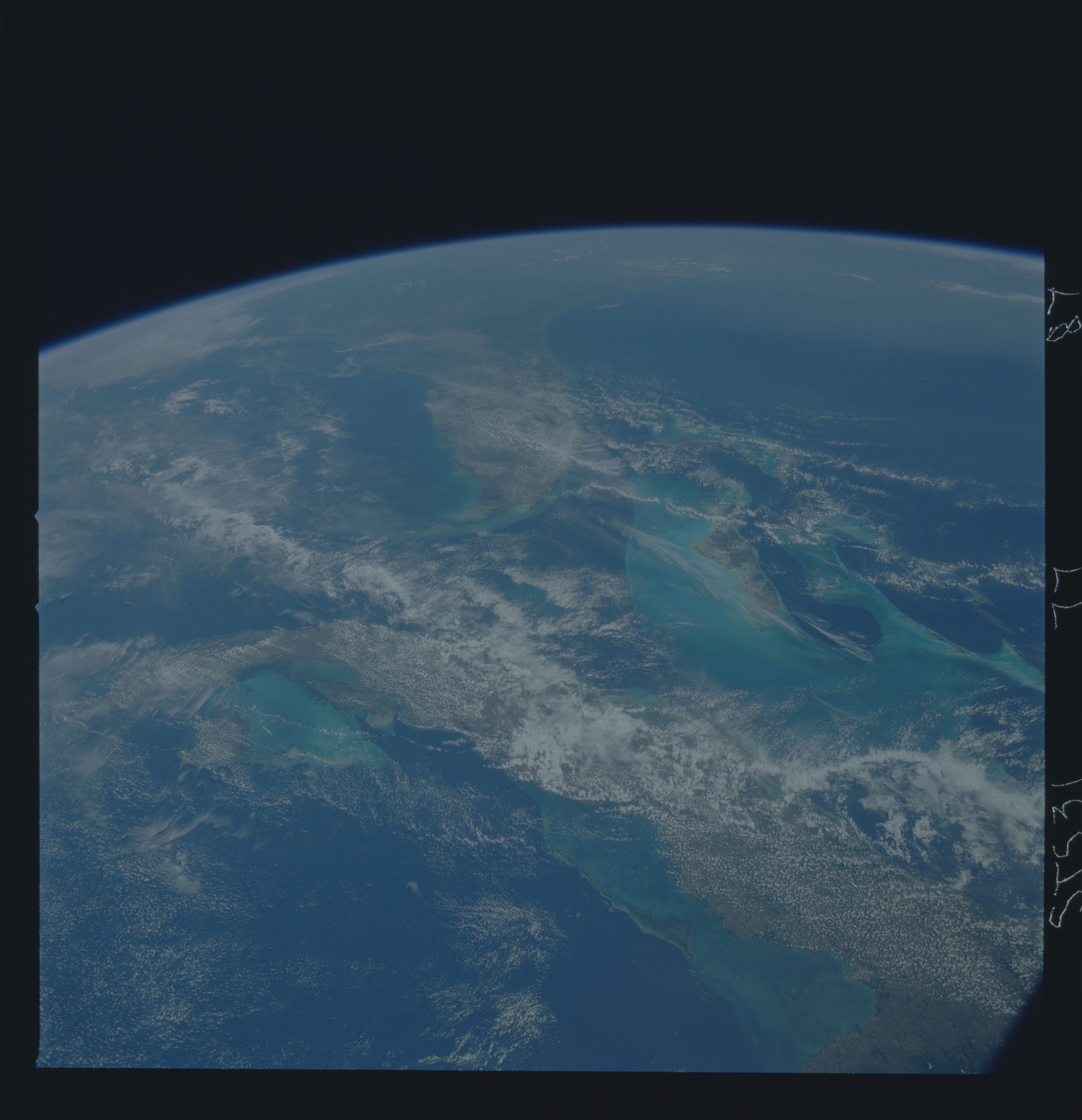
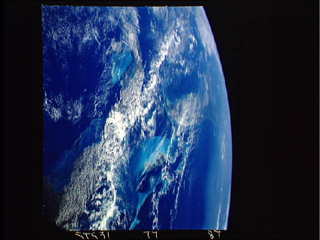
Photo center point: 24.0° N, 81.0° W
Photo center point by machine learning:
Photo center point: 24.0° N, 81.0° W
Photo center point by machine learning:
Nadir to Photo Center:
Spacecraft Altitude: nautical miles (0km)
Country or Geographic Name: | USA-FLORIDA |
Features: | FRONT-PANORAMA |
| Features Found Using Machine Learning: | |
Cloud Cover Percentage: | 70 (51-75)% |
Sun Elevation Angle: | ° |
Sun Azimuth: | ° |
Camera: | Hasselblad |
Focal Length: | 40mm |
Camera Tilt: | High Oblique |
Format: | 5017: Kodak, natural color positive, Ektachrome, X Professional, ASA 64, standard base |
Film Exposure: | Normal |
| Additional Information | |
| Width | Height | Annotated | Cropped | Purpose | Links |
|---|---|---|---|---|---|
| 5700 pixels | 5900 pixels | No | No | Download Image | |
| 500 pixels | 518 pixels | No | No | Download Image | |
| 640 pixels | 480 pixels | No | No | Download Image |
Download Packaged File
Download a Google Earth KML for this Image
View photo footprint information
Download a GeoTIFF for this photo
Image Caption: This decaying thunderstorm, seen as the trailing edge of a cloud mass over the Gulf of Mexico and approaching Florida, Bahamas and Cuba (24.0N, 81.0W) has lost much of its force but still dropped a considerable amount of rainfall over most of Cuba and Florida. The storm, remnants of the same front described in scene STS031-77-078, is seen as a thin front stretching northwest to southeast over the Gulf of Mexico just west of Florida.
