STS031-76-39
| NASA Photo ID | STS031-76-39 |
| Focal Length | 40mm |
| Date taken | 1990.04.25 |
| Time taken | 19:52:09 GMT |
Resolutions offered for this image:
5700 x 5900 pixels 500 x 518 pixels 640 x 480 pixels 1292 x 1284 pixels 440 x 425 pixels 747 x 528 pixels 528 x 747 pixels
5700 x 5900 pixels 500 x 518 pixels 640 x 480 pixels 1292 x 1284 pixels 440 x 425 pixels 747 x 528 pixels 528 x 747 pixels


Cloud masks available for this image:
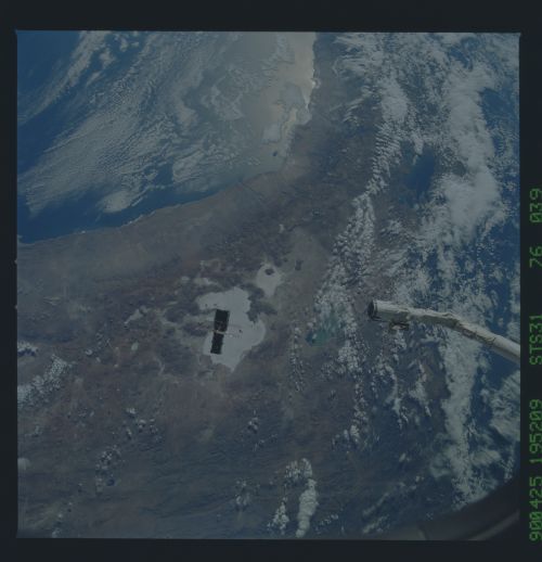
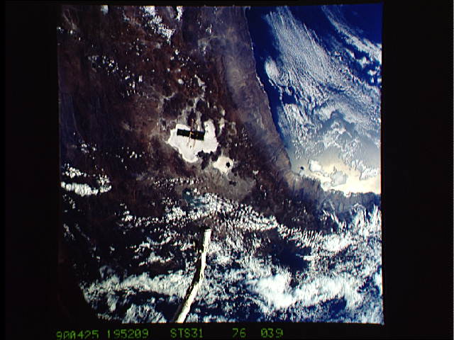
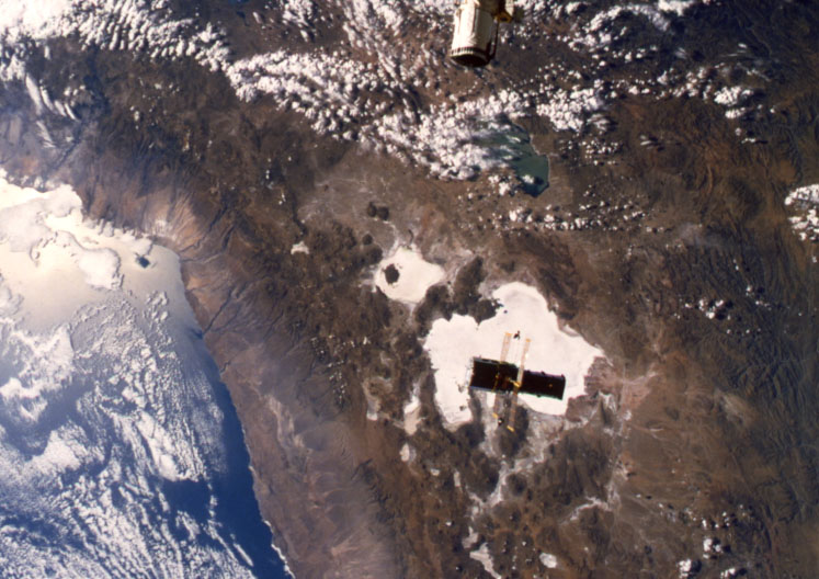
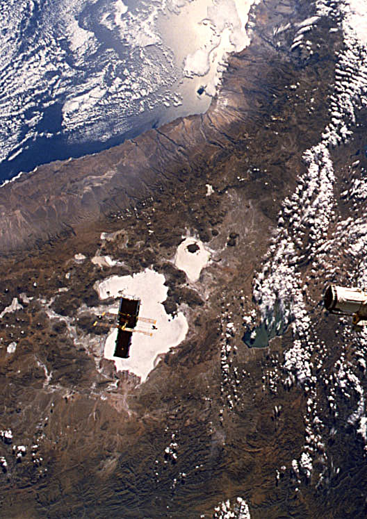
Spacecraft nadir point: 20.3° S, 66.1° W
Photo center point:
Photo center point by machine learning:
Photo center point:
Photo center point by machine learning:
Nadir to Photo Center:
Spacecraft Altitude: 334 nautical miles (619km)
Country or Geographic Name: | |
Features: | HUBBLE DEPLOY, FULL SAIL |
| Features Found Using Machine Learning: | |
Cloud Cover Percentage: | |
Sun Elevation Angle: | 28° |
Sun Azimuth: | 298° |
Camera: | Hasselblad |
Focal Length: | 40mm |
Camera Tilt: | Low Oblique |
Format: | 5017: Kodak, natural color positive, Ektachrome, X Professional, ASA 64, standard base |
Film Exposure: | Under Exposed |
| Additional Information | |
| Width | Height | Annotated | Cropped | Purpose | Links |
|---|---|---|---|---|---|
| 5700 pixels | 5900 pixels | No | No | Download Image | |
| 500 pixels | 518 pixels | No | No | Download Image | |
| 640 pixels | 480 pixels | No | No | Download Image | |
| 1292 pixels | 1284 pixels | No | No | Download Image | |
| 440 pixels | 425 pixels | No | No | Download Image | |
| 747 pixels | 528 pixels | No | No | Download Image | |
| 528 pixels | 747 pixels | Download Image |
Download Packaged File
Download a Google Earth KML for this Image
View photo footprint information
Download a GeoTIFF for this photo
Image Caption: Hubble Space Telescope (HST), with its solar array (SA) wings and high gain antennae (HGA) fully extended,is released from Discovery's, Orbiter Vehicle (OV) 103's, remote manipulator system (RMS) end effector and is set free into Earth orbit by the STS-31 crew. HST drifts away from the end effector over the Andes Mountains.Parts of Bolivia, Peru, Chile, and Argentina are visible. The view covers a huge area of the western half of South America stretching from 14 degrees south latitude to 23 degrees, about 1,000 kilometers.
