STS031-73-59
| NASA Photo ID | STS031-73-59 |
| Focal Length | 100mm |
| Date taken | 1990.04.25 |
| Time taken | 22:29:53 GMT |
Resolutions offered for this image:
5699 x 5675 pixels 5699 x 5675 pixels 540 x 546 pixels 5700 x 5900 pixels 500 x 518 pixels 640 x 480 pixels 512 x 455 pixels 540 x 535 pixels 400 x 396 pixels
5699 x 5675 pixels 5699 x 5675 pixels 540 x 546 pixels 5700 x 5900 pixels 500 x 518 pixels 640 x 480 pixels 512 x 455 pixels 540 x 535 pixels 400 x 396 pixels


Cloud masks available for this image:
Spacecraft nadir point: 28.5° N, 123.5° E
Photo center point: 40.5° N, 127.5° E
Photo center point by machine learning:
Photo center point: 40.5° N, 127.5° E
Photo center point by machine learning:
Nadir to Photo Center: North
Spacecraft Altitude: 334 nautical miles (619km)
Country or Geographic Name: | NORTH KOREA |
Features: | PAN-DUST STORM, KOREA BAY |
| Features Found Using Machine Learning: | |
Cloud Cover Percentage: | 25 (11-25)% |
Sun Elevation Angle: | 16° |
Sun Azimuth: | 83° |
Camera: | Hasselblad |
Focal Length: | 100mm |
Camera Tilt: | High Oblique |
Format: | 5017: Kodak, natural color positive, Ektachrome, X Professional, ASA 64, standard base |
Film Exposure: | Normal |
| Additional Information | |
| Width | Height | Annotated | Cropped | Purpose | Links |
|---|---|---|---|---|---|
| 5699 pixels | 5675 pixels | No | Earth From Space collection | Download Image | |
| 5699 pixels | 5675 pixels | No | No | NASA's Earth Observatory web site | Download Image |
| 540 pixels | 546 pixels | Yes | Yes | NASA's Earth Observatory web site | Download Image |
| 5700 pixels | 5900 pixels | No | No | Download Image | |
| 500 pixels | 518 pixels | No | No | Download Image | |
| 640 pixels | 480 pixels | No | No | Download Image | |
| 512 pixels | 455 pixels | No | No | Download Image | |
| 540 pixels | 535 pixels | No | No | NASA's Earth Observatory web site | Download Image |
| 400 pixels | 396 pixels | No | No | Photographic Highlights | Download Image |
Download Packaged File
Download a Google Earth KML for this Image
View photo footprint information
Download a GeoTIFF for this photo
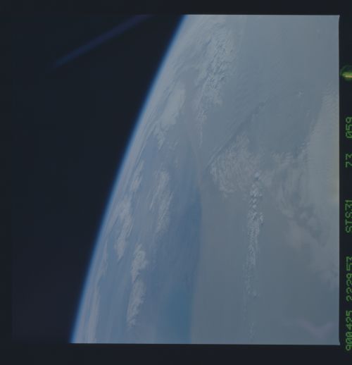
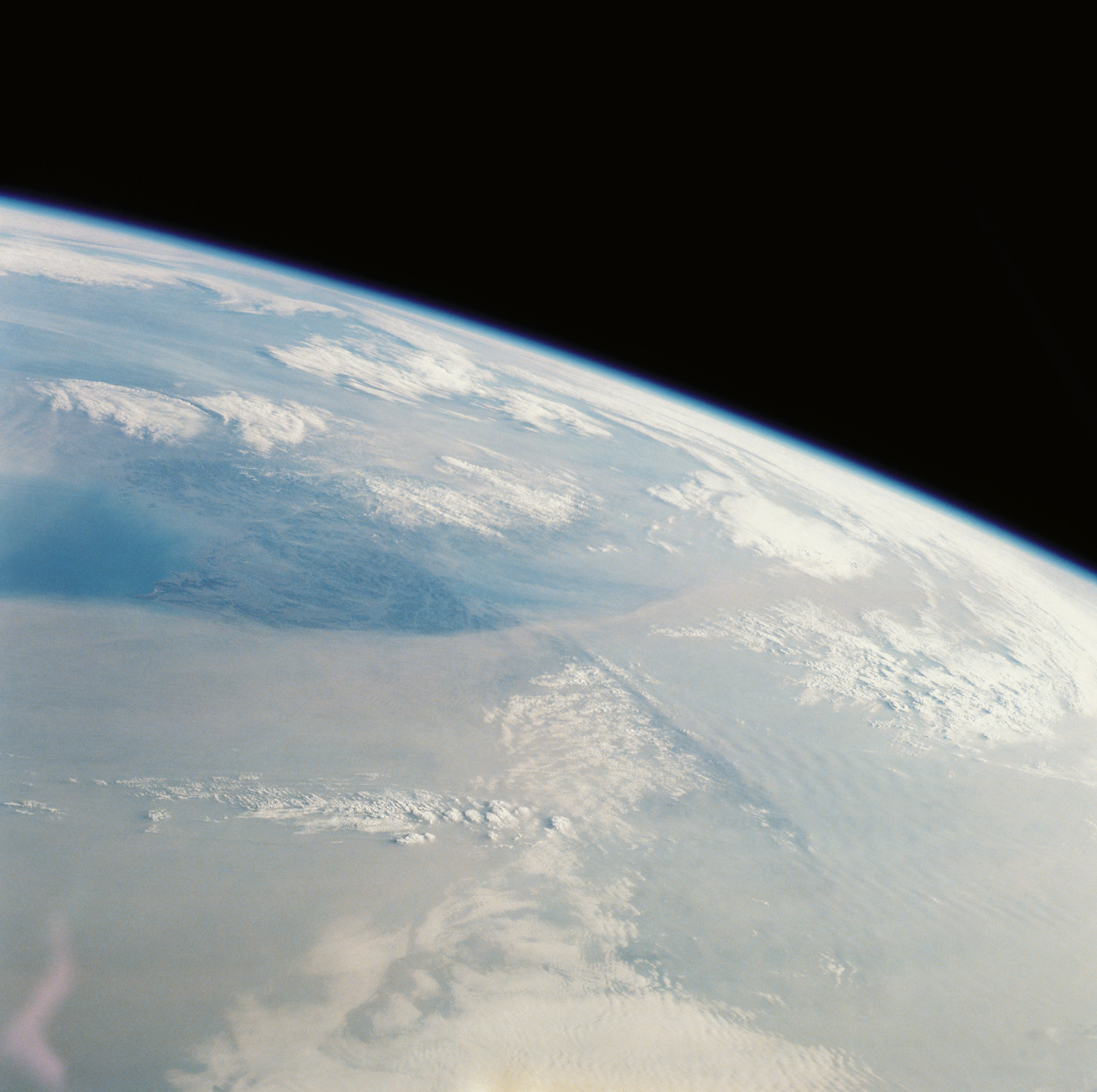
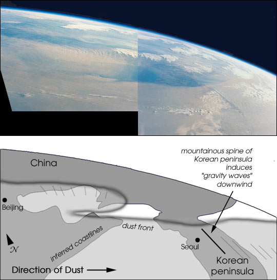
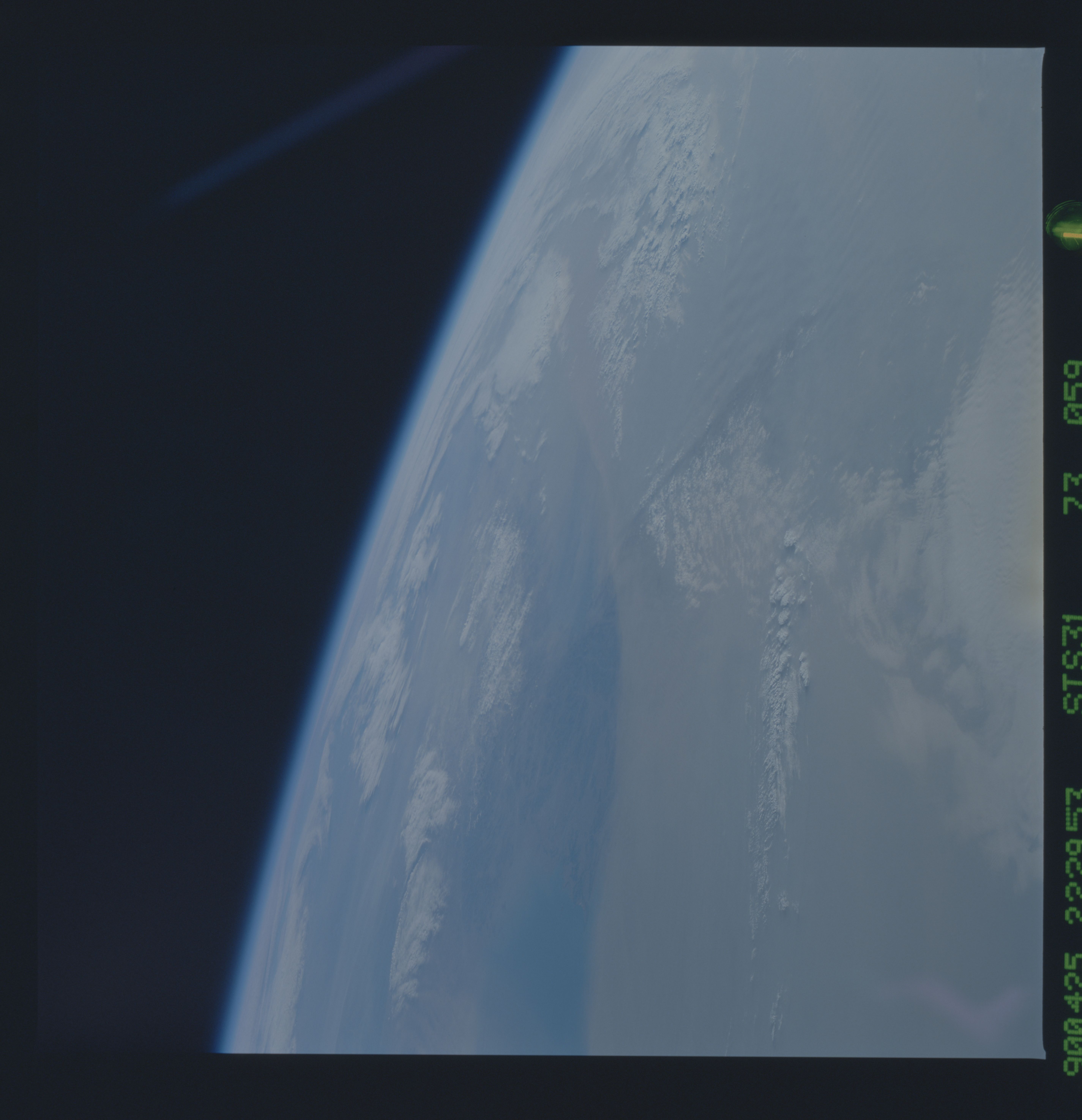
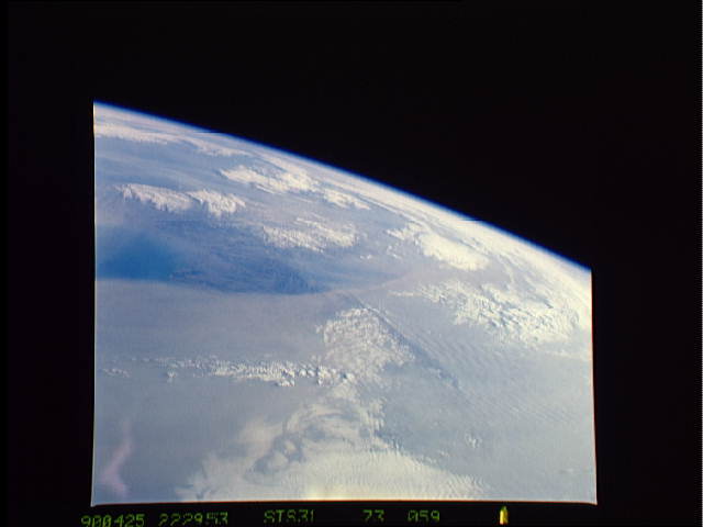
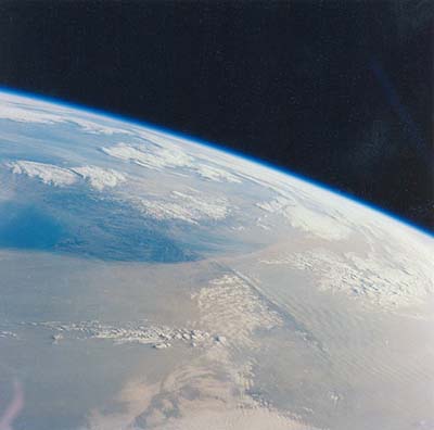
Image Caption: Dust blowing off the Gobi desert eastward across the China toward the Pacific Ocean is a common event in April. Space Shuttle astronauts have photographed these dusts storms several times. The photographs above, taken by astronauts on April 25, 1990, show a thick blanket of dust that entirely obscures the southern half of the Korean Peninsula. The dust is being transported from west (left) to east (right). The mountainous spine of the peninsula induces gravity waves in the dust cloud on the downwind (east) side.
The mosaic (NASA photos STS31-73-54 (left) and STS31-73-59 (right)) shows a second dust front over the Beijing region (Beijing lies under the northern margin), situated to the north of the main dust. An interpretive map is also provided.
The source of the dust is the vast loess (wind-laid dust) sheet of Inner Mongolia that stretches west from Beijing 1400 km to the Sinkiang border. The climatic gradient is characterized by rapidly decreasing rainfall west from Beijing, from 500 mm/yr to 250 mm/yr only 300 km upwind. Below 250 mm of yearly rainfall, vegetation density is low enough to allow wind deflation of surface dust. Air masses over the Takla Makan Desert of Sinkiang are usually dust laden to some degree. Occasionally, the dust loading becomes heavy and moves as far as Korea (as shown here), and then offshore over the Pacific.
