STS031-151-16
| NASA Photo ID | STS031-151-16 |
| Focal Length | 90mm |
| Date taken | 1990.04.26 |
| Time taken | 09:56:27 GMT |
Cloud masks available for this image:
Spacecraft nadir point: 23.3° N, 16.6° W
Photo center point: 21.5° N, 14.5° W
Photo center point by machine learning:
Photo center point: 21.5° N, 14.5° W
Photo center point by machine learning:
Nadir to Photo Center: Southeast
Spacecraft Altitude: 334 nautical miles (619km)
Country or Geographic Name: | MAURITANIA |
Features: | BAIE DE LEVERIER |
| Features Found Using Machine Learning: | |
Cloud Cover Percentage: | 5 (1-10)% |
Sun Elevation Angle: | 44° |
Sun Azimuth: | 93° |
Camera: | Linhof |
Focal Length: | 90mm |
Camera Tilt: | High Oblique |
Format: | QX868: Kodak, natural color positive, Ektachrome QX868(5017 emulsion), ASA 64, thin base |
Film Exposure: | Normal |
| Additional Information | |
| Width | Height | Annotated | Cropped | Purpose | Links |
|---|---|---|---|---|---|
| 5641 pixels | 4513 pixels | No | No | Earth From Space collection | Download Image |
| 640 pixels | 512 pixels | No | No | Earth From Space collection | Download Image |
| 640 pixels | 480 pixels | No | No | ISD 1 | Download Image |
Download Packaged File
Download a Google Earth KML for this Image
View photo footprint information
Download a GeoTIFF for this photo
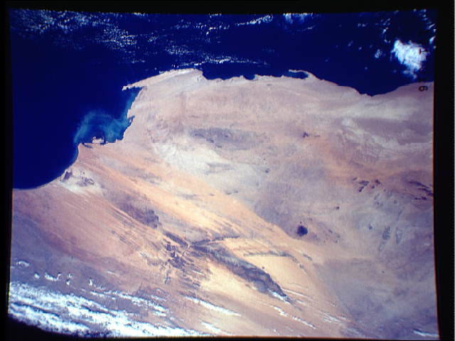
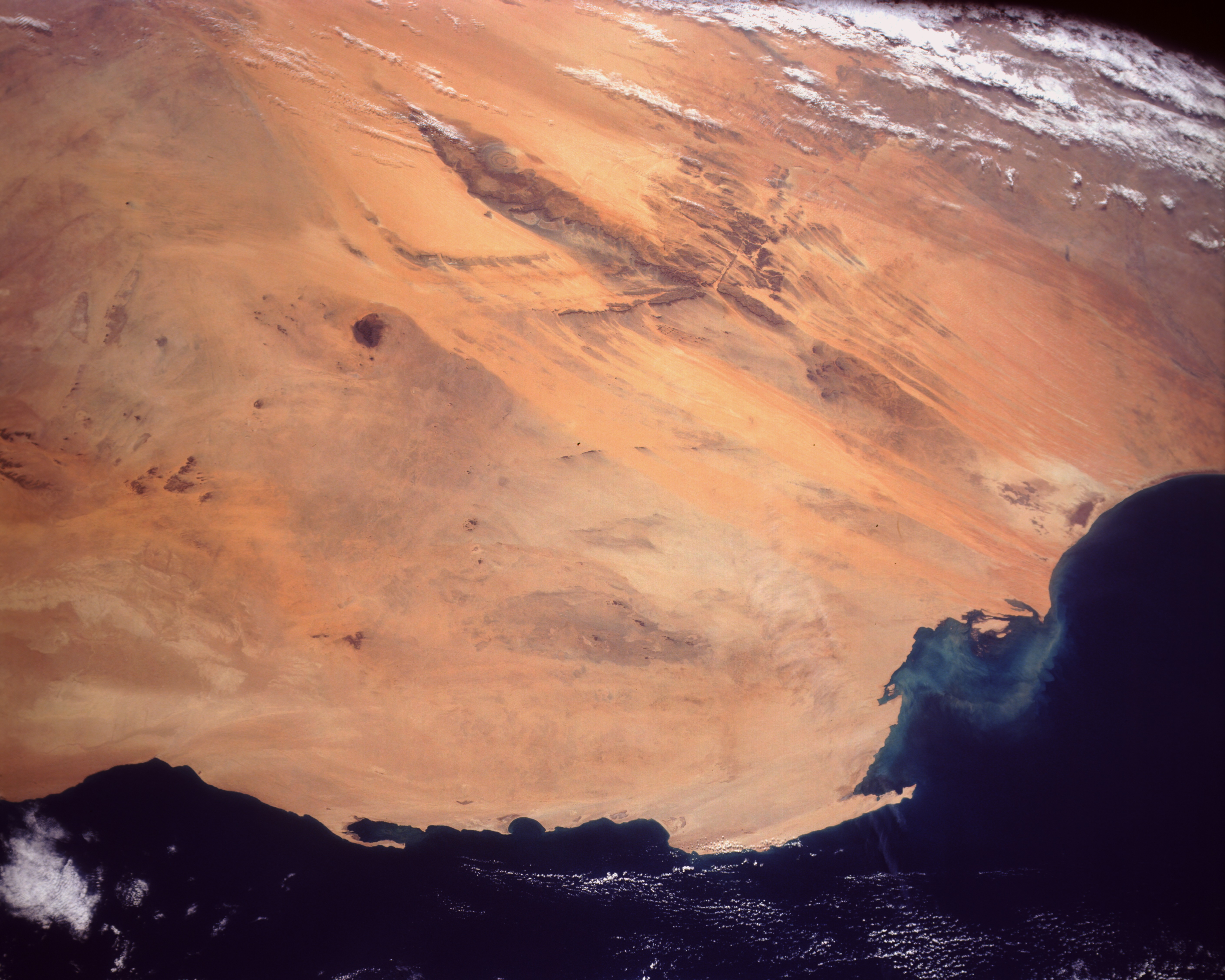
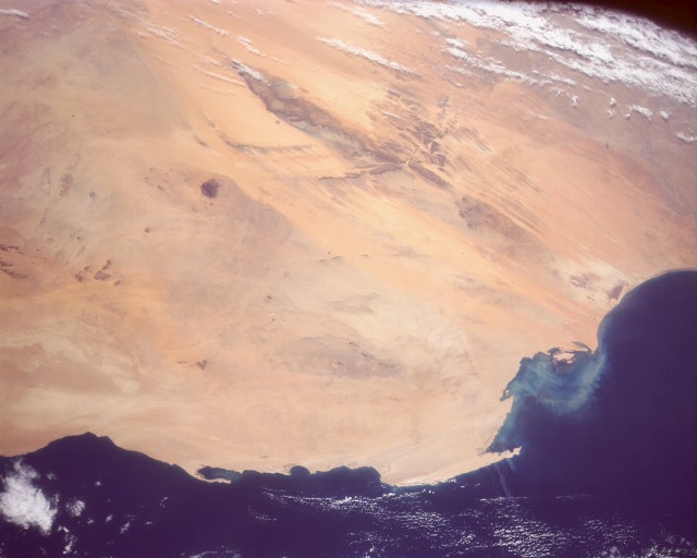
Image Caption: STS031-151-16 Linear Sand Dunes, Mauritania April 1990
The western end of the great Sahara Desert is captured in this southeast-looking, low oblique photograph of desert and coastal areas of Mauritania. This region of west Africa is a major source of eolian sand that is transported across the Atlantic Ocean to North America. Other photographs taken during Space Shuttle flights have charted the distance and areal extent that these west African dust palls travel. The yellow and orange areas are sand dunes and sand sheets, and the darker areas are bedrock outcrops. The entire area is overlain by Quaternary deposits. Pleistocene paleo-dune fields (A Zefal and Amoukrouz) are along the southern coast. The view covers an area roughly 700 by 800 km. The major area of northeast-southwest-trending bedrock produces a downwind "wind shadow" effect on the landscape that extends to the coast. The northern grayish areas with little or no sand are rock and gravel desert plains. The peninsula of Cape Blanc protrudes into Levrier Bay.
The western end of the great Sahara Desert is captured in this southeast-looking, low oblique photograph of desert and coastal areas of Mauritania. This region of west Africa is a major source of eolian sand that is transported across the Atlantic Ocean to North America. Other photographs taken during Space Shuttle flights have charted the distance and areal extent that these west African dust palls travel. The yellow and orange areas are sand dunes and sand sheets, and the darker areas are bedrock outcrops. The entire area is overlain by Quaternary deposits. Pleistocene paleo-dune fields (A Zefal and Amoukrouz) are along the southern coast. The view covers an area roughly 700 by 800 km. The major area of northeast-southwest-trending bedrock produces a downwind "wind shadow" effect on the landscape that extends to the coast. The northern grayish areas with little or no sand are rock and gravel desert plains. The peninsula of Cape Blanc protrudes into Levrier Bay.
