STS030-152-66
| NASA Photo ID | STS030-152-66 |
| Focal Length | 90mm |
| Date taken | 1989.05.06 |
| Time taken | 19:12:00 GMT |
Resolutions offered for this image:
640 x 480 pixels
640 x 480 pixels
Cloud masks available for this image:
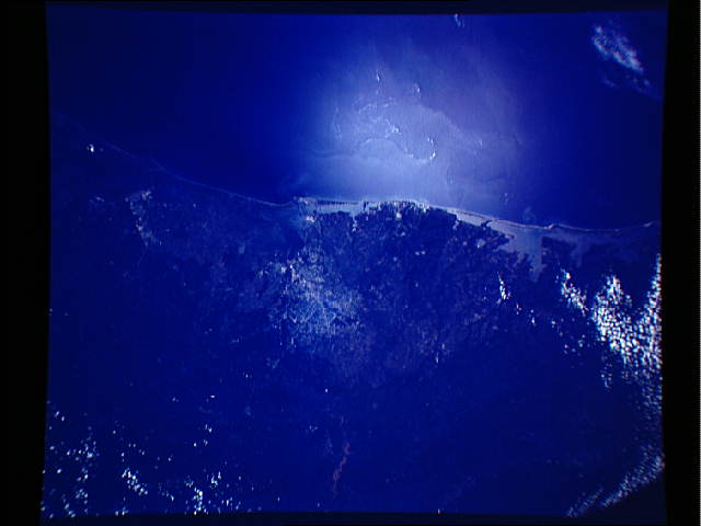
Spacecraft nadir point: 29.0° N, 94.3° W
Photo center point: 29.0° N, 95.0° W
Photo center point by machine learning:
Photo center point: 29.0° N, 95.0° W
Photo center point by machine learning:
Nadir to Photo Center: West
Spacecraft Altitude: 174 nautical miles (322km)
Country or Geographic Name: | USA-TEXAS |
Features: | GULF COAST, OCEAN FEATURES |
| Features Found Using Machine Learning: | |
Cloud Cover Percentage: | 10 (1-10)% |
Sun Elevation Angle: | 71° |
Sun Azimuth: | 230° |
Camera: | Linhof |
Focal Length: | 90mm |
Camera Tilt: | 14 degrees |
Format: | 5017: Kodak, natural color positive, Ektachrome, X Professional, ASA 64, standard base |
Film Exposure: | Normal |
| Additional Information | |
| Width | Height | Annotated | Cropped | Purpose | Links |
|---|---|---|---|---|---|
| 640 pixels | 480 pixels | No | No | ISD 1 | Download Image |
Download Packaged File
Download a Google Earth KML for this Image
View photo footprint information
Download a GeoTIFF for this photo
Image Caption: The Upper Texas Gulf Coast (29.0N, 95.5W) is clearly represented in this view from space. The area covered stretches almost 300 miles from Aransas Pass, on the Texas coast in the south to Cameron, Louisiana in the north. The sharp detail of both the natural and cultural features throughout the scene is especially evident in the Houston area where highways, major streets, airport runways and even some neighborhood lanes can be easily seen.
