STS029-92-38

| NASA Photo ID | STS029-92-38 |
| Focal Length | 250mm |
| Date taken | 1989.03.15 |
| Time taken | 12:45:09 GMT |
Resolutions offered for this image:
5255 x 5255 pixels 639 x 639 pixels 5700 x 5900 pixels 500 x 518 pixels 640 x 480 pixels 436 x 437 pixels
5255 x 5255 pixels 639 x 639 pixels 5700 x 5900 pixels 500 x 518 pixels 640 x 480 pixels 436 x 437 pixels

Cloud masks available for this image:
Spacecraft nadir point: 3.0° S, 34.3° E
Photo center point: 2.5° S, 36.0° E
Photo center point by machine learning:
Photo center point: 2.5° S, 36.0° E
Photo center point by machine learning:
Nadir to Photo Center: East
Spacecraft Altitude: 162 nautical miles (300km)
Country or Geographic Name: | TANZANIA |
Features: | LAKE NATRON |
| Features Found Using Machine Learning: | |
Cloud Cover Percentage: | 40 (26-50)% |
Sun Elevation Angle: | 46° |
Sun Azimuth: | 270° |
Camera: | Hasselblad |
Focal Length: | 250mm |
Camera Tilt: | 33 degrees |
Format: | 5017: Kodak, natural color positive, Ektachrome, X Professional, ASA 64, standard base |
Film Exposure: | Normal |
| Additional Information | |
| Width | Height | Annotated | Cropped | Purpose | Links |
|---|---|---|---|---|---|
| 5255 pixels | 5255 pixels | No | No | Earth From Space collection | Download Image |
| 639 pixels | 639 pixels | No | No | Earth From Space collection | Download Image |
| 5700 pixels | 5900 pixels | No | No | Download Image | |
| 500 pixels | 518 pixels | No | No | Download Image | |
| 640 pixels | 480 pixels | No | No | Download Image | |
| 436 pixels | 437 pixels | Yes | No | Download Image |
Download Packaged File
Download a Google Earth KML for this Image
View photo footprint information
Download a GeoTIFF for this photo
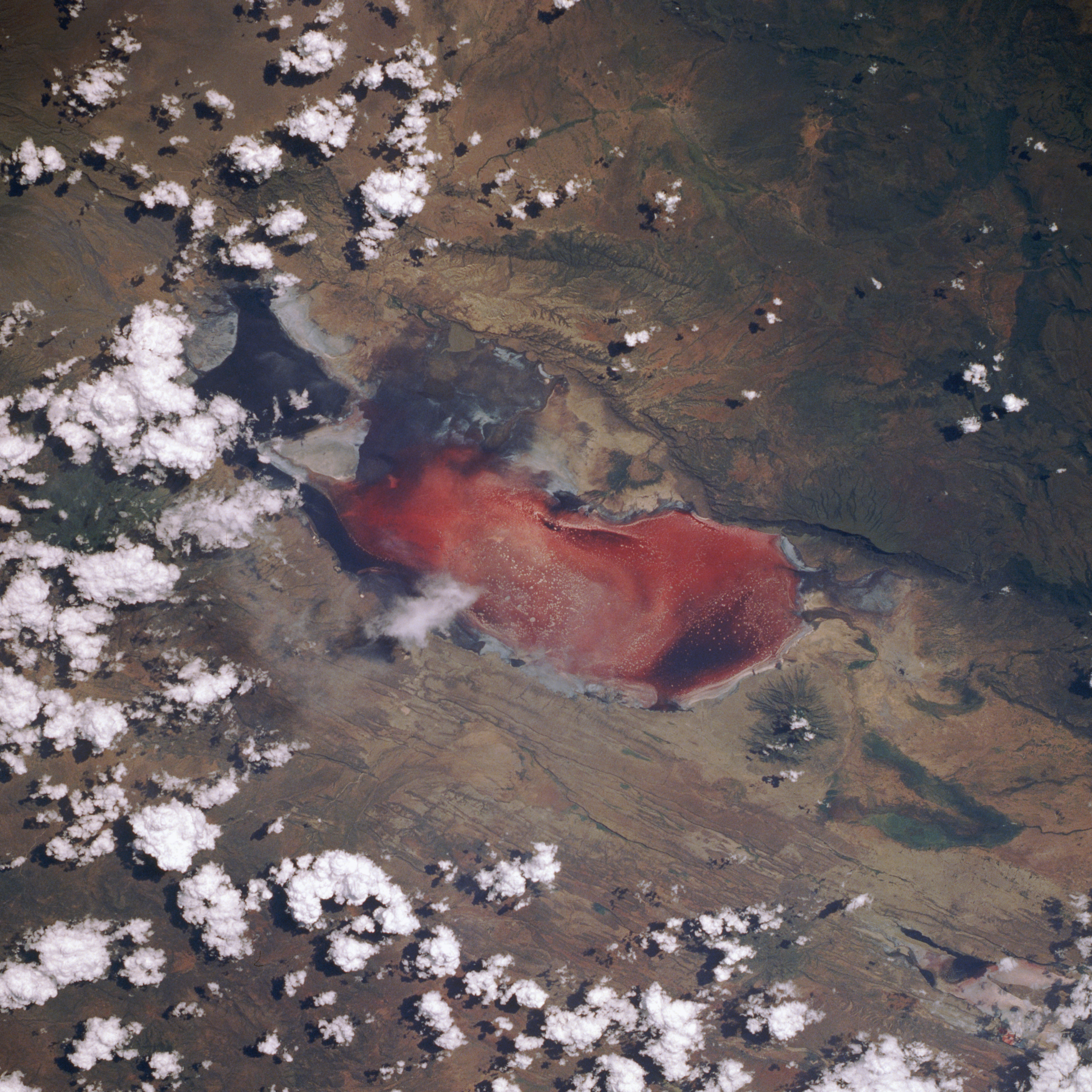
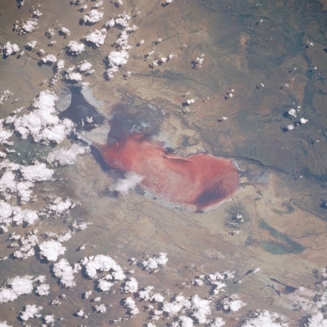
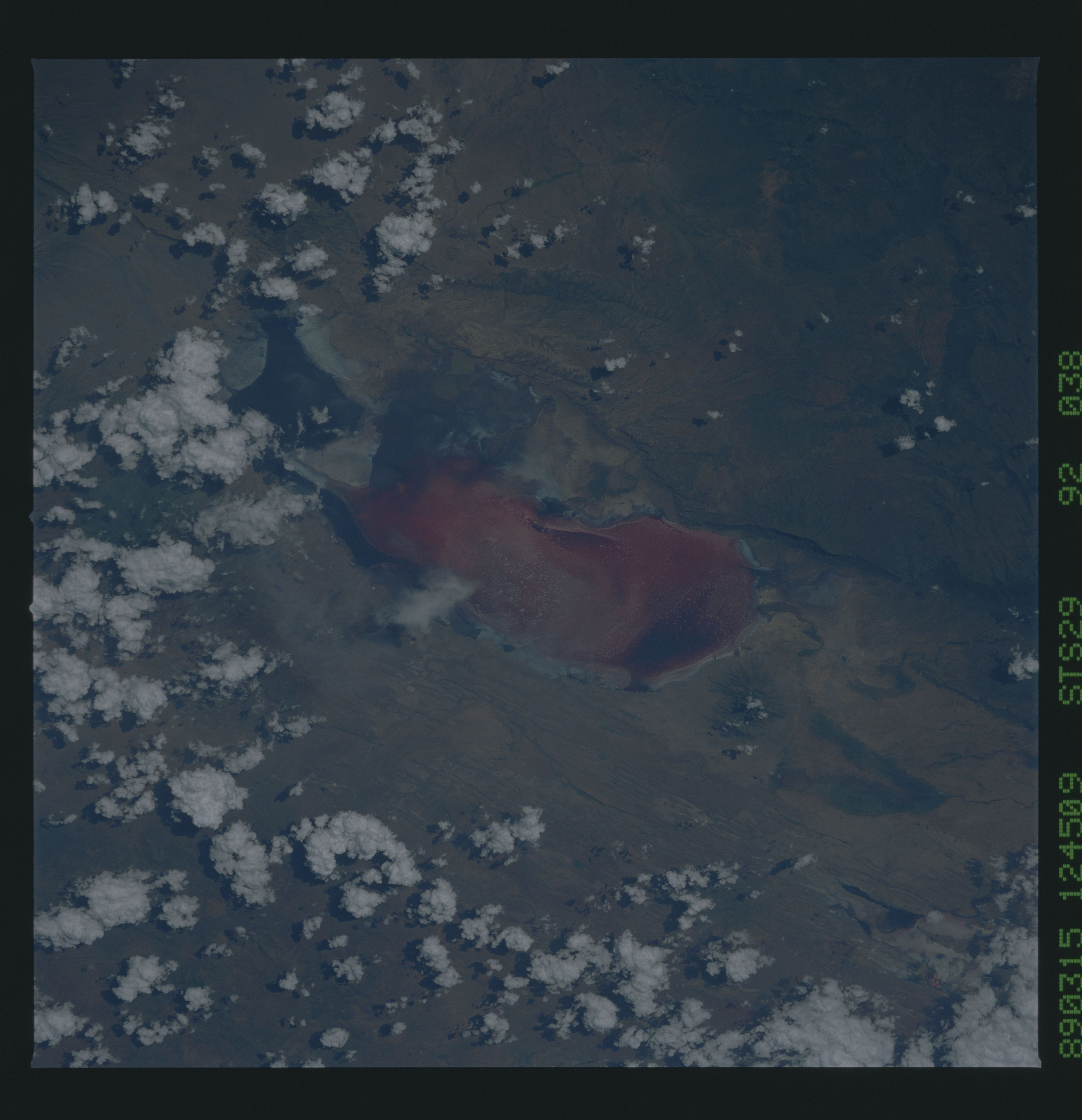
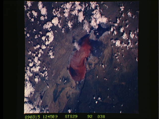
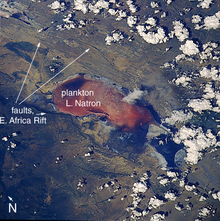
Image Caption: STS029-092-038 Lake Natron, Tanzania March 1989
Lake Natron (pink color results from the pigmented microorganisms on top of the salt crust), approximately 35 miles (56 kilometers) long and 15 miles (24 kilometers) wide, has its northern end on the Tanzania-Kenya border; the summit of the small volcano, 5130 feet (1560 meters) above sea level at the northern end of the lake, is in Kenya. The north-south-trending lines on either side of Lake Natron help to establish the width of the Rift Valley at this point as approximately 20 miles (32 kilometers). Although this part of Africa has a humid, equatorial classification, this area has a definite dry winter season and varying rainfall amounts averaging approximately 40 inches (100 centimeters) annually. Lake Natron and its flamingo population are very sensitive to rainfall amounts-both suffer during drought. (Refer to photograph STS-41B-046-2955, taken 5 years earlier, which shows differences in the extent of the salt crust.)
Lake Natron (pink color results from the pigmented microorganisms on top of the salt crust), approximately 35 miles (56 kilometers) long and 15 miles (24 kilometers) wide, has its northern end on the Tanzania-Kenya border; the summit of the small volcano, 5130 feet (1560 meters) above sea level at the northern end of the lake, is in Kenya. The north-south-trending lines on either side of Lake Natron help to establish the width of the Rift Valley at this point as approximately 20 miles (32 kilometers). Although this part of Africa has a humid, equatorial classification, this area has a definite dry winter season and varying rainfall amounts averaging approximately 40 inches (100 centimeters) annually. Lake Natron and its flamingo population are very sensitive to rainfall amounts-both suffer during drought. (Refer to photograph STS-41B-046-2955, taken 5 years earlier, which shows differences in the extent of the salt crust.)
