STS029-85-87

| NASA Photo ID | STS029-85-87 |
| Focal Length | 250mm |
| Date taken | 1989.03.17 |
| Time taken | 19:10:27 GMT |
Cloud masks available for this image:
Spacecraft nadir point: 3.7° S, 79.7° W
Photo center point: 3.5° S, 80.0° W
Photo center point by machine learning:
Photo center point: 3.5° S, 80.0° W
Photo center point by machine learning:
Nadir to Photo Center: Northwest
Spacecraft Altitude: 165 nautical miles (306km)
Country or Geographic Name: | ECUADOR |
Features: | GULF OF GUAYAQUIL |
| Features Found Using Machine Learning: | |
Cloud Cover Percentage: | 40 (26-50)% |
Sun Elevation Angle: | 64° |
Sun Azimuth: | 275° |
Camera: | Hasselblad |
Focal Length: | 250mm |
Camera Tilt: | 7 degrees |
Format: | 5017: Kodak, natural color positive, Ektachrome, X Professional, ASA 64, standard base |
Film Exposure: | Normal |
| Additional Information | |
| Width | Height | Annotated | Cropped | Purpose | Links |
|---|---|---|---|---|---|
| 5700 pixels | 5900 pixels | No | No | Download Image | |
| 500 pixels | 518 pixels | No | No | Download Image | |
| 640 pixels | 480 pixels | No | No | Download Image |
Download Packaged File
Download a Google Earth KML for this Image
View photo footprint information
Download a GeoTIFF for this photo
Image Caption:
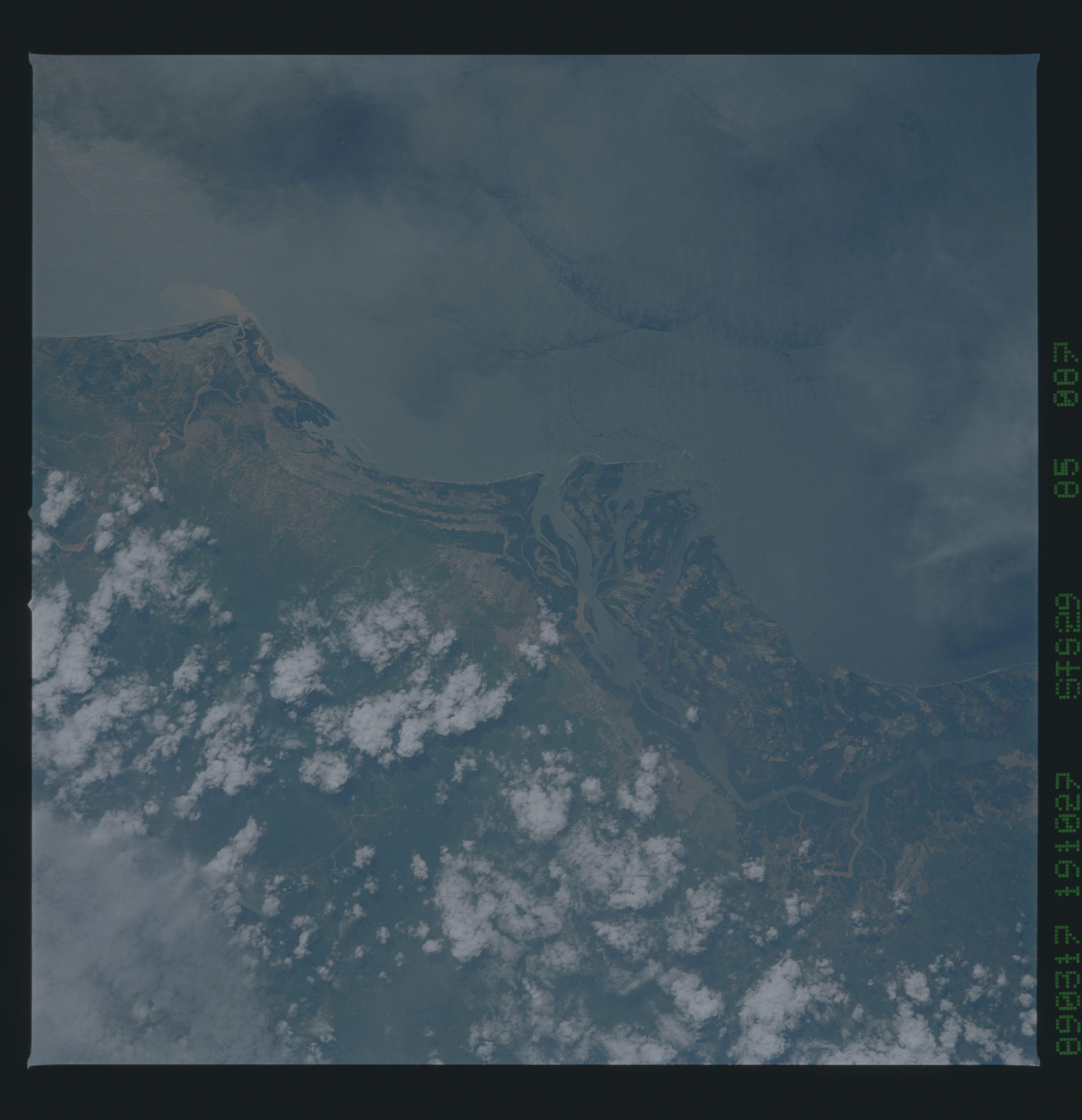
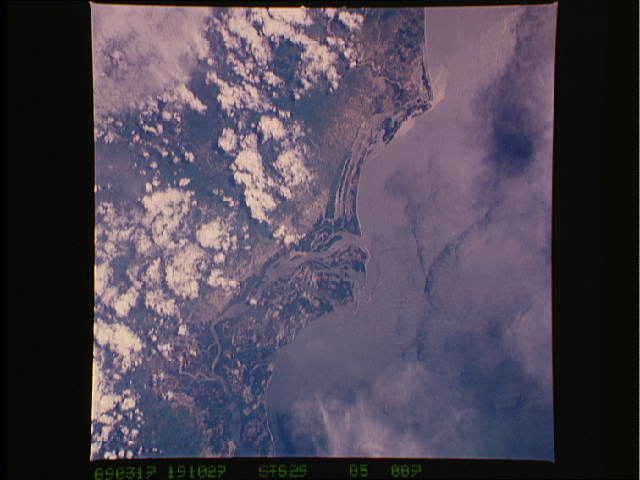
Gulf of Guayaquil, Ecuador Coast
The Southern Ecuador Coast and the Gulf of Guayaquil are visible
in this near vertical view taken in March 1989. Few photographs
from space exist of the Ecuador and Colombia Pacific Coast north
of the Gulf of Guayaquil. Sediment plumes can be seen at the
upper left of the view near the town of Tumbes, Peru. Sediment
is coming from the foothills of the Northern Peruvian Andes Moun-
tains. Ocean patterns, much like internal waves, can be seen at
the top of the photograph. (S29-85-087)
