STS029-82-60
| NASA Photo ID | STS029-82-60 |
| Focal Length | 250mm |
| Date taken | 1989.03.16 |
| Time taken | 12:55:55 GMT |

Cloud masks available for this image:
Spacecraft nadir point: 3.0° S, 23.0° E
Photo center point: 1.0° S, 23.5° E
Photo center point by machine learning:
Photo center point: 1.0° S, 23.5° E
Photo center point by machine learning:
Nadir to Photo Center: North
Spacecraft Altitude: 163 nautical miles (302km)
Country or Geographic Name: | DEM. REP. OF CONGO |
Features: | TSHUAPA RIVER |
| Features Found Using Machine Learning: | |
Cloud Cover Percentage: | 50 (26-50)% |
Sun Elevation Angle: | 55° |
Sun Azimuth: | 271° |
Camera: | Hasselblad |
Focal Length: | 250mm |
Camera Tilt: | 37 degrees |
Format: | 5017: Kodak, natural color positive, Ektachrome, X Professional, ASA 64, standard base |
Film Exposure: | Normal |
| Additional Information | |
| Width | Height | Annotated | Cropped | Purpose | Links |
|---|---|---|---|---|---|
| 5700 pixels | 5900 pixels | No | No | Download Image | |
| 500 pixels | 518 pixels | No | No | Download Image | |
| 640 pixels | 480 pixels | No | No | Download Image |
Download Packaged File
Download a Google Earth KML for this Image
View photo footprint information
Download a GeoTIFF for this photo
Image Caption:
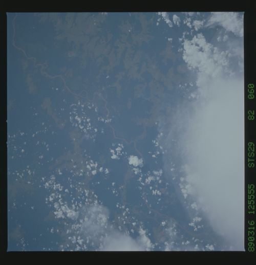
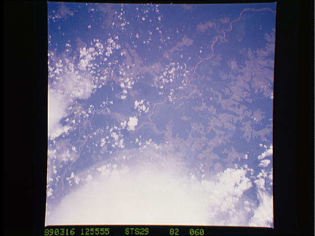
Tshuapa River, Southern Zaire River Basin T21
A rare break in the clouds allowed the STS-29 crew in March, 1989
to photograph the land use patterns in the northeastern portion
of the Southern Zaire River Basin Site. Grassland in this region
occurs on the higher ground between the numerous river tribu-
taries and not in the actual river floodplains. The Tshuapa
River traverses the photographs from the bottom left to the top
right. (S29-82-059, 060)
