STS029-81-51
| NASA Photo ID | STS029-81-51 |
| Focal Length | 100mm |
| Date taken | 1989.03.17 |
| Time taken | 19:09:42 GMT |


Cloud masks available for this image:
Spacecraft nadir point: 2.3° S, 82.1° W
Photo center point:
Photo center point by machine learning:
Photo center point:
Photo center point by machine learning:
Nadir to Photo Center:
Spacecraft Altitude: 166 nautical miles (307km)
Country or Geographic Name: | PACIFIC OCEAN |
Features: | SUNGLINT |
| Features Found Using Machine Learning: | |
Cloud Cover Percentage: | 50 (26-50)% |
Sun Elevation Angle: | 66° |
Sun Azimuth: | 272° |
Camera: | Hasselblad |
Focal Length: | 100mm |
Camera Tilt: | |
Format: | 5017: Kodak, natural color positive, Ektachrome, X Professional, ASA 64, standard base |
Film Exposure: | Normal |
| Additional Information | |
| Width | Height | Annotated | Cropped | Purpose | Links |
|---|---|---|---|---|---|
| 5700 pixels | 5900 pixels | No | No | Download Image | |
| 500 pixels | 518 pixels | No | No | Download Image | |
| 640 pixels | 480 pixels | No | No | Download Image |
Download Packaged File
Download a Google Earth KML for this Image
View photo footprint information
Download a GeoTIFF for this photo
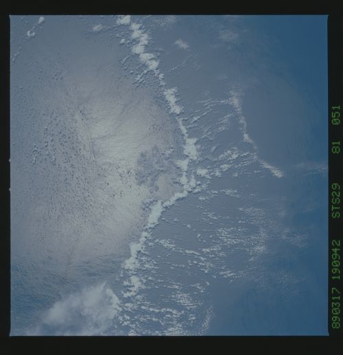
Image Caption: Air-Sea Interface off of Ecuador.
(nadir 2.3S 82.1W) In the South Pacific, about 70 nm off
the coast of Ecuador. The line of clouds is forming along
the boundary between the cold upwelled coastal water and
the warmer offshore water.
(nadir 2.3S 82.1W) In the South Pacific, about 70 nm off
the coast of Ecuador. The line of clouds is forming along
the boundary between the cold upwelled coastal water and
the warmer offshore water.
