STS028-97-85
| NASA Photo ID | STS028-97-85 |
| Focal Length | 250mm |
| Date taken | 1989.08.10 |
| Time taken | 20:45:53 GMT |
Resolutions offered for this image:
3904 x 3856 pixels 639 x 632 pixels 5700 x 5900 pixels 7232 x 7306 pixels 7232 x 7306 pixels 500 x 518 pixels 640 x 480 pixels 2441 x 2404 pixels
3904 x 3856 pixels 639 x 632 pixels 5700 x 5900 pixels 7232 x 7306 pixels 7232 x 7306 pixels 500 x 518 pixels 640 x 480 pixels 2441 x 2404 pixels

Cloud masks available for this image:
Spacecraft nadir point: 57.0° N, 140.0° W
Photo center point: 59.0° N, 138.5° W
Photo center point by machine learning:
Photo center point: 59.0° N, 138.5° W
Photo center point by machine learning:
Nadir to Photo Center: Northeast
Spacecraft Altitude: 161 nautical miles (298km)
Country or Geographic Name: | USA-ALASKA |
Features: | ALSEK R, ST. ELIAS MTNS. |
| Features Found Using Machine Learning: | |
Cloud Cover Percentage: | 20 (11-25)% |
Sun Elevation Angle: | 48° |
Sun Azimuth: | 166° |
Camera: | Hasselblad |
Focal Length: | 250mm |
Camera Tilt: | 43 degrees |
Format: | 5017: Kodak, natural color positive, Ektachrome, X Professional, ASA 64, standard base |
Film Exposure: | Normal |
| Additional Information | |
| Width | Height | Annotated | Cropped | Purpose | Links |
|---|---|---|---|---|---|
| 3904 pixels | 3856 pixels | No | No | Earth From Space collection | Download Image |
| 639 pixels | 632 pixels | No | No | Earth From Space collection | Download Image |
| 5700 pixels | 5900 pixels | No | No | Download Image | |
| 7232 pixels | 7306 pixels | No | No | Scientist Request | Download Image |
| 7232 pixels | 7306 pixels | No | No | Scientist Request | Download Image |
| 500 pixels | 518 pixels | No | No | Download Image | |
| 640 pixels | 480 pixels | No | No | Download Image | |
| 2441 pixels | 2404 pixels | No | Yes | Download Image |
Download Packaged File
Download a Google Earth KML for this Image
View photo footprint information
Download a GeoTIFF for this photo
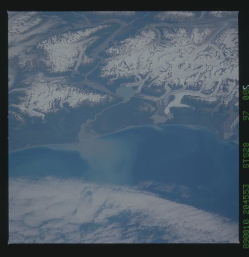
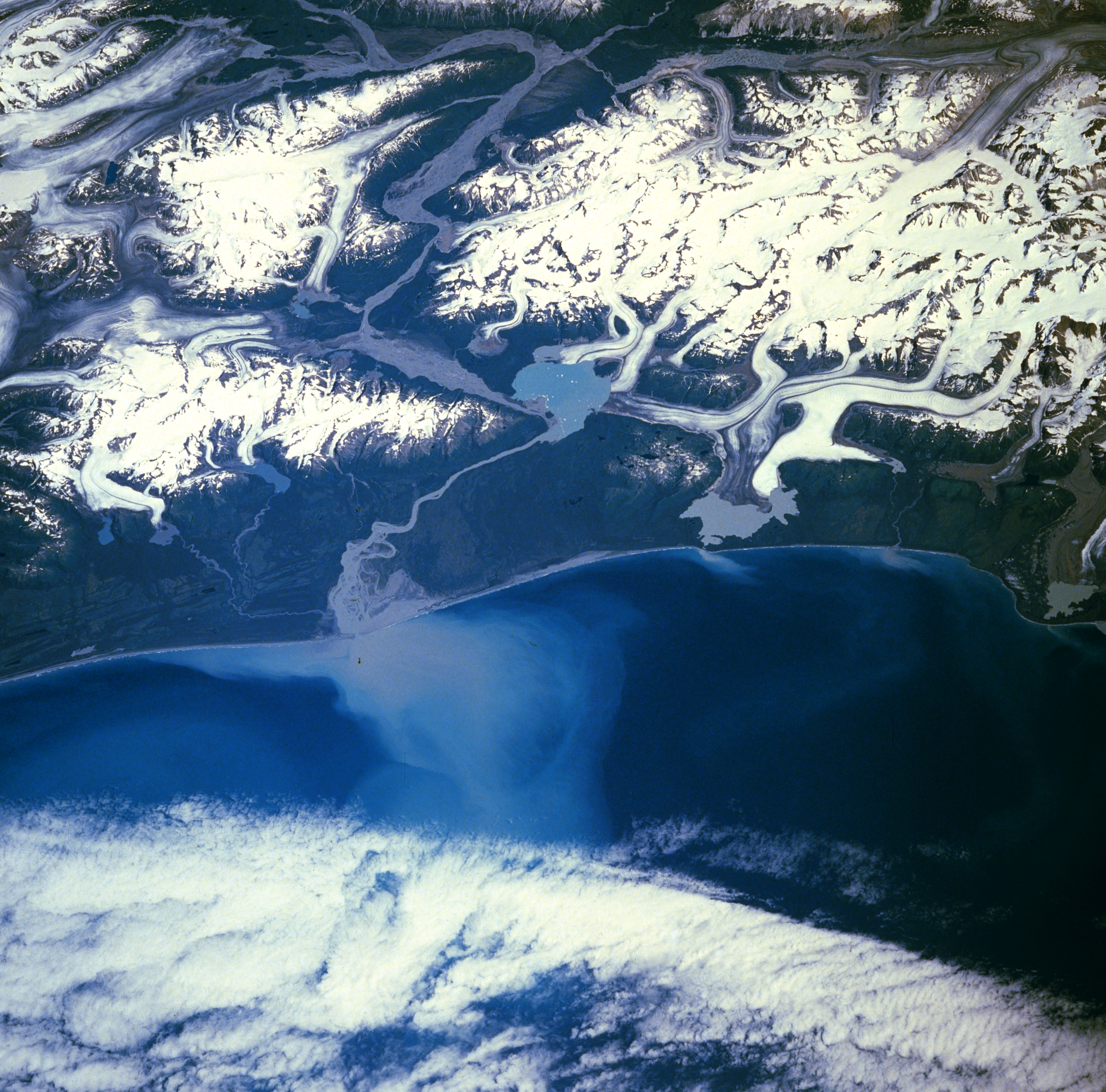
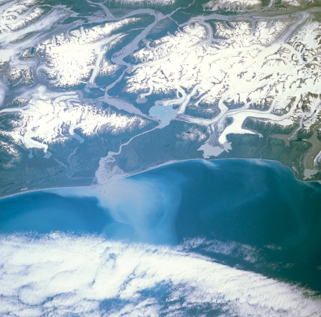
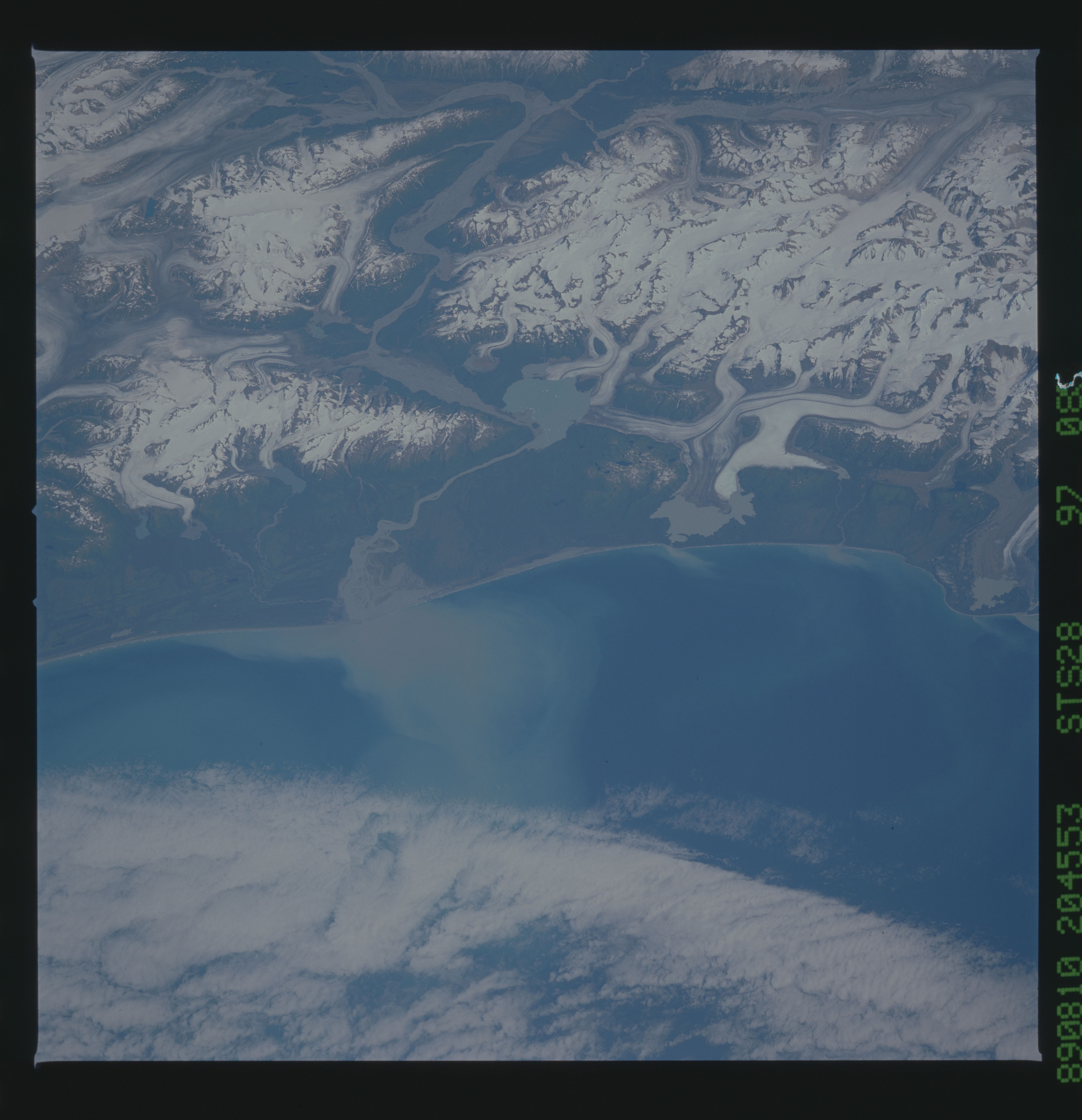
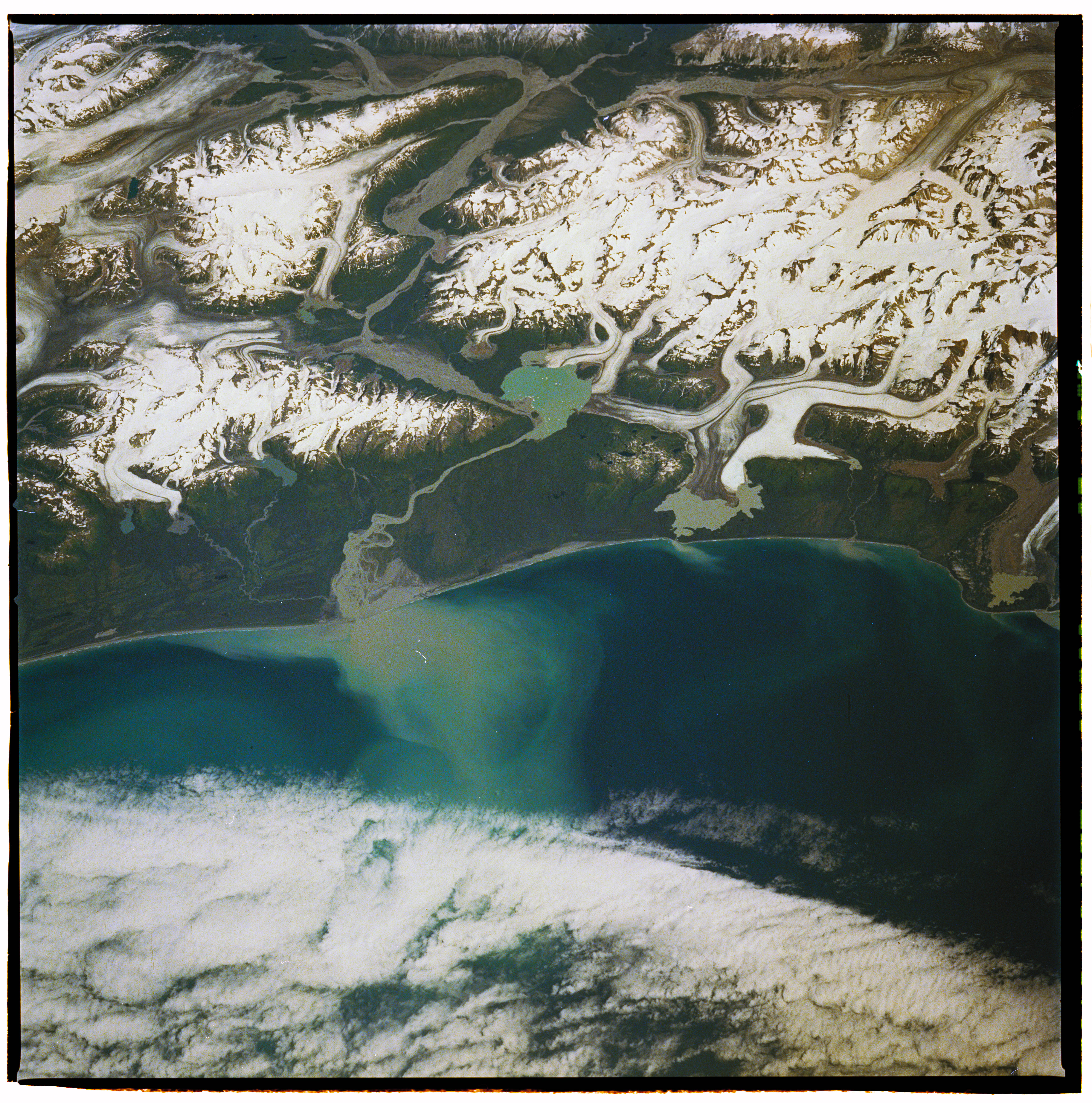
Image Caption: STS028-097-085 Saint Elias Mountains, Alaska, U.S.A. August 1989
The northwest-southeast-oriented Saint Elias Mountains appear slightly inland from the coast and are the major landform in this photograph. This area of glaciated terrain lies immediately southeast of the large Malaspina Glacier (not discernible in this photograph). Visible are low stratus clouds off the coast, a light blue sediment plume at the mouth of the Alsek River, and a variety of medial moraines (darker lines created by the debris carried by glaciers as they move through the valleys). Apparent in the photograph are several large, U-shaped valleys at the top and Cape Fairweather, the protrusion of land along the right edge.
The northwest-southeast-oriented Saint Elias Mountains appear slightly inland from the coast and are the major landform in this photograph. This area of glaciated terrain lies immediately southeast of the large Malaspina Glacier (not discernible in this photograph). Visible are low stratus clouds off the coast, a light blue sediment plume at the mouth of the Alsek River, and a variety of medial moraines (darker lines created by the debris carried by glaciers as they move through the valleys). Apparent in the photograph are several large, U-shaped valleys at the top and Cape Fairweather, the protrusion of land along the right edge.
