STS028-91-B
| NASA Photo ID | STS028-91-B |
| Focal Length | 250mm |
| Date taken | 1989.08.__ |
| Time taken | GMT |
Resolutions offered for this image:
4096 x 4096 pixels 640 x 640 pixels 5700 x 5900 pixels 500 x 518 pixels 640 x 480 pixels
4096 x 4096 pixels 640 x 640 pixels 5700 x 5900 pixels 500 x 518 pixels 640 x 480 pixels

Cloud masks available for this image:
Spacecraft nadir point:
Photo center point: 46.0° N, 81.0° E
Photo center point by machine learning:
Photo center point: 46.0° N, 81.0° E
Photo center point by machine learning:
Nadir to Photo Center:
Spacecraft Altitude: nautical miles (0km)
Country or Geographic Name: | KAZAKHSTAN |
Features: | LAKE SASYKKOL |
| Features Found Using Machine Learning: | |
Cloud Cover Percentage: | 5 (1-10)% |
Sun Elevation Angle: | ° |
Sun Azimuth: | ° |
Camera: | Hasselblad |
Focal Length: | 250mm |
Camera Tilt: | Low Oblique |
Format: | 5017: Kodak, natural color positive, Ektachrome, X Professional, ASA 64, standard base |
Film Exposure: | Normal |
| Additional Information | |
| Width | Height | Annotated | Cropped | Purpose | Links |
|---|---|---|---|---|---|
| 4096 pixels | 4096 pixels | No | No | Earth From Space collection | Download Image |
| 640 pixels | 640 pixels | No | No | Earth From Space collection | Download Image |
| 5700 pixels | 5900 pixels | No | No | Download Image | |
| 500 pixels | 518 pixels | No | No | Download Image | |
| 640 pixels | 480 pixels | No | No | Download Image |
Download Packaged File
Download a Google Earth KML for this Image
View photo footprint information
Download a GeoTIFF for this photo
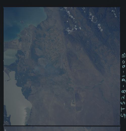
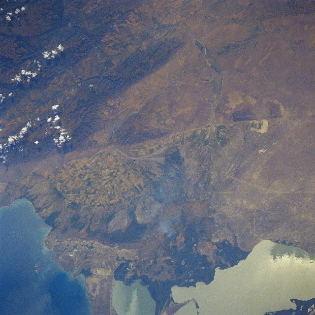
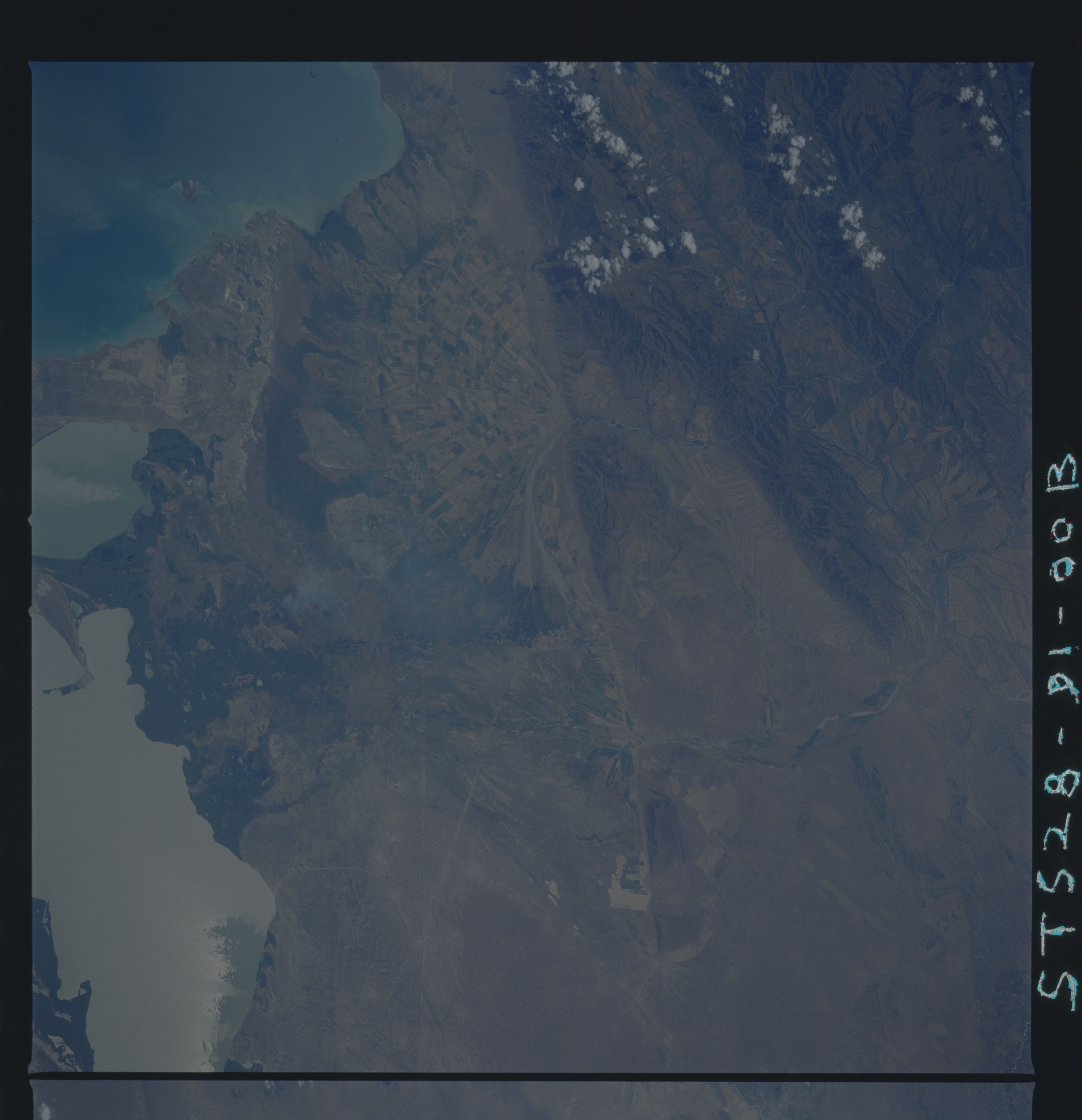
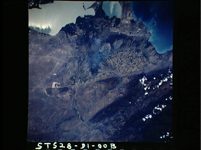
Image Caption: STS028-091-00B Dzhungarsk Range, Sasykkol Salt Lake, Kazakhstan August 1989
The northern part of the Dzhungarsk Range can be seen in the upper left portion of the image in this southwest-looking view. The southern part of Sasykkol Salt Lake (highly reflective surface) is visible in the lower right part of the image. The northwestern part of Alakol Salt Lake is discernible in the lower left portion of the image. Roads are visible traversing the scene from just below the right corner of the image (northwest) exiting the scene at the left center of the image. These roads are the main transportation routes between China and Kazakhstan. A large alluvial fan covered with agricultural fields is visible midway between the left center and center of the image. A smoke plume is discernible in the lowland marshes of the Shinzhaly River Plain midway between the bottom center and center of the image.
The northern part of the Dzhungarsk Range can be seen in the upper left portion of the image in this southwest-looking view. The southern part of Sasykkol Salt Lake (highly reflective surface) is visible in the lower right part of the image. The northwestern part of Alakol Salt Lake is discernible in the lower left portion of the image. Roads are visible traversing the scene from just below the right corner of the image (northwest) exiting the scene at the left center of the image. These roads are the main transportation routes between China and Kazakhstan. A large alluvial fan covered with agricultural fields is visible midway between the left center and center of the image. A smoke plume is discernible in the lowland marshes of the Shinzhaly River Plain midway between the bottom center and center of the image.
