STS028-83-27
| NASA Photo ID | STS028-83-27 |
| Focal Length | 100mm |
| Date taken | 1989.08.11 |
| Time taken | 16:16:54 GMT |
Resolutions offered for this image:
3904 x 3904 pixels 639 x 639 pixels 5700 x 5900 pixels 500 x 518 pixels 640 x 480 pixels
3904 x 3904 pixels 639 x 639 pixels 5700 x 5900 pixels 500 x 518 pixels 640 x 480 pixels


Cloud masks available for this image:
Spacecraft nadir point: 51.8° N, 117.2° W
Photo center point: 51.5° N, 117.5° W
Photo center point by machine learning:
Photo center point: 51.5° N, 117.5° W
Photo center point by machine learning:
Nadir to Photo Center: Southwest
Spacecraft Altitude: 161 nautical miles (298km)
Country or Geographic Name: | CANADA-BC |
Features: | COLUMBIA RIVER |
| Features Found Using Machine Learning: | |
Cloud Cover Percentage: | 5 (1-10)% |
Sun Elevation Angle: | 34° |
Sun Azimuth: | 110° |
Camera: | Hasselblad |
Focal Length: | 100mm |
Camera Tilt: | 9 degrees |
Format: | 5017: Kodak, natural color positive, Ektachrome, X Professional, ASA 64, standard base |
Film Exposure: | Normal |
| Additional Information | |
| Width | Height | Annotated | Cropped | Purpose | Links |
|---|---|---|---|---|---|
| 3904 pixels | 3904 pixels | No | No | Earth From Space collection | Download Image |
| 639 pixels | 639 pixels | No | No | Earth From Space collection | Download Image |
| 5700 pixels | 5900 pixels | No | No | Download Image | |
| 500 pixels | 518 pixels | No | No | Download Image | |
| 640 pixels | 480 pixels | No | No | Download Image |
Download Packaged File
Download a Google Earth KML for this Image
View photo footprint information
Download a GeoTIFF for this photo
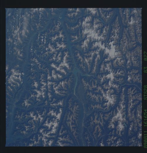
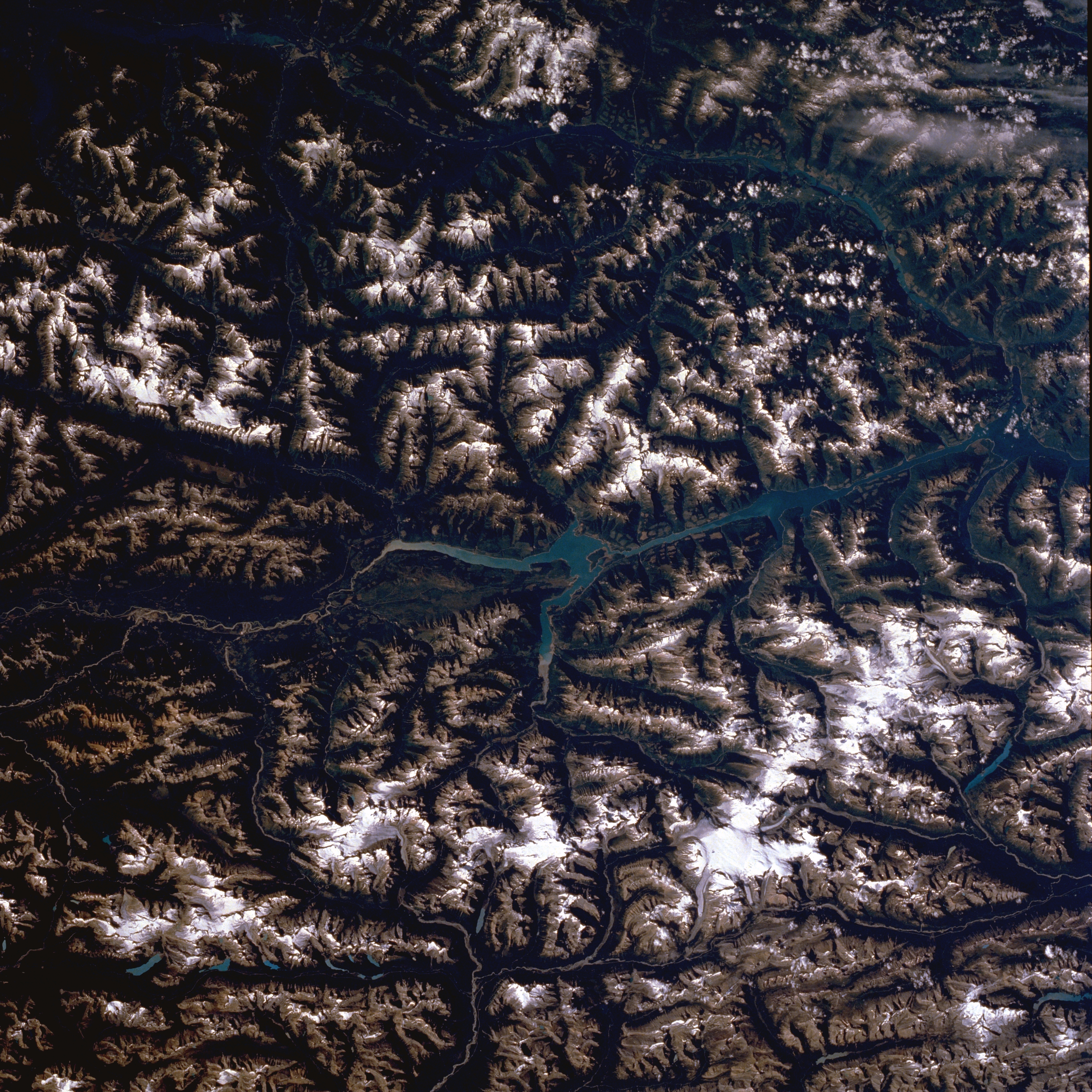
Image Caption: STS028-083-027 Columbia River, British Columbia, Canada August 1989
The snow covered, ice formed peaks of the Canadian Rocky Mountains (parallel to the bottom of the picture) form the border between British Columbia (west or top) and Alberta (east or bottom). These elevated peaks, generally exceeding 10,000 feet (3,050 meters) above sea level, are part of the northern portion of the Continental Divide. The wider stretch of water in this part of the Columbia River is known as Kinbasket Lake (center). The two large snow capped peaks in the lower right quadrant of the image show the locations of the Clemenceau and Columbia Ice Fields in Alberta, where elevations exceed 12,000 feet (3,660 meters) above sea level.
The snow covered, ice formed peaks of the Canadian Rocky Mountains (parallel to the bottom of the picture) form the border between British Columbia (west or top) and Alberta (east or bottom). These elevated peaks, generally exceeding 10,000 feet (3,050 meters) above sea level, are part of the northern portion of the Continental Divide. The wider stretch of water in this part of the Columbia River is known as Kinbasket Lake (center). The two large snow capped peaks in the lower right quadrant of the image show the locations of the Clemenceau and Columbia Ice Fields in Alberta, where elevations exceed 12,000 feet (3,660 meters) above sea level.
