STS028-73-56
| NASA Photo ID | STS028-73-56 |
| Focal Length | 250mm |
| Date taken | 1989.08.11 |
| Time taken | 21:02:24 GMT |
Resolutions offered for this image:
3850 x 3892 pixels 633 x 639 pixels 5700 x 5900 pixels 500 x 518 pixels 640 x 480 pixels
3850 x 3892 pixels 633 x 639 pixels 5700 x 5900 pixels 500 x 518 pixels 640 x 480 pixels


Cloud masks available for this image:
Spacecraft nadir point: 40.7° N, 98.9° W
Photo center point: 41.0° N, 98.0° W
Photo center point by machine learning:
Photo center point: 41.0° N, 98.0° W
Photo center point by machine learning:
Nadir to Photo Center: East
Spacecraft Altitude: 163 nautical miles (302km)
Country or Geographic Name: | USA-NEBRASKA |
Features: | GRAND ISLAND |
| Features Found Using Machine Learning: | |
Cloud Cover Percentage: | 20 (11-25)% |
Sun Elevation Angle: | 50° |
Sun Azimuth: | 241° |
Camera: | Hasselblad |
Focal Length: | 250mm |
Camera Tilt: | 19 degrees |
Format: | 5017: Kodak, natural color positive, Ektachrome, X Professional, ASA 64, standard base |
Film Exposure: | Normal |
| Additional Information | |
| Width | Height | Annotated | Cropped | Purpose | Links |
|---|---|---|---|---|---|
| 3850 pixels | 3892 pixels | No | No | Earth From Space collection | Download Image |
| 633 pixels | 639 pixels | No | No | Earth From Space collection | Download Image |
| 5700 pixels | 5900 pixels | No | No | Download Image | |
| 500 pixels | 518 pixels | No | No | Download Image | |
| 640 pixels | 480 pixels | No | No | Download Image |
Download Packaged File
Download a Google Earth KML for this Image
View photo footprint information
Download a GeoTIFF for this photo
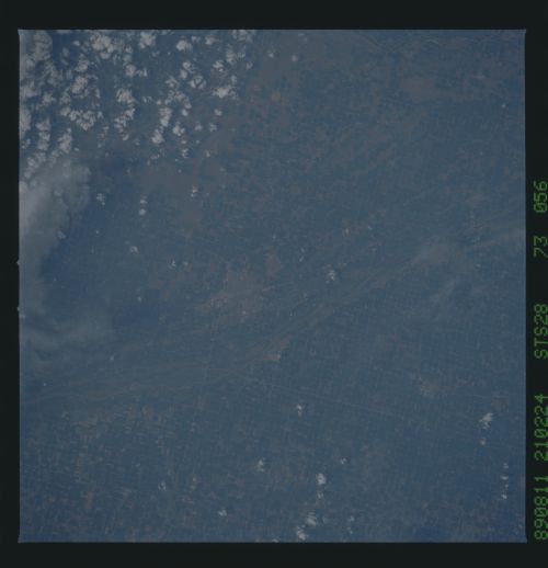
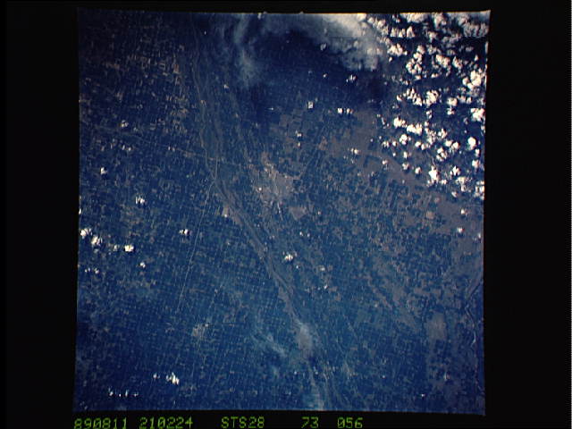
Image Caption: STS028-073-056 Grand Island and Platte River, Nebraska, U.S.A. August 1989
In the Platte River Valley near the junction of the Wood River and the Platte River, Grand Island is apparent in this west-looking, low-oblique photograph. The city is a major manufacturing and shopping center in this rich agricultural area of central Nebraska. Farm implements, flour mills, packing houses, and dairies are the major industries in the city. Interstate Highway 80 (barely discernible) traverses west-east just south of the city.
In the Platte River Valley near the junction of the Wood River and the Platte River, Grand Island is apparent in this west-looking, low-oblique photograph. The city is a major manufacturing and shopping center in this rich agricultural area of central Nebraska. Farm implements, flour mills, packing houses, and dairies are the major industries in the city. Interstate Highway 80 (barely discernible) traverses west-east just south of the city.
