STS028-152-165
| NASA Photo ID | STS028-152-165 |
| Focal Length | 250mm |
| Date taken | 1989.08.10 |
| Time taken | 20:52:20 GMT |
Cloud masks available for this image:
Spacecraft nadir point: 47.8° N, 102.2° W
Photo center point: 47.5° N, 102.0° W
Photo center point by machine learning:
Photo center point: 47.5° N, 102.0° W
Photo center point by machine learning:
Nadir to Photo Center: Southeast
Spacecraft Altitude: 163 nautical miles (302km)
Country or Geographic Name: | USA-NORTH DAKOTA |
Features: | L. SAKAKAWEA, MO. R, AGR |
| Features Found Using Machine Learning: | |
Cloud Cover Percentage: | 40 (26-50)% |
Sun Elevation Angle: | 50° |
Sun Azimuth: | 227° |
Camera: | Linhof |
Focal Length: | 250mm |
Camera Tilt: | 8 degrees |
Format: | QX868: Kodak, natural color positive, Ektachrome QX868(5017 emulsion), ASA 64, thin base |
Film Exposure: | Normal |
| Additional Information | |
| Width | Height | Annotated | Cropped | Purpose | Links |
|---|---|---|---|---|---|
| 4096 pixels | 5216 pixels | No | No | Earth From Space collection | Download Image |
| 502 pixels | 640 pixels | No | No | Earth From Space collection | Download Image |
| 640 pixels | 480 pixels | No | No | ISD 1 | Download Image |
Download Packaged File
Download a Google Earth KML for this Image
View photo footprint information
Download a GeoTIFF for this photo
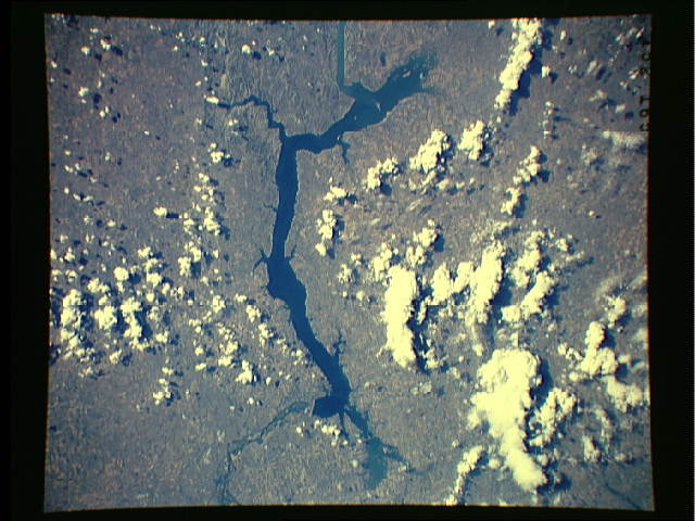
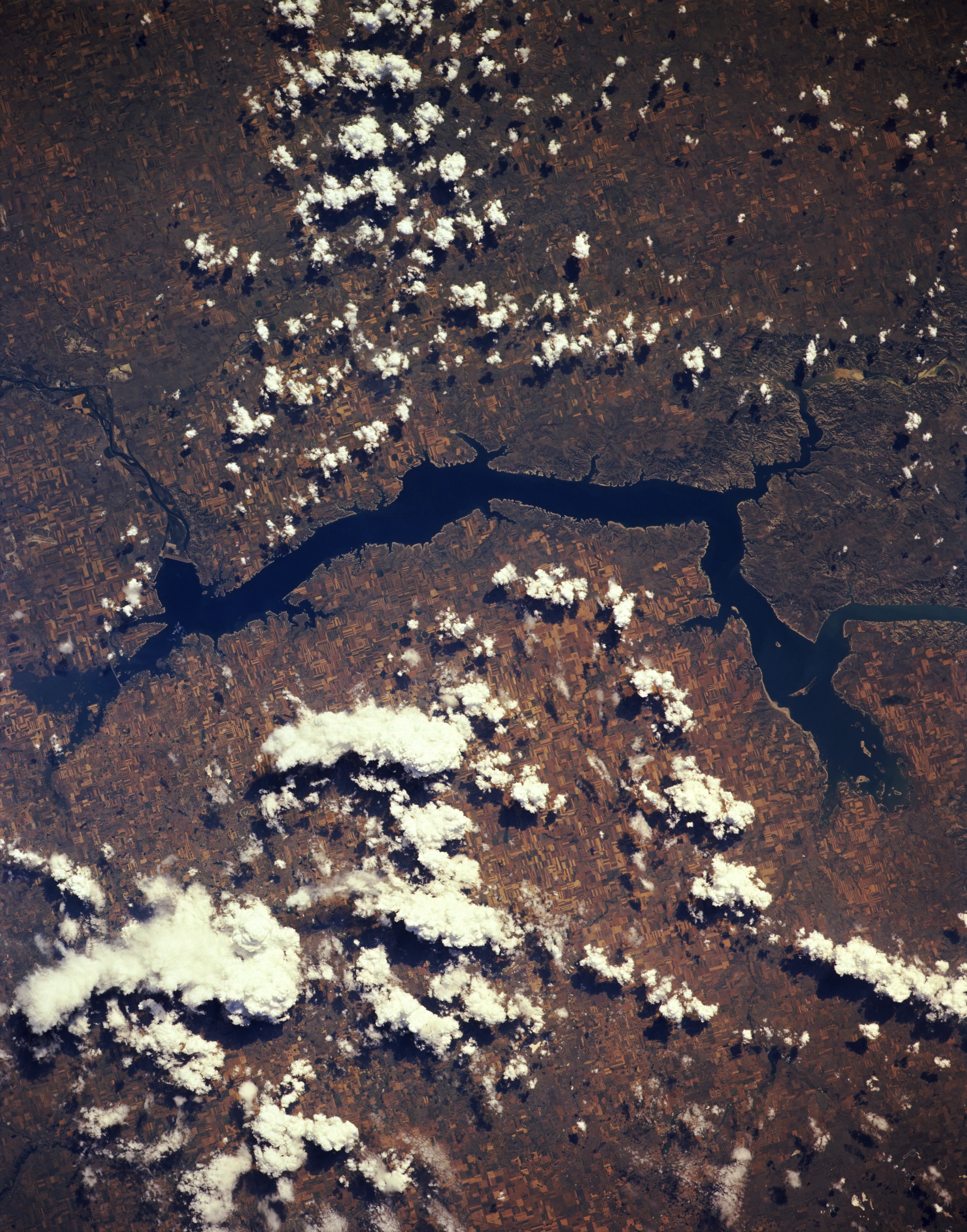
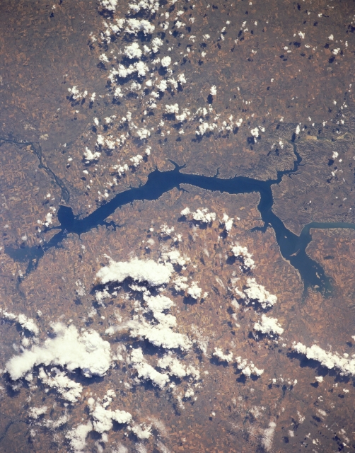
Image Caption: STS028-152-165 Garrison Dam and Lake Sakakawea, North Dakota, U.S.A. August 1989
Lake Sakakawea, with more than 1600 miles (2576 kilometers) of shoreline, is featured in this south-southwest-looking, low-oblique photograph. The lake extends westward almost 200 miles (322 kilometers) to near Williston, North Dakota (not in photograph). A smaller portion of the lake, including the Van Hook Arm, lies within the Fort Berthold Indian Reservation. The part of the Missouri River that forms Lake Sakakawea marks the approximate boundary of glaciers that covered North Dakota--to the east and north glacial deposits blanket the land, and to the west and south lie bedrock and the Bad Lands through which travels the Little Missouri River before entering Lake Sakakawea. Garrison Dam (left center) is one of the largest rolled-earth dams in the world. To its east appear Audubon Lake and the Audubon National Wildlife Refuge.
Lake Sakakawea, with more than 1600 miles (2576 kilometers) of shoreline, is featured in this south-southwest-looking, low-oblique photograph. The lake extends westward almost 200 miles (322 kilometers) to near Williston, North Dakota (not in photograph). A smaller portion of the lake, including the Van Hook Arm, lies within the Fort Berthold Indian Reservation. The part of the Missouri River that forms Lake Sakakawea marks the approximate boundary of glaciers that covered North Dakota--to the east and north glacial deposits blanket the land, and to the west and south lie bedrock and the Bad Lands through which travels the Little Missouri River before entering Lake Sakakawea. Garrison Dam (left center) is one of the largest rolled-earth dams in the world. To its east appear Audubon Lake and the Audubon National Wildlife Refuge.
