STS028-152-149
| NASA Photo ID | STS028-152-149 |
| Focal Length | 250mm |
| Date taken | 1989.08.10 |
| Time taken | 17:44:47 GMT |
Cloud masks available for this image:
Spacecraft nadir point: 57.1° N, 94.7° W
Photo center point: 57.0° N, 93.0° W
Photo center point by machine learning:
Photo center point: 57.0° N, 93.0° W
Photo center point by machine learning:
Nadir to Photo Center: East
Spacecraft Altitude: 161 nautical miles (298km)
Country or Geographic Name: | CANADA-M |
Features: | NELSON R, HUDSON BAY |
| Features Found Using Machine Learning: | |
Cloud Cover Percentage: | 30 (26-50)% |
Sun Elevation Angle: | 48° |
Sun Azimuth: | 166° |
Camera: | Linhof |
Focal Length: | 250mm |
Camera Tilt: | 32 degrees |
Format: | QX868: Kodak, natural color positive, Ektachrome QX868(5017 emulsion), ASA 64, thin base |
Film Exposure: | Normal |
| Additional Information | |
| Width | Height | Annotated | Cropped | Purpose | Links |
|---|---|---|---|---|---|
| 5184 pixels | 4032 pixels | No | No | Earth From Space collection | Download Image |
| 640 pixels | 497 pixels | No | No | Earth From Space collection | Download Image |
| 640 pixels | 480 pixels | No | No | ISD 1 | Download Image |
Download Packaged File
Download a Google Earth KML for this Image
View photo footprint information
Download a GeoTIFF for this photo
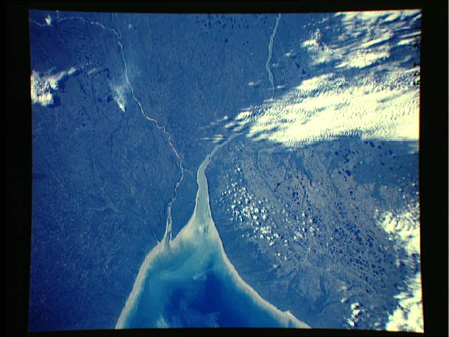
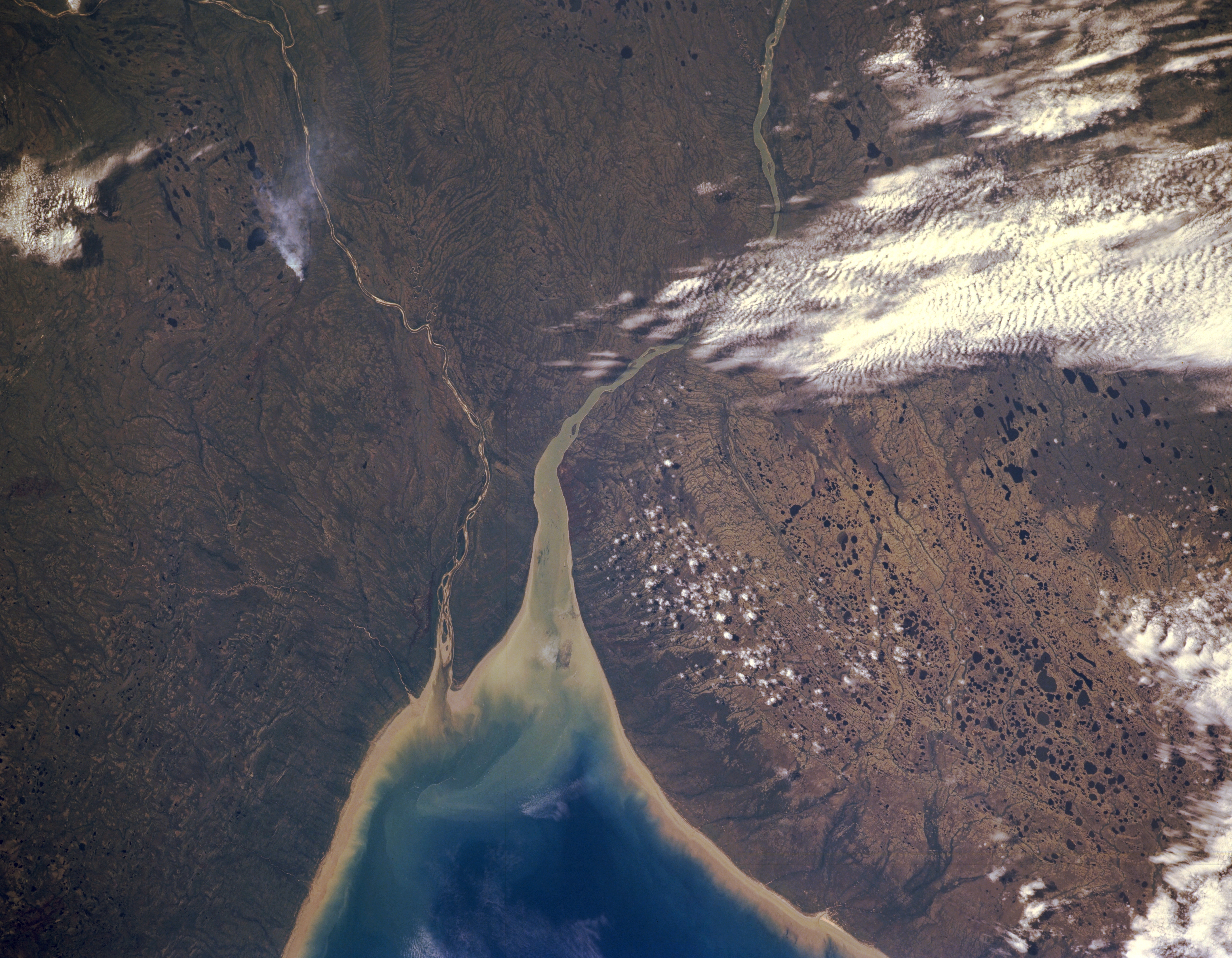
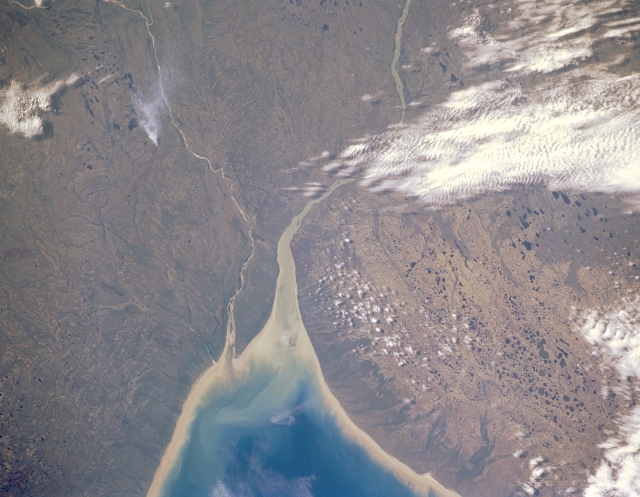
Image Caption: STS028-152-149 Nelson River, Manitoba, Canada August 1989
The Nelson River (larger, westerly) and the Hayes River (smaller, southwesterly) form a small peninsula that extends modestly into the southwest side of Hudson Bay. In this image there is no hint of human development or activity with the possible exception of a single smoke plume east of the Hayes River. But even the fire could have been started earlier by a lightning strike from a passing thunderstorm. The lighter colored shorelines east and north of the mouths of these rivers are sandy beaches. The spongy pattern made by a multitude of small lakes (dark features) shows the boggy landscape that is prevalent around Hudson Bay.
The Nelson River (larger, westerly) and the Hayes River (smaller, southwesterly) form a small peninsula that extends modestly into the southwest side of Hudson Bay. In this image there is no hint of human development or activity with the possible exception of a single smoke plume east of the Hayes River. But even the fire could have been started earlier by a lightning strike from a passing thunderstorm. The lighter colored shorelines east and north of the mouths of these rivers are sandy beaches. The spongy pattern made by a multitude of small lakes (dark features) shows the boggy landscape that is prevalent around Hudson Bay.
