STS027-45-81
| NASA Photo ID | STS027-45-81 |
| Focal Length | 100mm |
| Date taken | 1988.12.05 |
| Time taken | 23:43:10 GMT |

Cloud masks available for this image:
Spacecraft nadir point: 44.3° N, 143.2° E
Photo center point: 43.5° N, 144.5° E
Photo center point by machine learning:
Photo center point: 43.5° N, 144.5° E
Photo center point by machine learning:
Nadir to Photo Center: Southeast
Spacecraft Altitude: 240 nautical miles (444km)
Camera: | Hasselblad |
Focal Length: | 100mm |
Camera Tilt: | 21 degrees |
Format: | 5036: Kodak, natural color positive, Ektachrome 5036,200 Professional, ASA 200, stand |
Film Exposure: | Normal |
| Additional Information | |
| Width | Height | Annotated | Cropped | Purpose | Links |
|---|---|---|---|---|---|
| 5700 pixels | 5900 pixels | No | No | Download Image | |
| 500 pixels | 518 pixels | No | No | Download Image | |
| 640 pixels | 480 pixels | No | No | Download Image |
Download Packaged File
Download a Google Earth KML for this Image
View photo footprint information
Download a GeoTIFF for this photo
Image Caption:
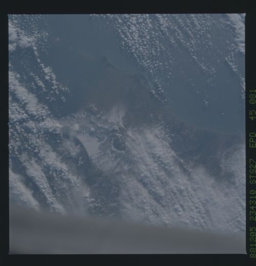
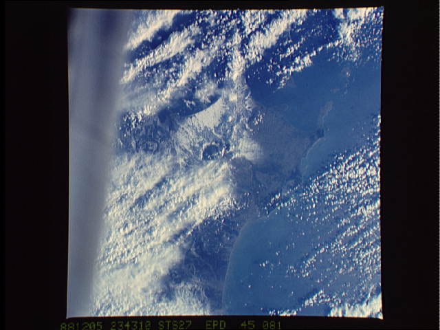
Kussharo Caldera
These two near-vertical views show a string of volcanoes in the
northeastern portion of Hokkaido Island, including the large lake
filled Kussharo Caldera (1). Numerous other volcanic features
are highlighted by snowfall including calderas (2) and Mount
Shart Volcano (3). Volcanic ash flow (4) extend from the
Kussharo Caldera towards the coast. Many canyons are eroded into
the relatively soft ash flows. The active volcano Mount Akan is
located south of the Kussharo Caldera (toward the bottom center
of the lower photograph) but is not visible due to cloud cover.
(S27-45-081, S27-43-064)
