STS027-39-27
| NASA Photo ID | STS027-39-27 |
| Focal Length | 250mm |
| Date taken | 1988.12.03 |
| Time taken | 03:00:54 GMT |
Resolutions offered for this image:
5307 x 4723 pixels 640 x 569 pixels 5700 x 5900 pixels 500 x 518 pixels 640 x 480 pixels
5307 x 4723 pixels 640 x 569 pixels 5700 x 5900 pixels 500 x 518 pixels 640 x 480 pixels
Cloud masks available for this image:
Spacecraft nadir point: 22.2° N, 85.1° E
Photo center point:
Photo center point by machine learning:
Photo center point:
Photo center point by machine learning:
Nadir to Photo Center:
Spacecraft Altitude: 241 nautical miles (446km)
Country or Geographic Name: | INDIA |
Features: | GANGES RIVER |
| Features Found Using Machine Learning: | |
Cloud Cover Percentage: | 30 (26-50)% |
Sun Elevation Angle: | 26° |
Sun Azimuth: | 131° |
Camera: | Hasselblad |
Focal Length: | 250mm |
Camera Tilt: | High Oblique |
Format: | 5017: Kodak, natural color positive, Ektachrome, X Professional, ASA 64, standard base |
Film Exposure: | Normal |
| Additional Information | |
| Width | Height | Annotated | Cropped | Purpose | Links |
|---|---|---|---|---|---|
| 5307 pixels | 4723 pixels | No | No | Earth From Space collection | Download Image |
| 640 pixels | 569 pixels | No | No | Earth From Space collection | Download Image |
| 5700 pixels | 5900 pixels | No | No | Download Image | |
| 500 pixels | 518 pixels | No | No | Download Image | |
| 640 pixels | 480 pixels | No | No | Download Image |
Download Packaged File
Download a Google Earth KML for this Image
View photo footprint information
Download a GeoTIFF for this photo
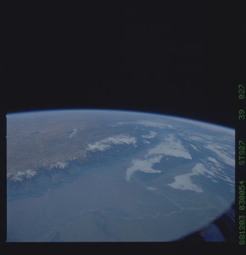
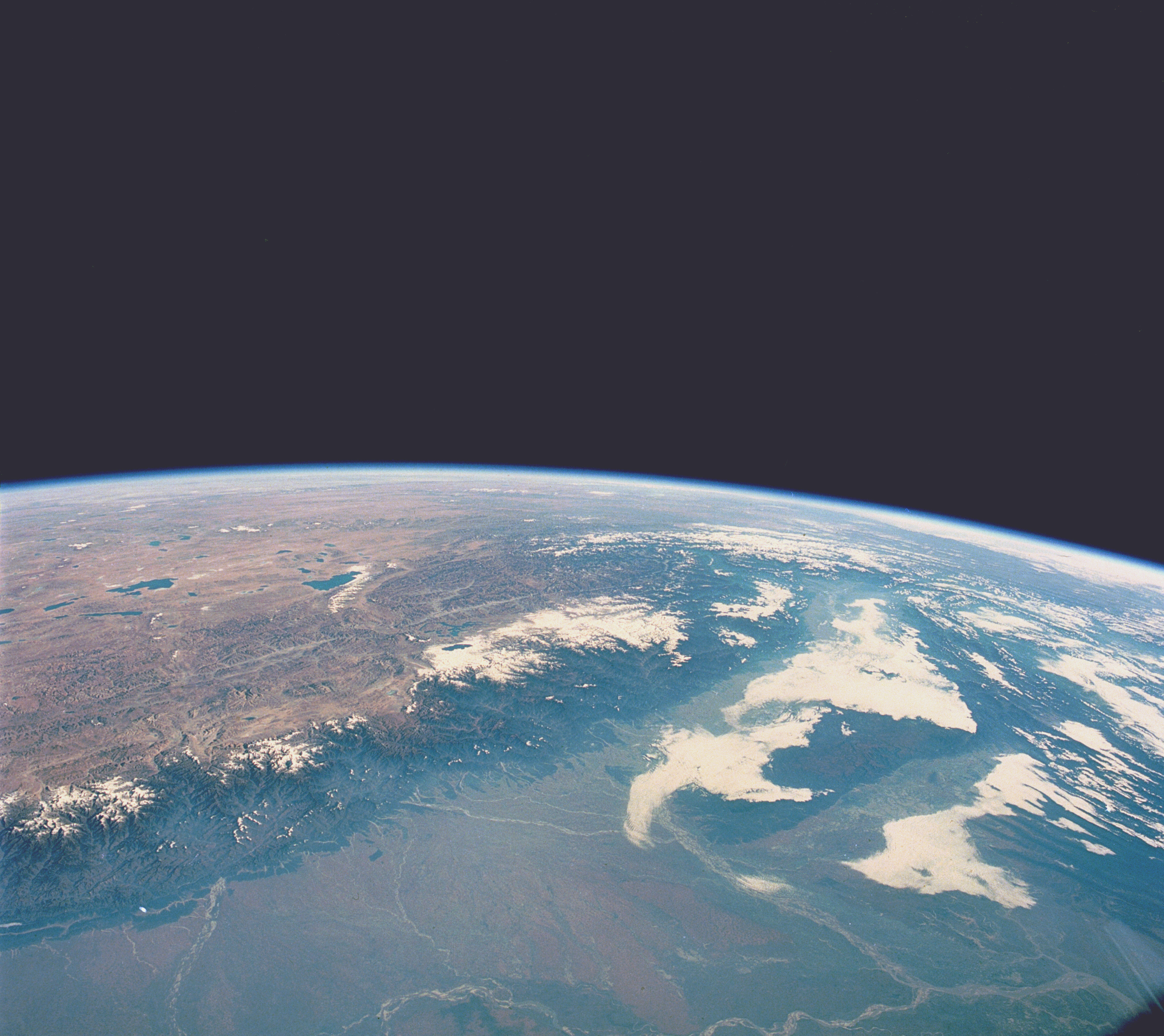
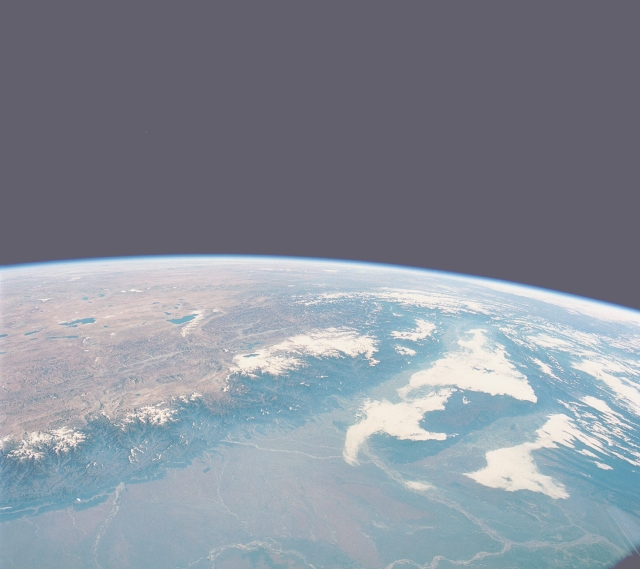
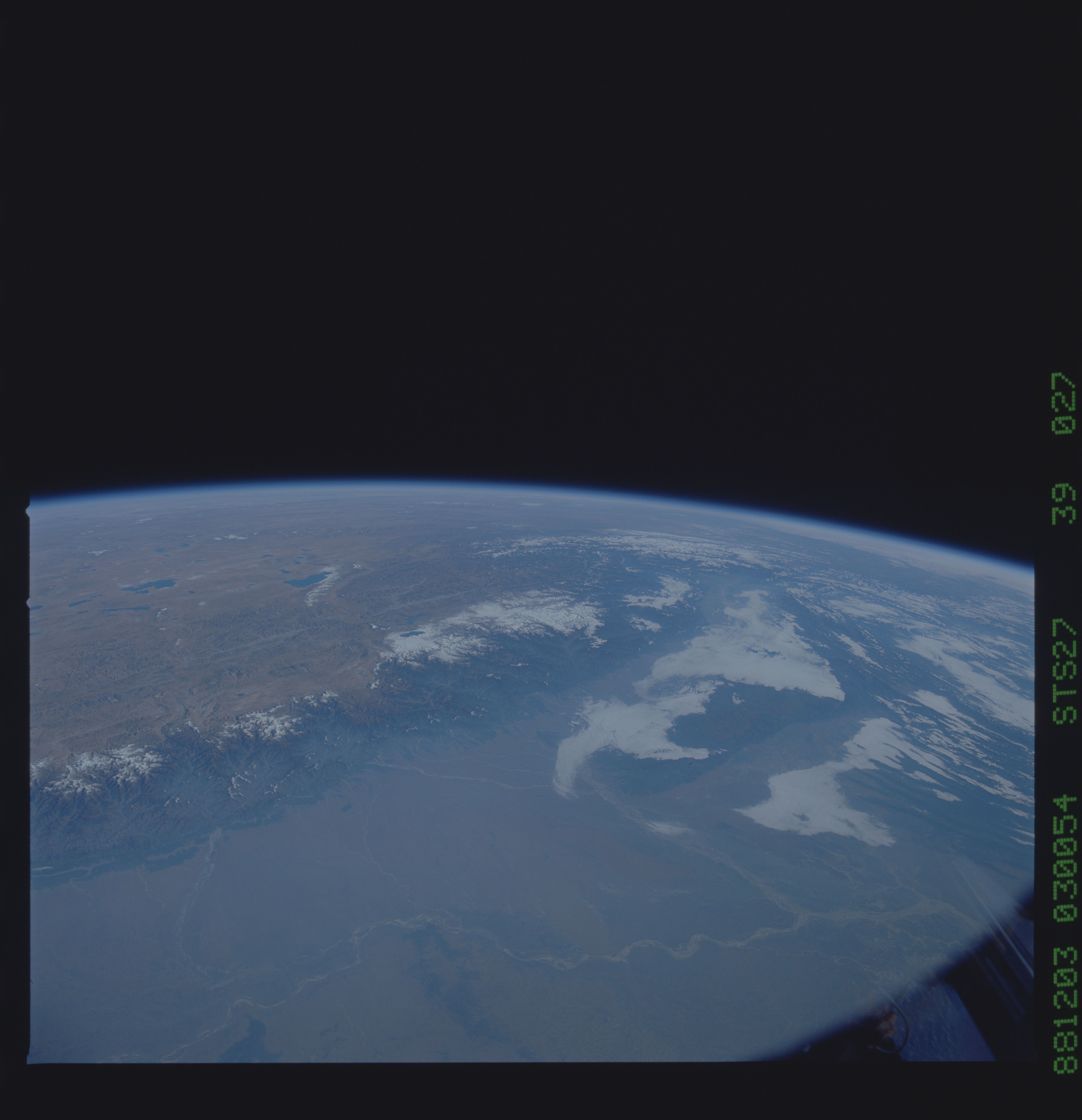
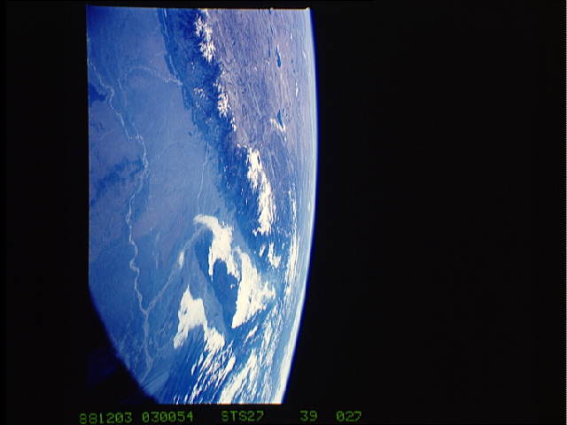
Image Caption: STS027-039-027 Himalaya Mountains and Northeast India December 1988
This high-oblique, northeast-looking photograph of northeast India and a small part of the Tibetan Plateau of China provides a view of various landforms. Visible is a segment of the east-west trending Himalayas, the world's highest mountain range, with many ridgelines and peaks exceeding 20 000 feet (6095 meters). These mountains were created by the dramatic collision of the Australian-Indian Plate and the Eurasian Plate. The water levels of numerous blue lakes on the high plateau of Tibet are primarily maintained by meltwater from the snow and glaciers of the high Himalayas. Immediately north of these lakes, elevations rise to more than 15 000 feet (4710 meters). In contrast to the arid Tibetan Plateau is the Brahmaputra River valley of northeast India, the world's second wettest spot (the island of Kauai, Hawaii, is the wettest). Most of the rainfall occurs in the Brahmaputra valley during the monsoon season of northeast India. The Brahmaputra River with its braided multichannels bends south around the Kasi Hills of northeast India. A small part of the highly populated Ganges River Plain is visible along the southern edge of the photograph.
This high-oblique, northeast-looking photograph of northeast India and a small part of the Tibetan Plateau of China provides a view of various landforms. Visible is a segment of the east-west trending Himalayas, the world's highest mountain range, with many ridgelines and peaks exceeding 20 000 feet (6095 meters). These mountains were created by the dramatic collision of the Australian-Indian Plate and the Eurasian Plate. The water levels of numerous blue lakes on the high plateau of Tibet are primarily maintained by meltwater from the snow and glaciers of the high Himalayas. Immediately north of these lakes, elevations rise to more than 15 000 feet (4710 meters). In contrast to the arid Tibetan Plateau is the Brahmaputra River valley of northeast India, the world's second wettest spot (the island of Kauai, Hawaii, is the wettest). Most of the rainfall occurs in the Brahmaputra valley during the monsoon season of northeast India. The Brahmaputra River with its braided multichannels bends south around the Kasi Hills of northeast India. A small part of the highly populated Ganges River Plain is visible along the southern edge of the photograph.
