STS026-43-49
| NASA Photo ID | STS026-43-49 |
| Focal Length | 250mm |
| Date taken | 1988.10.01 |
| Time taken | 19:32:20 GMT |
Cloud masks available for this image:
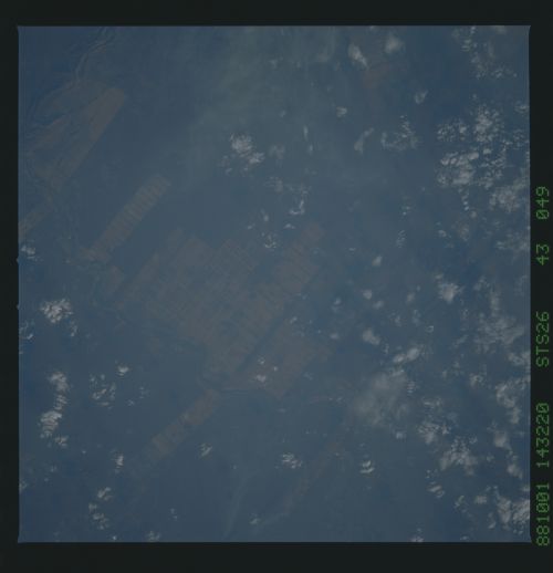
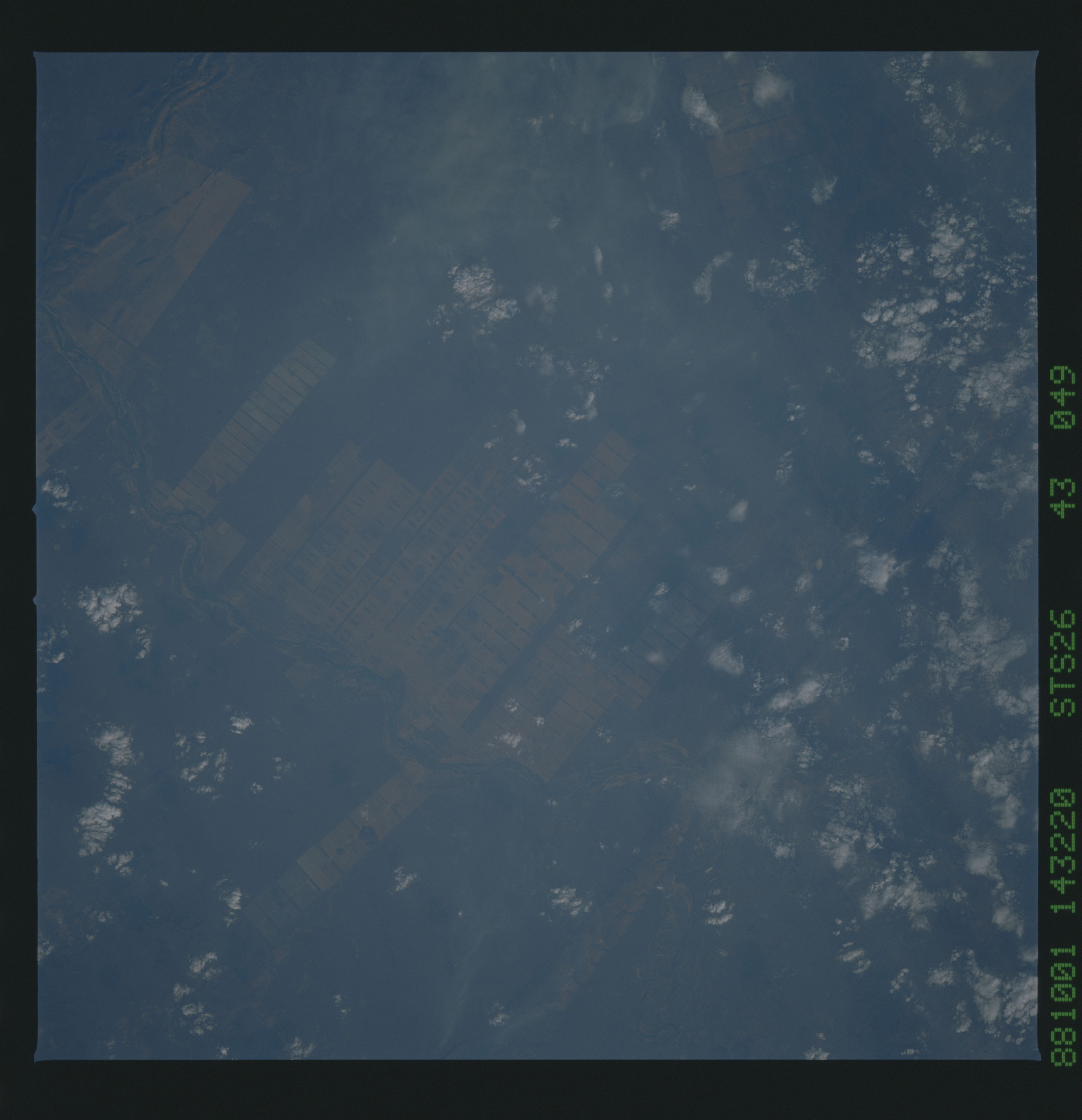
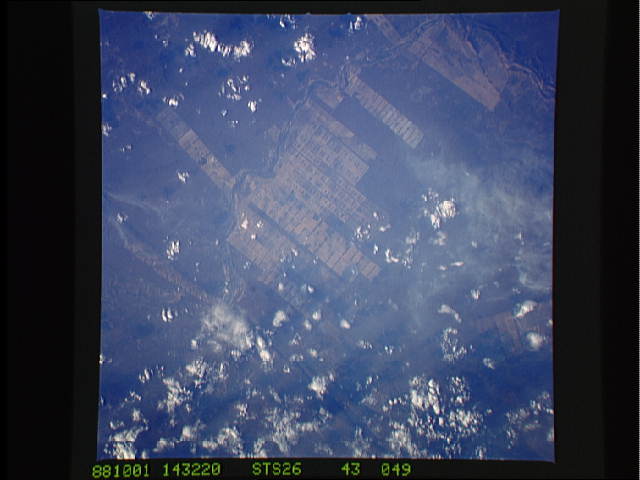
Spacecraft nadir point: 11.2° S, 43.7° W
Photo center point: 11.5° S, 43.5° W
Photo center point by machine learning:
Photo center point: 11.5° S, 43.5° W
Photo center point by machine learning:
Nadir to Photo Center: Southeast
Spacecraft Altitude: 163 nautical miles (302km)
Country or Geographic Name: | BRAZIL |
Features: | AGRICULTURE, RIO GRANDE |
| Features Found Using Machine Learning: | |
Cloud Cover Percentage: | 60 (51-75)% |
Sun Elevation Angle: | 18° |
Sun Azimuth: | 269° |
Camera: | Hasselblad |
Focal Length: | 250mm |
Camera Tilt: | 8 degrees |
Format: | 5017: Kodak, natural color positive, Ektachrome, X Professional, ASA 64, standard base |
Film Exposure: | Normal |
| Additional Information | |
| Width | Height | Annotated | Cropped | Purpose | Links |
|---|---|---|---|---|---|
| 5700 pixels | 5900 pixels | No | No | Download Image | |
| 500 pixels | 518 pixels | No | No | Download Image | |
| 640 pixels | 480 pixels | No | No | Download Image |
Download Packaged File
Download a Google Earth KML for this Image
View photo footprint information
Download a GeoTIFF for this photo
Image Caption: The large field patterns in this view of the Rio Sao Francisco basin, Brazil, South America, (11.5S, 43.5W) indicate a commercial agriculture venture; family subsistence farms are much smaller and laid out in different patterns. Land clearing in Brazil has increased at an alarming rate in recent years and preliminary estimates suggest a 25 to 30% increase in deforestation since 1984. The long term impact on the ecological processes are still unknown.
