STS026-33-80
| NASA Photo ID | STS026-33-80 |
| Focal Length | 100mm |
| Date taken | 1988.09.30 |
| Time taken | 11:35:14 GMT |
Resolutions offered for this image:
5239 x 5239 pixels 640 x 640 pixels 5700 x 5900 pixels 500 x 518 pixels 640 x 480 pixels
5239 x 5239 pixels 640 x 640 pixels 5700 x 5900 pixels 500 x 518 pixels 640 x 480 pixels

Cloud masks available for this image:
Spacecraft nadir point: 12.8° N, 40.6° E
Photo center point: 13.5° N, 40.5° E
Photo center point by machine learning:
Photo center point: 13.5° N, 40.5° E
Photo center point by machine learning:
Nadir to Photo Center: North
Spacecraft Altitude: 164 nautical miles (304km)
Country or Geographic Name: | ETHIOPIA |
Features: | ERTA ALE |
| Features Found Using Machine Learning: | |
Cloud Cover Percentage: | 20 (11-25)% |
Sun Elevation Angle: | 50° |
Sun Azimuth: | 249° |
Camera: | Hasselblad |
Focal Length: | 100mm |
Camera Tilt: | 14 degrees |
Format: | 5017: Kodak, natural color positive, Ektachrome, X Professional, ASA 64, standard base |
Film Exposure: | Normal |
| Additional Information | |
| Width | Height | Annotated | Cropped | Purpose | Links |
|---|---|---|---|---|---|
| 5239 pixels | 5239 pixels | No | No | Earth From Space collection | Download Image |
| 640 pixels | 640 pixels | No | No | Earth From Space collection | Download Image |
| 5700 pixels | 5900 pixels | No | No | Download Image | |
| 500 pixels | 518 pixels | No | No | Download Image | |
| 640 pixels | 480 pixels | No | No | Download Image |
Download Packaged File
Download a Google Earth KML for this Image
View photo footprint information
Download a GeoTIFF for this photo
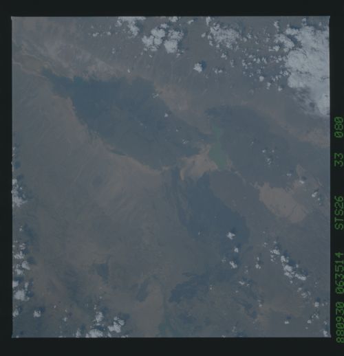
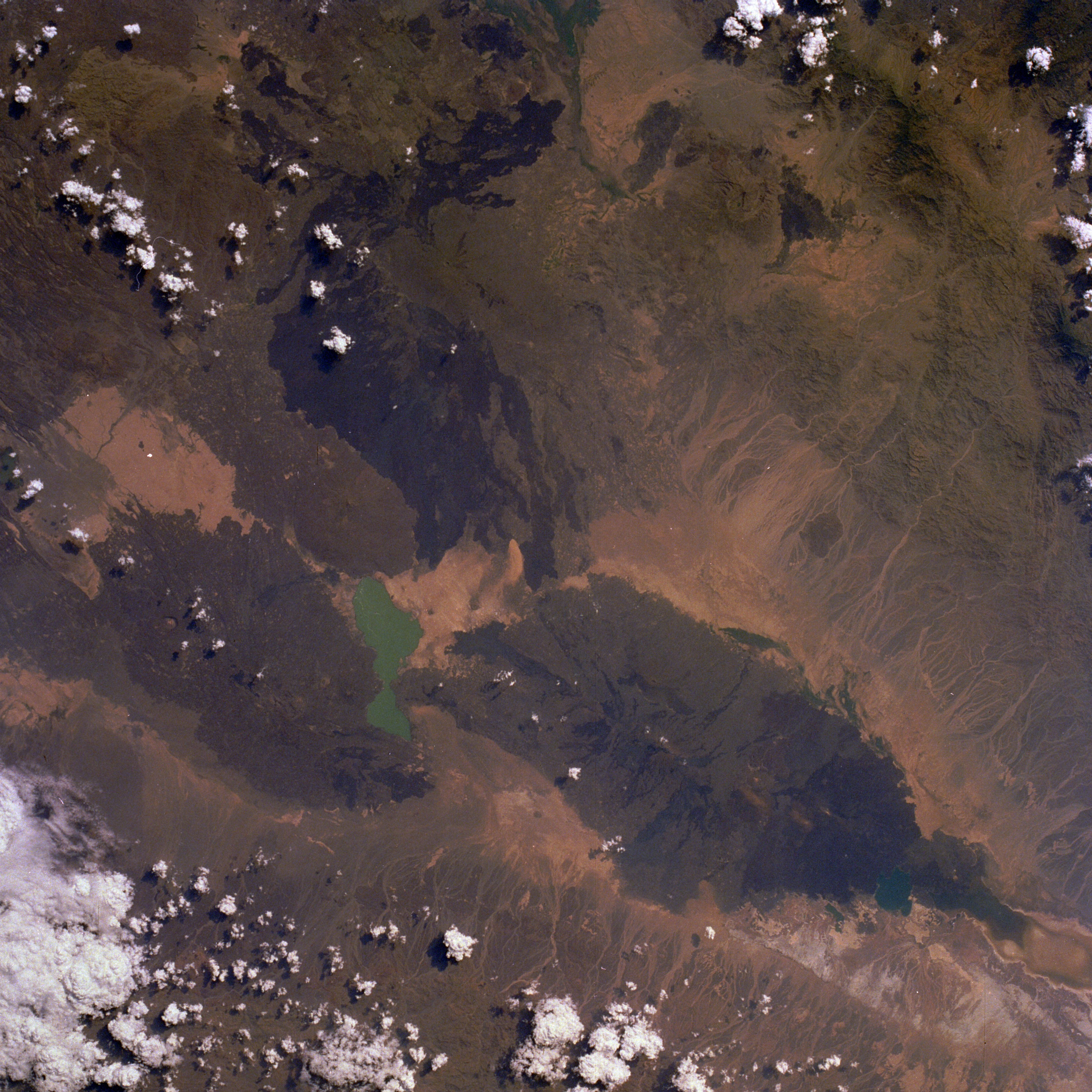
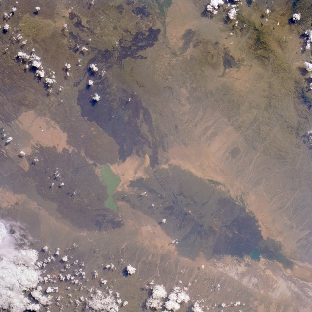
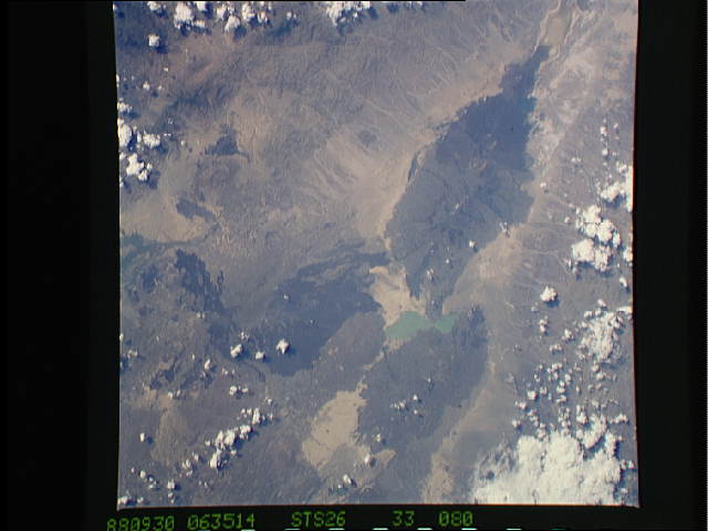
Image Caption: STS026-033-080 Erta Alle Volcano, Ethiopia September 1988
Erta Alle, a shield volcano located within the Rift Valley of northern Ethiopia, is visible in this near-vertical photograph taken north of turquoise Afrera Ye Ch'ew Lake. The volcano, called "the smoking mountain" by the local tribesmen, has an active lava lake (barely discernible in the photograph) approximately 150 feet (46 meters) wide, which has been in a constant state of eruption since the late 1960s. Erta Alle is one of the world's few volcanoes in which permanent lava lakes reside; Kilauea Volcano on the big island of Hawaii is another. Erta Alle is located in the Afar Depression, where the Eastern Rift lies between the Red Sea to the north and east (not included in the photograph) and the Ethiopian Highlands to the west (not included in the photograph). The volcano is in a forbidding region of the Earth--hot, dry, below sea level, and mostly uninhabited. Other dark lava flows are visible from a number of smaller volcanoes south and southwest of the lake.
Erta Alle, a shield volcano located within the Rift Valley of northern Ethiopia, is visible in this near-vertical photograph taken north of turquoise Afrera Ye Ch'ew Lake. The volcano, called "the smoking mountain" by the local tribesmen, has an active lava lake (barely discernible in the photograph) approximately 150 feet (46 meters) wide, which has been in a constant state of eruption since the late 1960s. Erta Alle is one of the world's few volcanoes in which permanent lava lakes reside; Kilauea Volcano on the big island of Hawaii is another. Erta Alle is located in the Afar Depression, where the Eastern Rift lies between the Red Sea to the north and east (not included in the photograph) and the Ethiopian Highlands to the west (not included in the photograph). The volcano is in a forbidding region of the Earth--hot, dry, below sea level, and mostly uninhabited. Other dark lava flows are visible from a number of smaller volcanoes south and southwest of the lake.
