STS008-48-2510
| NASA Photo ID | STS008-48-2510 |
| Focal Length | 250mm |
| Date taken | 1983.__.__ |
| Time taken | GMT |
Resolutions offered for this image:
3899 x 3895 pixels 639 x 639 pixels 4393 x 4600 pixels 478 x 500 pixels 640 x 480 pixels
3899 x 3895 pixels 639 x 639 pixels 4393 x 4600 pixels 478 x 500 pixels 640 x 480 pixels


Cloud masks available for this image:
Spacecraft nadir point:
Photo center point: 23.5° S, 123.0° E
Photo center point by machine learning:
Photo center point: 23.5° S, 123.0° E
Photo center point by machine learning:
Nadir to Photo Center:
Spacecraft Altitude: nautical miles (0km)
Country or Geographic Name: | AUSTRALIA-WA |
Features: | LAKE DISAPPOINTMENT |
| Features Found Using Machine Learning: | |
Cloud Cover Percentage: | 0 (no clouds present) |
Sun Elevation Angle: | ° |
Sun Azimuth: | ° |
Camera: | Hasselblad |
Focal Length: | 250mm |
Camera Tilt: | Low Oblique |
Format: | 6017: Kodak Ektachrome 64, 220 Roll Format |
Film Exposure: | Normal |
| Additional Information | |
| Width | Height | Annotated | Cropped | Purpose | Links |
|---|---|---|---|---|---|
| 3899 pixels | 3895 pixels | No | No | Earth From Space collection | Download Image |
| 639 pixels | 639 pixels | No | No | Earth From Space collection | Download Image |
| 4393 pixels | 4600 pixels | No | No | Download Image | |
| 478 pixels | 500 pixels | No | No | Download Image | |
| 640 pixels | 480 pixels | No | No | Download Image |
Download Packaged File
Download a Google Earth KML for this Image
View photo footprint information
Download a GeoTIFF for this photo
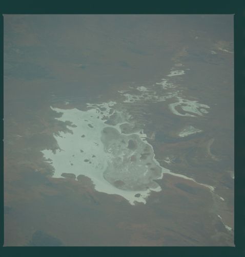
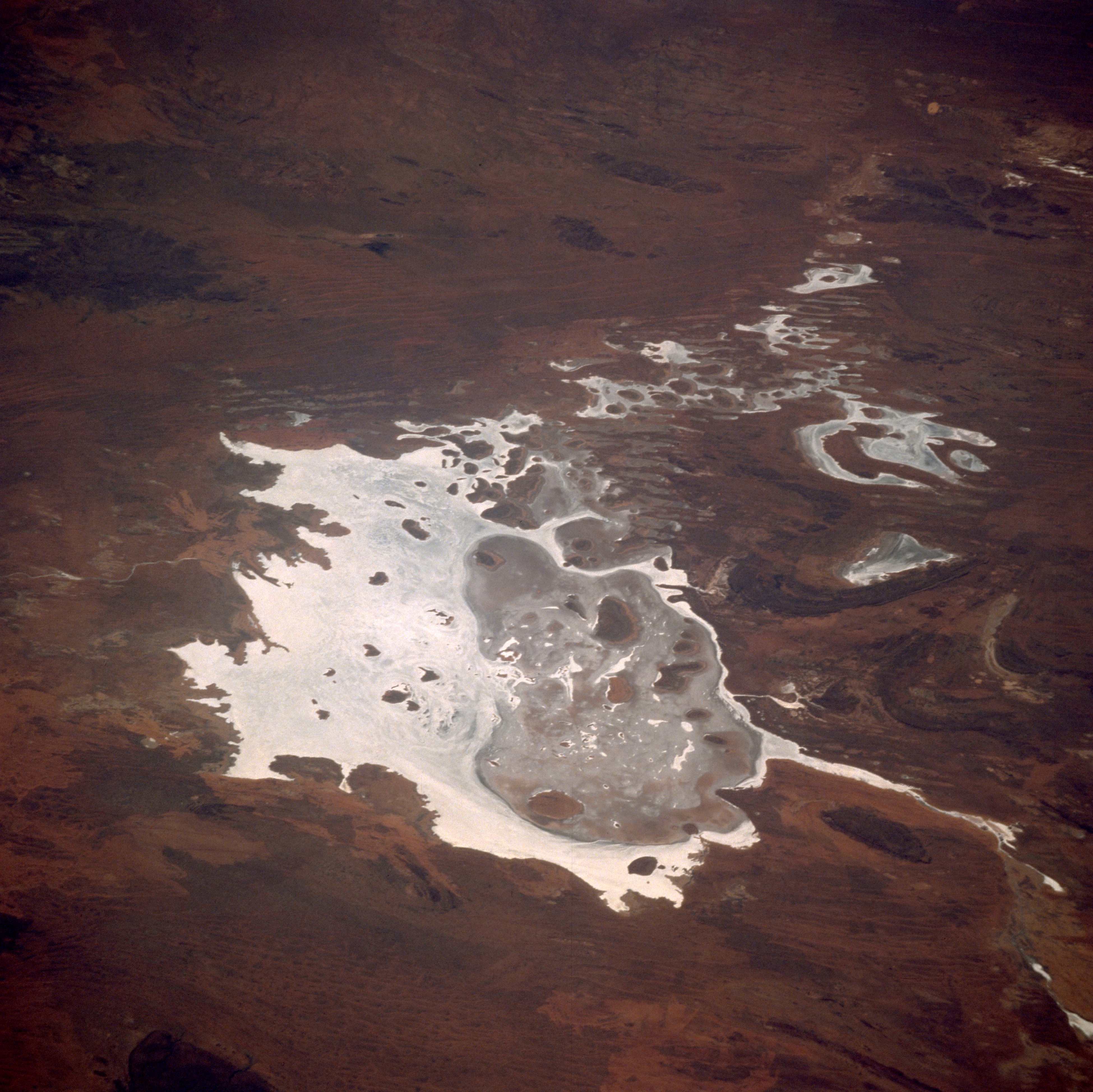
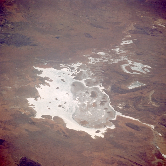
Image Caption: STS008-48-2510 Lake Disappointment, Western Australia, Australia September 1983
Lake Disappointment is an irregularly shaped dry lake that is located in north central Western Australia. The lake covers approximately 370650 acres (150000 ha) and is fed by the Savory Creek (not discernible on this image) that feeds into the northwest side of the lake. Lake Disappointment lies at the lowest point in a large basin (the Little Sandy Desert bioregion) of exposed sandstone. Evaporation rates far exceed the meager rainfall amount--mean annual rainfall is 7.5 inches (190 mm). Sand dunes on the lake form islands rising 16-60 feet (5-18 meters) above the bed. Notice the eastern half of the lake is darker in color, indicating that the elevation of the land is probably somewhat higher with more vegetative cover than the highly reflective western side of the lake. The lake was named in 1897 by explorer F. H. Hann who was searching for fresh water but was disappointed when he discovered that the lake was saline.
Lake Disappointment is an irregularly shaped dry lake that is located in north central Western Australia. The lake covers approximately 370650 acres (150000 ha) and is fed by the Savory Creek (not discernible on this image) that feeds into the northwest side of the lake. Lake Disappointment lies at the lowest point in a large basin (the Little Sandy Desert bioregion) of exposed sandstone. Evaporation rates far exceed the meager rainfall amount--mean annual rainfall is 7.5 inches (190 mm). Sand dunes on the lake form islands rising 16-60 feet (5-18 meters) above the bed. Notice the eastern half of the lake is darker in color, indicating that the elevation of the land is probably somewhat higher with more vegetative cover than the highly reflective western side of the lake. The lake was named in 1897 by explorer F. H. Hann who was searching for fresh water but was disappointed when he discovered that the lake was saline.
