STS006-43-235
| NASA Photo ID | STS006-43-235 |
| Focal Length | 100mm |
| Date taken | 1983.04.__ |
| Time taken | GMT |

Cloud masks available for this image:
Spacecraft nadir point:
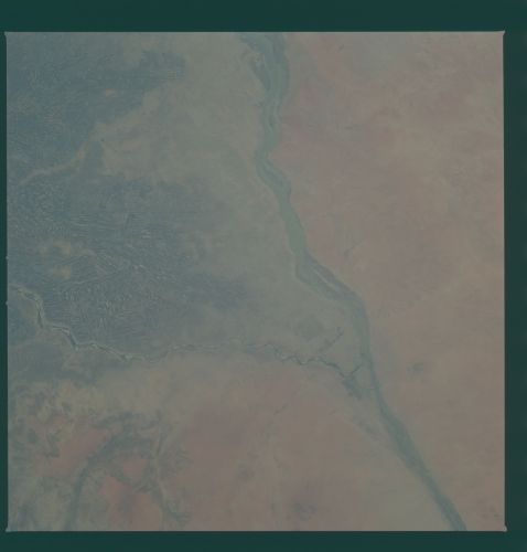
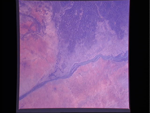
Photo center point: 15.5° N, 32.5° E
Photo center point by machine learning:
Photo center point: 15.5° N, 32.5° E
Photo center point by machine learning:
Nadir to Photo Center:
Spacecraft Altitude: nautical miles (0km)
Country or Geographic Name: | SUDAN |
Features: | NILE RIVER, KHARTOUM |
| Features Found Using Machine Learning: | |
Cloud Cover Percentage: | 0 (no clouds present) |
Sun Elevation Angle: | ° |
Sun Azimuth: | ° |
Camera: | Hasselblad |
Focal Length: | 100mm |
Camera Tilt: | Near Vertical |
Format: | 5017: Kodak, natural color positive, Ektachrome, X Professional, ASA 64, standard base |
Film Exposure: | Normal |
| Additional Information | |
| Width | Height | Annotated | Cropped | Purpose | Links |
|---|---|---|---|---|---|
| 4393 pixels | 4600 pixels | No | No | Download Image | |
| 478 pixels | 500 pixels | No | No | Download Image | |
| 640 pixels | 480 pixels | No | No | Download Image |
Download Packaged File
Download a Google Earth KML for this Image
View photo footprint information
Download a GeoTIFF for this photo
Image Caption: This view shows the confluence of the White Nile and the Blue Nile rivers to form the Nile River at Khartoum, the capital city of Sudan (15.5N, 32.5E). The White Nile comes from the south and drains the Sudd swamp and African Rift Valley while the Blue Nile comes from the southeast draining the Ethiopian highlands. The herringbone field patterns to the south of the city are agricultural fields where cotton is the main crop.
