STS005-40-1234
| NASA Photo ID | STS005-40-1234 |
| Focal Length | 100mm |
| Date taken | 1982.11.__ |
| Time taken | GMT |

Cloud masks available for this image:
Spacecraft nadir point:
Photo center point: 2.5° S, 42.7° W
Photo center point by machine learning:
Photo center point: 2.5° S, 42.7° W
Photo center point by machine learning:
Nadir to Photo Center:
Spacecraft Altitude: nautical miles (0km)
Country or Geographic Name: | BRAZIL |
Features: | RIO PARANAIBA, COAST |
| Features Found Using Machine Learning: | |
Cloud Cover Percentage: | 25 (11-25)% |
Sun Elevation Angle: | ° |
Sun Azimuth: | ° |
Camera: | Hasselblad |
Focal Length: | 100mm |
Camera Tilt: | Low Oblique |
Format: | 5017: Kodak, natural color positive, Ektachrome, X Professional, ASA 64, standard base |
Film Exposure: | Normal |
| Additional Information | |
| Width | Height | Annotated | Cropped | Purpose | Links |
|---|---|---|---|---|---|
| 4393 pixels | 4600 pixels | No | No | Download Image | |
| 478 pixels | 500 pixels | No | No | Download Image | |
| 640 pixels | 480 pixels | No | No | Download Image |
Download Packaged File
Download a Google Earth KML for this Image
View photo footprint information
Download a GeoTIFF for this photo
Image Caption:
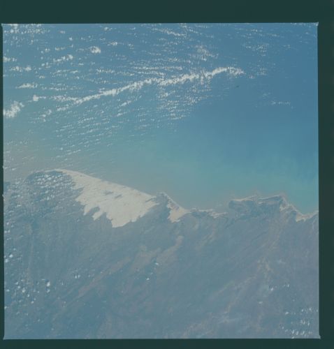
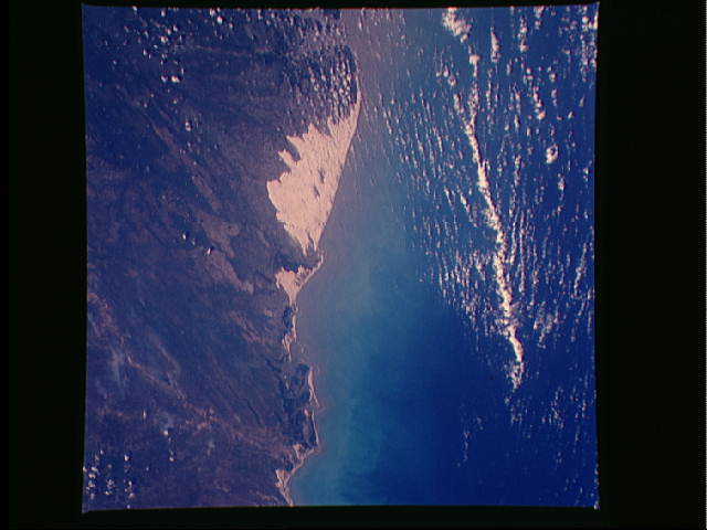
Mouth of Rio Parnaiba
A large sand dune region to the west of the mouth of the Rio Par-
naiba (1) can be seen in the low oblique, east-looking view. Sed-
iment from streams, such as the Rio Parnaiba which is over 1290
km long, and rises in the Brazilian Highlands, is carried to the
sea and then eastwards along the coast by strong nearshore
currents. Wind blows this sand from the beach forming the large,
white sand dune areas in this region. Excessive deforestation in
the northeastern Brazil Highlands has increased soil erosion.
The dunes in this region should be increasing in size. (STS5-
40-1234)
