STS004-40-1125

| NASA Photo ID | STS004-40-1125 |
| Focal Length | 100mm |
| Date taken | 1982.__.__ |
| Time taken | GMT |
Cloud masks available for this image:
Spacecraft nadir point:
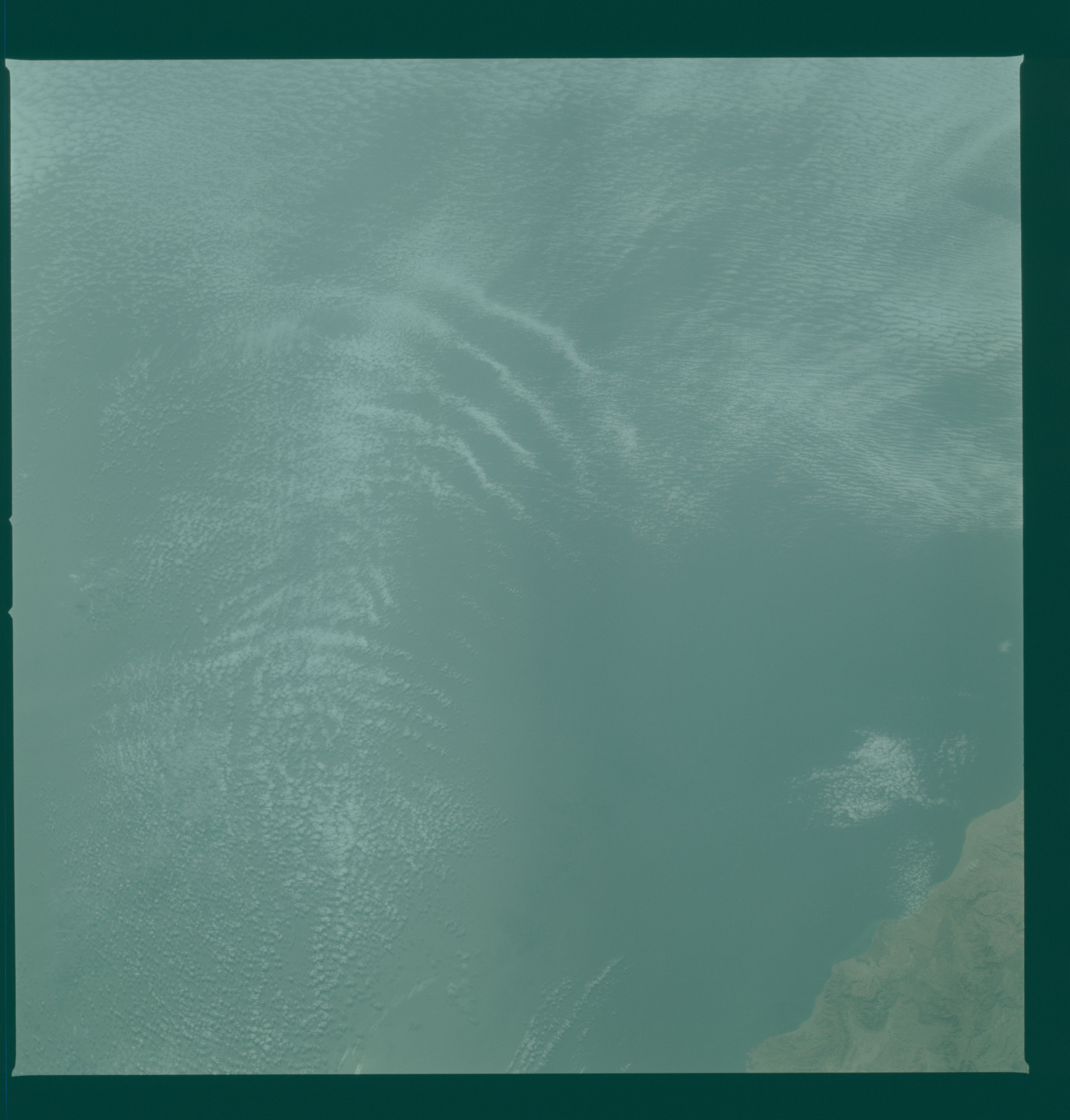
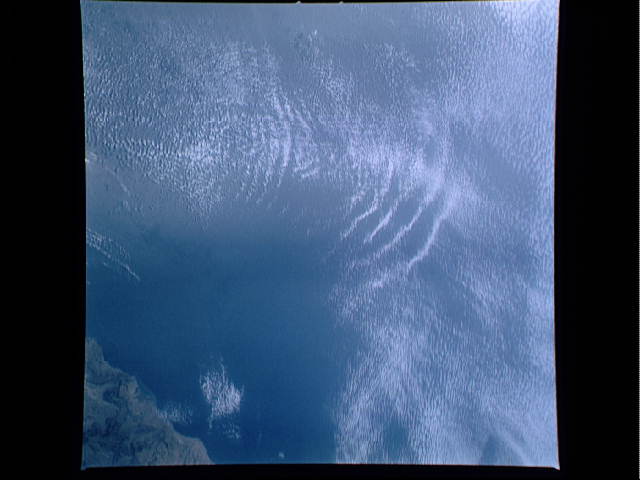
Photo center point: 24.0° N, 59.5° E
Photo center point by machine learning:
Photo center point: 24.0° N, 59.5° E
Photo center point by machine learning:
Nadir to Photo Center:
Spacecraft Altitude: nautical miles (0km)
Country or Geographic Name: | OMAN |
Features: | GULF OF OMAN |
| Features Found Using Machine Learning: | |
Cloud Cover Percentage: | 70 (51-75)% |
Sun Elevation Angle: | ° |
Sun Azimuth: | ° |
Camera: | Hasselblad |
Focal Length: | 100mm |
Camera Tilt: | Low Oblique |
Format: | 2448: Fine Grain Aerochrome II color-reversal camera film, 70mm, process EA-5 |
Film Exposure: | Normal |
| Additional Information | |
| Width | Height | Annotated | Cropped | Purpose | Links |
|---|---|---|---|---|---|
| 4393 pixels | 4600 pixels | No | No | Download Image | |
| 478 pixels | 500 pixels | No | No | Download Image | |
| 640 pixels | 480 pixels | No | No | Download Image |
Download Packaged File
Download a Google Earth KML for this Image
View photo footprint information
Download a GeoTIFF for this photo
Image Caption: The wind currents off Ras (Cape) al Hadd, Oman cause interesting cloud patterns over the Gulf of Oman (23.5N, 60.0E). Meteorologists assert that the cloud patterns are the effect of the peculiar combination of heat from the deserts, being funneled by the mountains, toward the topography of the coastal headlands, clashing with the prevailing ocean breezes and varying sea conditions all coming together in this restricted location.
