STS004-40-1116

| NASA Photo ID | STS004-40-1116 |
| Focal Length | 100mm |
| Date taken | 1982.__.__ |
| Time taken | GMT |
Cloud masks available for this image:
Spacecraft nadir point:
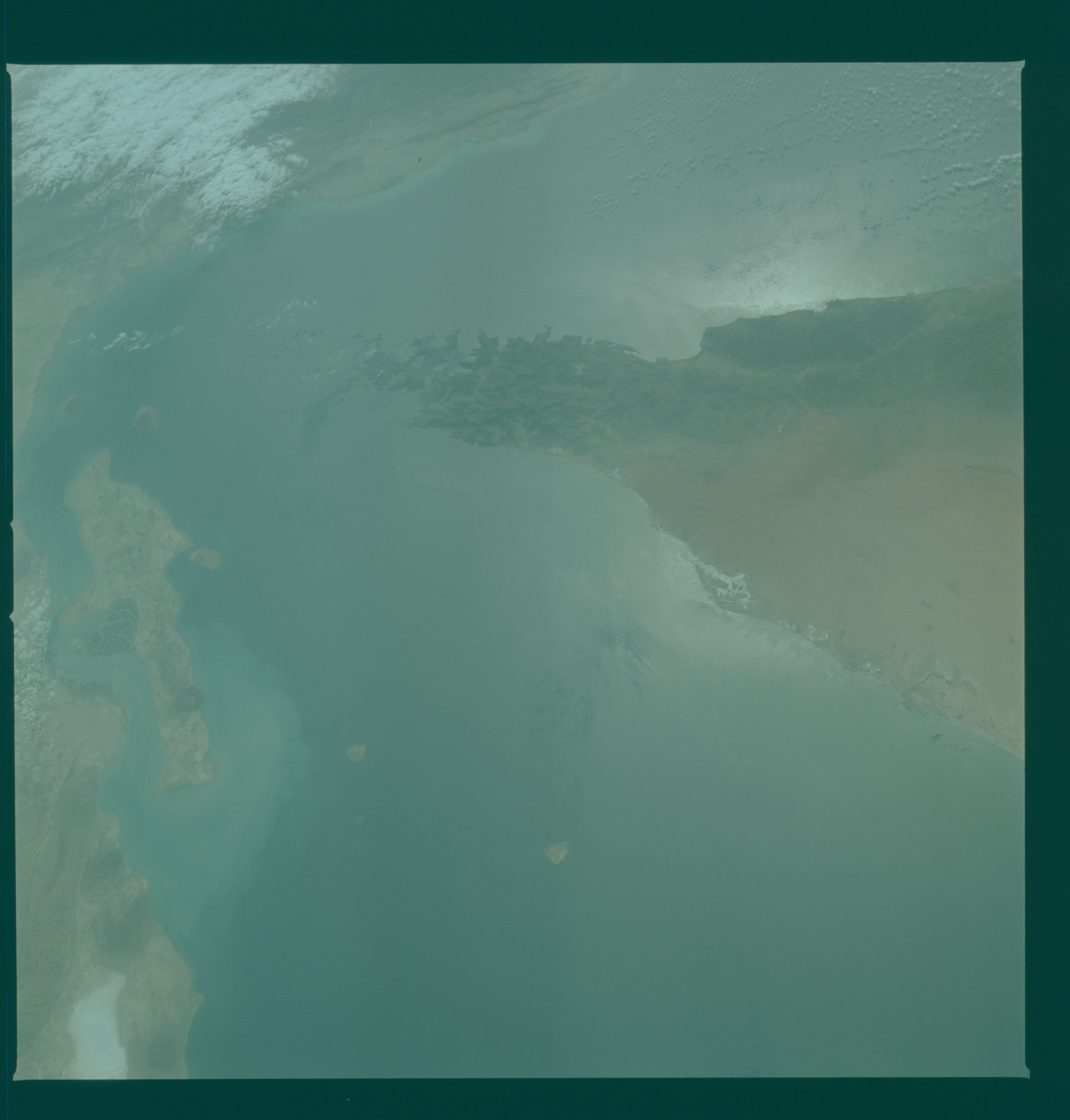
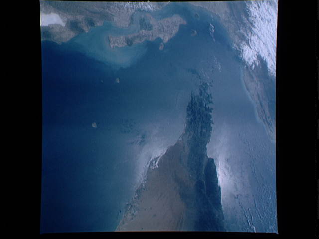
Photo center point: 26.0° N, 56.0° E
Photo center point by machine learning:
Photo center point: 26.0° N, 56.0° E
Photo center point by machine learning:
Nadir to Photo Center:
Spacecraft Altitude: nautical miles (0km)
Country or Geographic Name: | UNITED ARAB EMIRATES |
Features: | STRAIT OF HORMUZ |
| Features Found Using Machine Learning: | |
Cloud Cover Percentage: | 20 (11-25)% |
Sun Elevation Angle: | ° |
Sun Azimuth: | ° |
Camera: | Hasselblad |
Focal Length: | 100mm |
Camera Tilt: | Low Oblique |
Format: | 2448: Fine Grain Aerochrome II color-reversal camera film, 70mm, process EA-5 |
Film Exposure: | Normal |
| Additional Information | |
| Width | Height | Annotated | Cropped | Purpose | Links |
|---|---|---|---|---|---|
| 4393 pixels | 4600 pixels | No | No | Download Image | |
| 478 pixels | 500 pixels | No | No | Download Image | |
| 640 pixels | 480 pixels | No | No | Download Image |
Download Packaged File
Download a Google Earth KML for this Image
View photo footprint information
Download a GeoTIFF for this photo
Image Caption: Sunglint in the Strait of Hormuz
There are two tools we use in the Space Shuttle photography to give us information about the worlds water features. One is sunglint ( the reflection of the sun off the Earth's surface) and the other is color. Note that the sunglint is over the United Arab Emirates Peninsula and that to the left of the Peninsula no ocean features are defined.
There are two tools we use in the Space Shuttle photography to give us information about the worlds water features. One is sunglint ( the reflection of the sun off the Earth's surface) and the other is color. Note that the sunglint is over the United Arab Emirates Peninsula and that to the left of the Peninsula no ocean features are defined.
