STS002-13-267
| NASA Photo ID | STS002-13-267 |
| Focal Length | 100mm |
| Date taken | 1981.11.__ |
| Time taken | GMT |

Cloud masks available for this image:
Spacecraft nadir point:
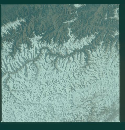
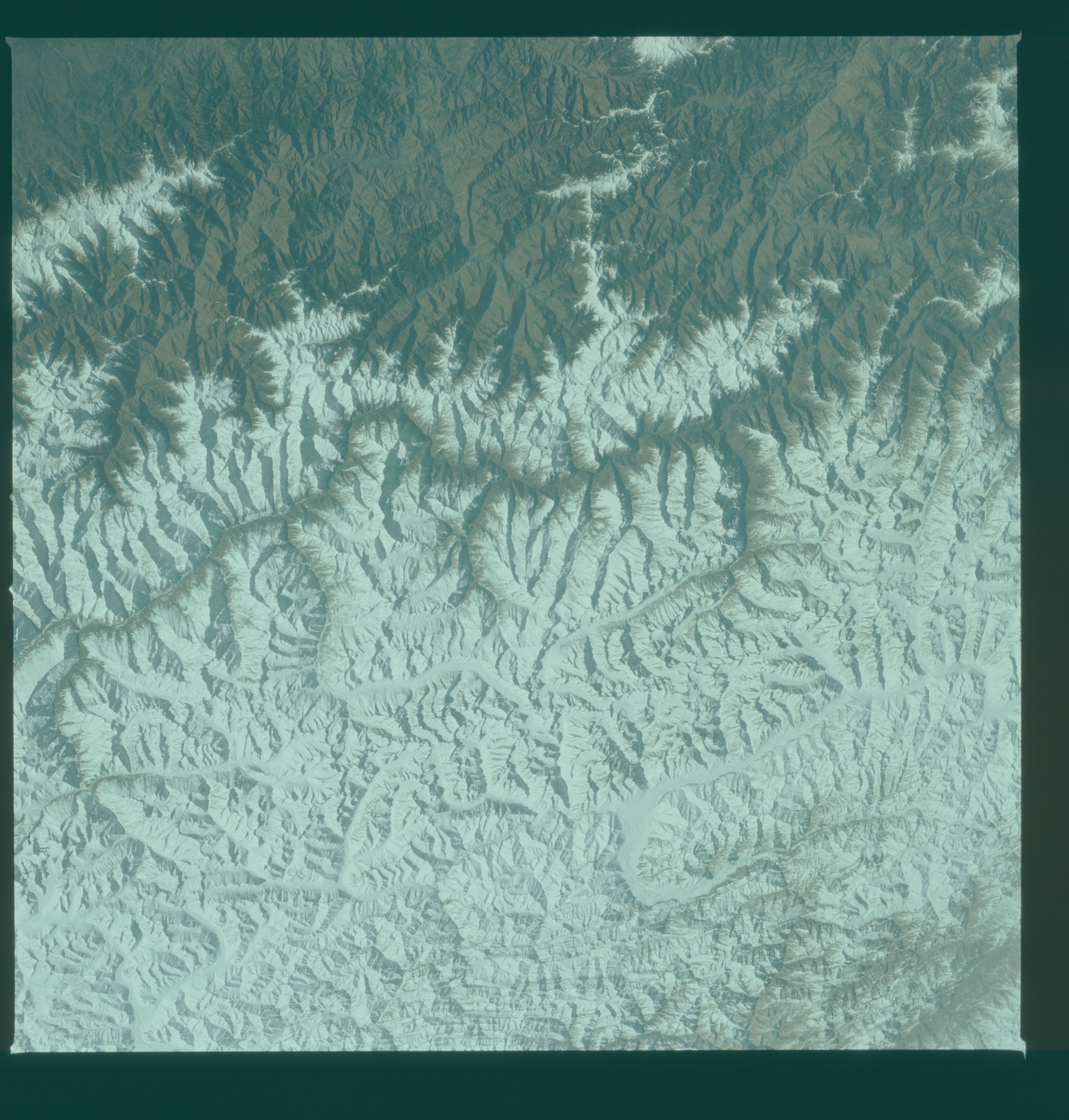
Photo center point: 33.0° N, 76.5° E
Photo center point by machine learning:
Photo center point: 33.0° N, 76.5° E
Photo center point by machine learning:
Nadir to Photo Center:
Spacecraft Altitude: nautical miles (0km)
Country or Geographic Name: | INDIA |
Features: | HIMALAYAS |
| Features Found Using Machine Learning: | |
Cloud Cover Percentage: | 0 (no clouds present) |
Sun Elevation Angle: | ° |
Sun Azimuth: | ° |
Camera: | Hasselblad |
Focal Length: | 100mm |
Camera Tilt: | Near Vertical |
Format: | QX824: Kodak Ektachrome 64 |
Film Exposure: | Normal |
| Additional Information | |
| Width | Height | Annotated | Cropped | Purpose | Links |
|---|---|---|---|---|---|
| 4393 pixels | 4600 pixels | No | No | Download Image | |
| 478 pixels | 500 pixels | No | No | Download Image | |
| 640 pixels | 480 pixels | No | No | Download Image |
Download Packaged File
Download a Google Earth KML for this Image
View photo footprint information
Download a GeoTIFF for this photo
Image Caption: Snow is present the year round in most of the high Himalaya Mountain Range (33.0N, 76.5E). In this view taken at the onset of winter, the continuous snow line can be seen for hundreds of miles along the south face of the range in the Indian states of Punjab and Kashmir. The snow line is at about 12,000 ft. altitude but the deep Cenab River gorge is easily delineated as a break along the south edge of the snow covered mountains. '
