STS002-11-105
| NASA Photo ID | STS002-11-105 |
| Focal Length | 100mm |
| Date taken | 1981.11.__ |
| Time taken | GMT |

Cloud masks available for this image:
Spacecraft nadir point:
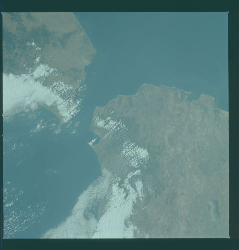
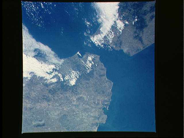
Photo center point: 36.0° N, 5.5° W
Photo center point by machine learning:
Photo center point: 36.0° N, 5.5° W
Photo center point by machine learning:
Nadir to Photo Center:
Spacecraft Altitude: nautical miles (0km)
Country or Geographic Name: | SPAIN |
Features: | STRAIT OF GIBRALTAR |
| Features Found Using Machine Learning: | |
Cloud Cover Percentage: | 25 (11-25)% |
Sun Elevation Angle: | ° |
Sun Azimuth: | ° |
Camera: | Hasselblad |
Focal Length: | 100mm |
Camera Tilt: | Low Oblique |
Format: | QX824: Kodak Ektachrome 64 |
Film Exposure: | Normal |
| Additional Information | |
| Width | Height | Annotated | Cropped | Purpose | Links |
|---|---|---|---|---|---|
| 4393 pixels | 4600 pixels | No | No | Download Image | |
| 478 pixels | 500 pixels | No | No | Download Image | |
| 640 pixels | 480 pixels | No | No | Download Image |
Download Packaged File
Download a Google Earth KML for this Image
View photo footprint information
Download a GeoTIFF for this photo
Image Caption: The Strait of Gibraltar (36.0N, 5.5W), at the mouth of the Mediterranean Sea, separates Europe and Africa. On the Spanish side of the strait, the port of Cadiz and the Rota Naval Base as well as the great Andalucian city of Seville can be seen. To the south in Morocco, the coastal cities of Tangier, Tetouan and Ceuta are easily seen.
