STS001-13-412
| NASA Photo ID | STS001-13-412 |
| Focal Length | 250mm |
| Date taken | 1981.04.__ |
| Time taken | GMT |

Cloud masks available for this image:
Spacecraft nadir point:
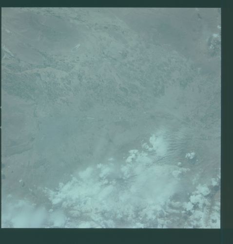
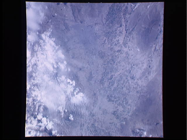
Photo center point: 35.5° N, 51.5° E
Photo center point by machine learning:
Photo center point: 35.5° N, 51.5° E
Photo center point by machine learning:
Nadir to Photo Center:
Spacecraft Altitude: nautical miles (0km)
Country or Geographic Name: | IRAN |
Features: | TEHRAN |
| Features Found Using Machine Learning: | |
Cloud Cover Percentage: | 30 (26-50)% |
Sun Elevation Angle: | ° |
Sun Azimuth: | ° |
Camera: | Hasselblad |
Focal Length: | 250mm |
Camera Tilt: | Near Vertical |
Format: | QX807: SO368 film (fine-grain Ektachrome) with yellow dye layer equivalent to Wratten 2A |
Film Exposure: | Normal |
| Additional Information | |
| Width | Height | Annotated | Cropped | Purpose | Links |
|---|---|---|---|---|---|
| 4400 pixels | 4600 pixels | No | No | Download Image | |
| 478 pixels | 500 pixels | No | No | Download Image | |
| 640 pixels | 480 pixels | No | No | Download Image |
Download Packaged File
Download a Google Earth KML for this Image
View photo footprint information
Download a GeoTIFF for this photo
Image Caption: Tehran,(35.5N, 51.5E) national capital of Iran is seen in this vertical view of northern Iran. The city is situated on the plains between the Elburz Mountains and the Dashte-Kavir salt desert. The extensive agricultural area to the south supports the city with farm produce.
