SL4-139-3989
| NASA Photo ID | SL4-139-3989 |
| Focal Length | 100mm |
| Date taken | |
| Time taken | GMT |

Cloud masks available for this image:
Spacecraft nadir point:
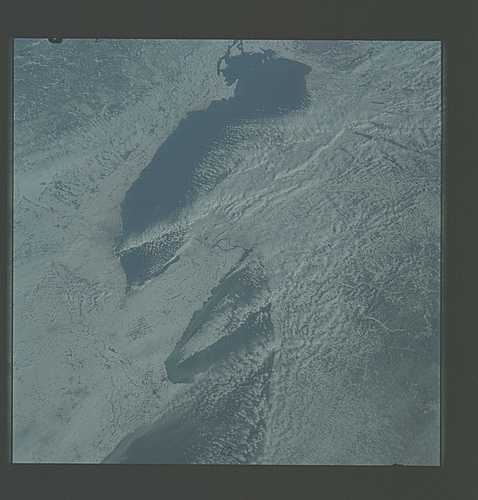
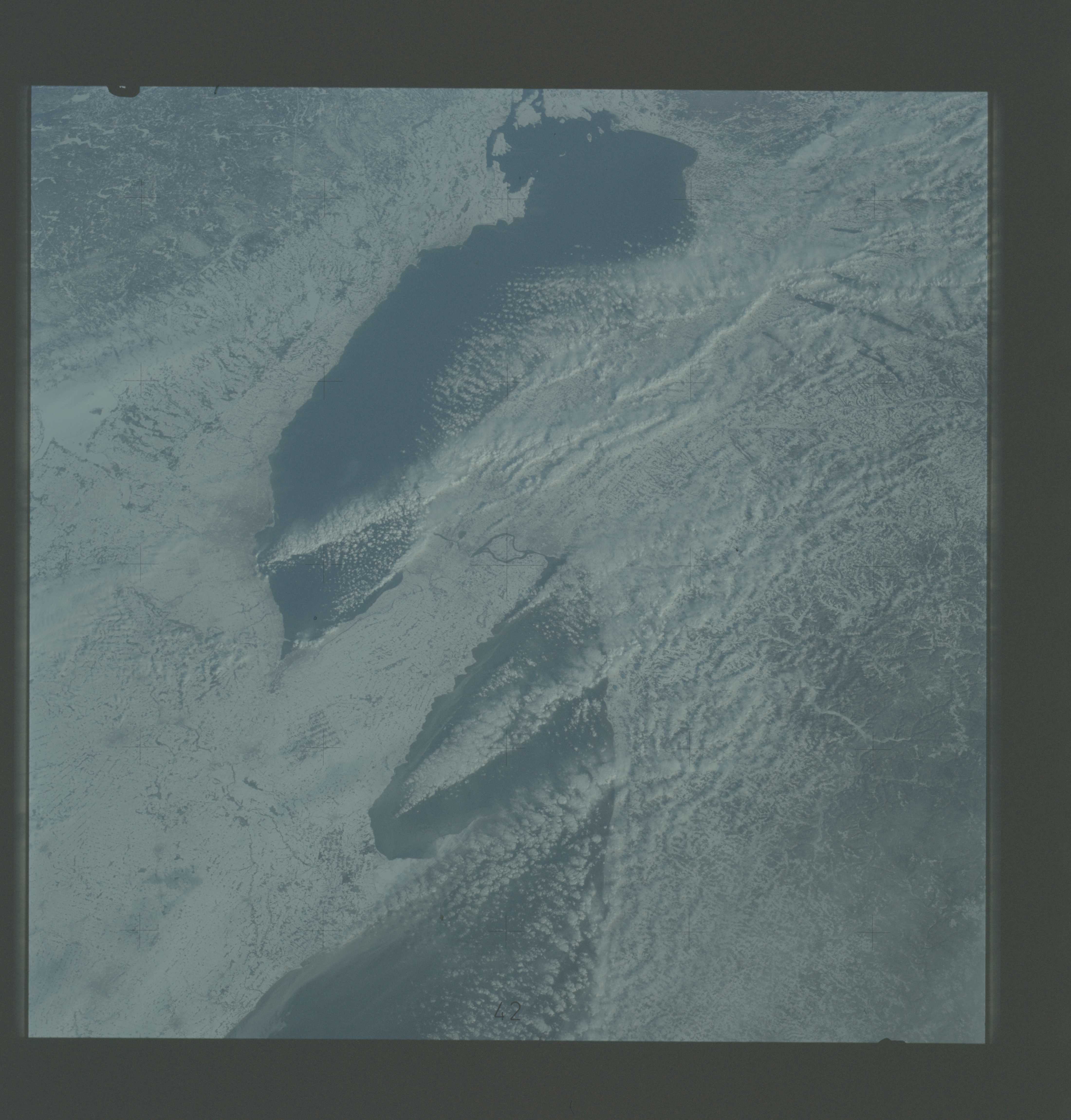
Photo center point: 43.0° N, 79.0° W
Photo center point by machine learning:
Photo center point: 43.0° N, 79.0° W
Photo center point by machine learning:
Nadir to Photo Center:
Spacecraft Altitude: nautical miles (0km)
Country or Geographic Name: | USA-NEW YORK |
Features: | LAKE ERIE, LAKE ONTARIO |
| Features Found Using Machine Learning: | |
Cloud Cover Percentage: | 40 (26-50)% |
Sun Elevation Angle: | ° |
Sun Azimuth: | ° |
Camera: | Hasselblad |
Focal Length: | 100mm |
Camera Tilt: | Low Oblique |
Format: | SO368: Kodak Ektachrome MS, equivalent to 2448 Kodak Aerochrome, ASA64, thin base, fine grain |
Film Exposure: | Normal |
| Additional Information | |
| Width | Height | Annotated | Cropped | Purpose | Links |
|---|---|---|---|---|---|
| 4400 pixels | 4600 pixels | No | No | Download Image | |
| 4400 pixels | 4600 pixels | No | No | Original file from film scan | Download Image |
| 478 pixels | 500 pixels | No | No | Download Image |
Download Packaged File
Download a Google Earth KML for this Image
View photo footprint information
Download a GeoTIFF for this photo
Image Caption: An oblique view of a portion of the Great Lakes (43.0N, 70.0W) area as seen from the Skylab space station in Earth orbit. lake Erie is in the foreground; and Lake Ontario is in the background. The Niagara Falls area is in the center of the photograph. Portions of Pennsylvania, New York, and Ontario, Canada are visible, but under nearly complete snow cover. Major structural features, drainage patterns, road systems and the cities of Buffalo and Toronto are easily distinguished and actually enhanced by the snow. At the time this picture was taken, these two Great Lakes had no observable ice, although cloud formations partially mask the southern shores of the two bodies of water.
