SL4-137-3700
| NASA Photo ID | SL4-137-3700 |
| Focal Length | 100mm |
| Date taken | |
| Time taken | GMT |
Resolutions offered for this image:
4400 x 4600 pixels 4400 x 4600 pixels 478 x 500 pixels 960 x 955 pixels
4400 x 4600 pixels 4400 x 4600 pixels 478 x 500 pixels 960 x 955 pixels

Cloud masks available for this image:
Spacecraft nadir point:
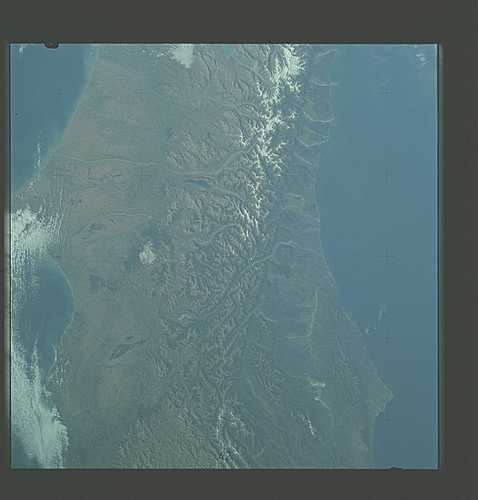
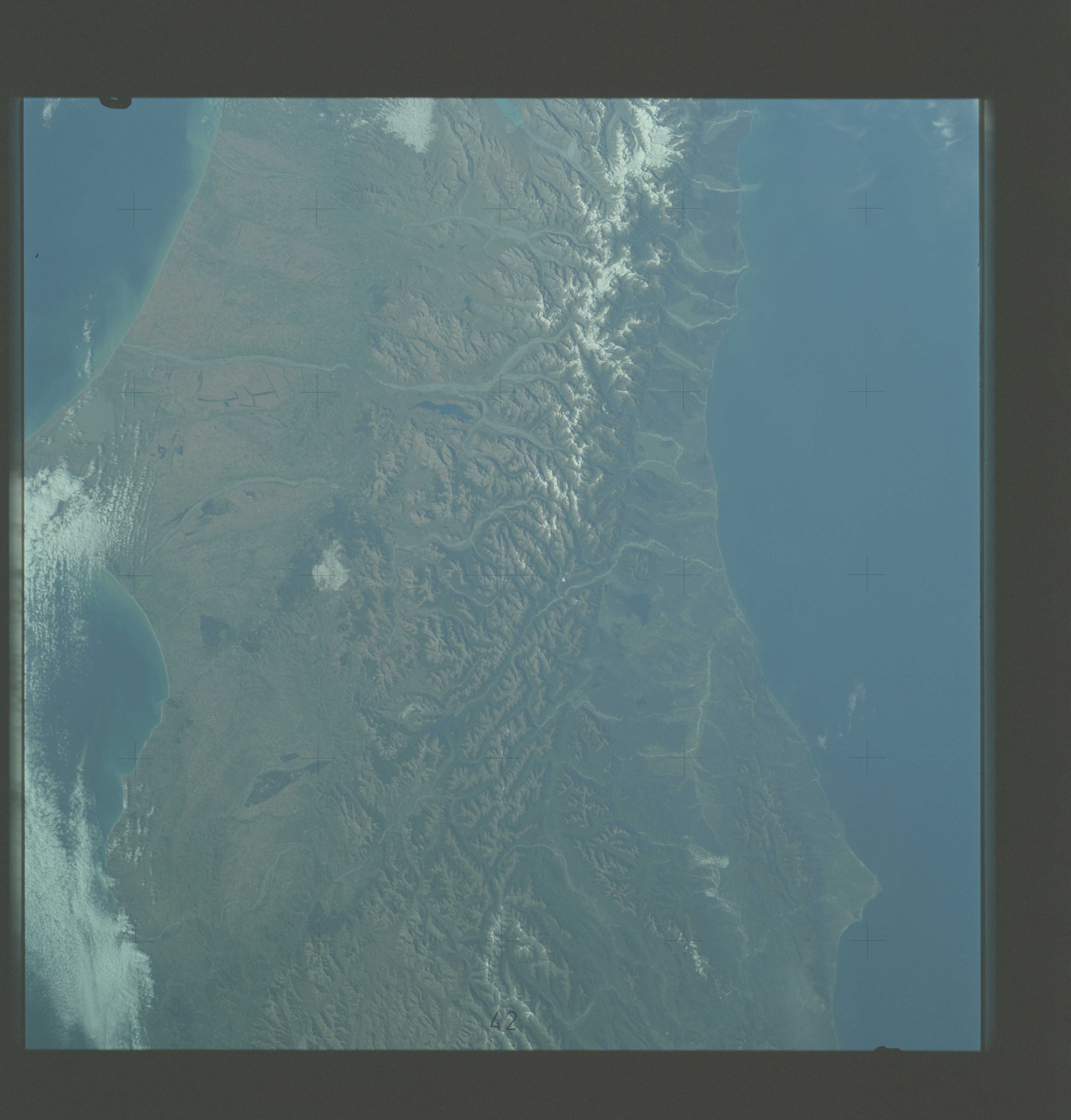
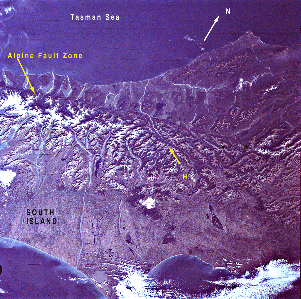
Photo center point: 43.0° S, 171.5° E
Photo center point by machine learning:
Photo center point: 43.0° S, 171.5° E
Photo center point by machine learning:
Nadir to Photo Center:
Spacecraft Altitude: nautical miles (0km)
Country or Geographic Name: | NEW ZEALAND |
Features: | SO. I., SOUTHERN ALPS |
| Features Found Using Machine Learning: | |
Cloud Cover Percentage: | 40 (26-50)% |
Sun Elevation Angle: | ° |
Sun Azimuth: | ° |
Camera: | Hasselblad |
Focal Length: | 100mm |
Camera Tilt: | Low Oblique |
Format: | SO368: Kodak Ektachrome MS, equivalent to 2448 Kodak Aerochrome, ASA64, thin base, fine grain |
Film Exposure: | Normal |
| Additional Information | |
| Width | Height | Annotated | Cropped | Purpose | Links |
|---|---|---|---|---|---|
| 4400 pixels | 4600 pixels | No | No | Download Image | |
| 4400 pixels | 4600 pixels | No | No | Original file from film scan | Download Image |
| 478 pixels | 500 pixels | No | No | Download Image | |
| 960 pixels | 955 pixels | Yes | No | Download Image |
Download Packaged File
Download a Google Earth KML for this Image
View photo footprint information
Download a GeoTIFF for this photo
Image Caption: A near vertical view of a portion of South Island, New Zealand (43.0S, 171.5E) as seen from the Skylab space station in Earth orbit. Cape Foulwind is at the upper left. The City of Christchurch is under clouds at the center right margin. Note the movement of sediment of alongside currents, especially on the east (right) side of the island, the Alpine Fault, which is part of the circu-Pacific volcanic-tectonic belt, is clearly visible on the left side of the island. The fault line is marked by a scarp which appears very distinct from orbital altitude. Differences in topography and vegetation on either side of the fault are also sharp.
