SL3-33-167
| NASA Photo ID | SL3-33-167 |
| Focal Length | 152mm |
| Date taken | 1973.09.04 |
| Time taken | GMT |
Cloud masks available for this image:
Spacecraft nadir point: 27.7° S, 57.0° W
Photo center point: 27.7° S, 57.0° W
Photo center point by machine learning:
Photo center point: 27.7° S, 57.0° W
Photo center point by machine learning:
Nadir to Photo Center:
Spacecraft Altitude: 235 nautical miles (435km)
Country or Geographic Name: | |
Features: | |
| Features Found Using Machine Learning: | |
Cloud Cover Percentage: | 0 (no clouds present) |
Sun Elevation Angle: | ° |
Sun Azimuth: | ° |
Camera: | Skylab Multispectral (S190A) |
Focal Length: | 152mm |
Camera Tilt: | 0 degrees |
Format: | E2443: Kodak color infrared |
Film Exposure: | |
| Additional Information | |
| Width | Height | Annotated | Cropped | Purpose | Links |
|---|---|---|---|---|---|
| 6830 pixels | 4937 pixels | No | No | Download Image | |
| 500 pixels | 361 pixels | No | No | Download Image |
Download Packaged File
Download a Google Earth KML for this Image
View photo footprint information
Download a GeoTIFF for this photo
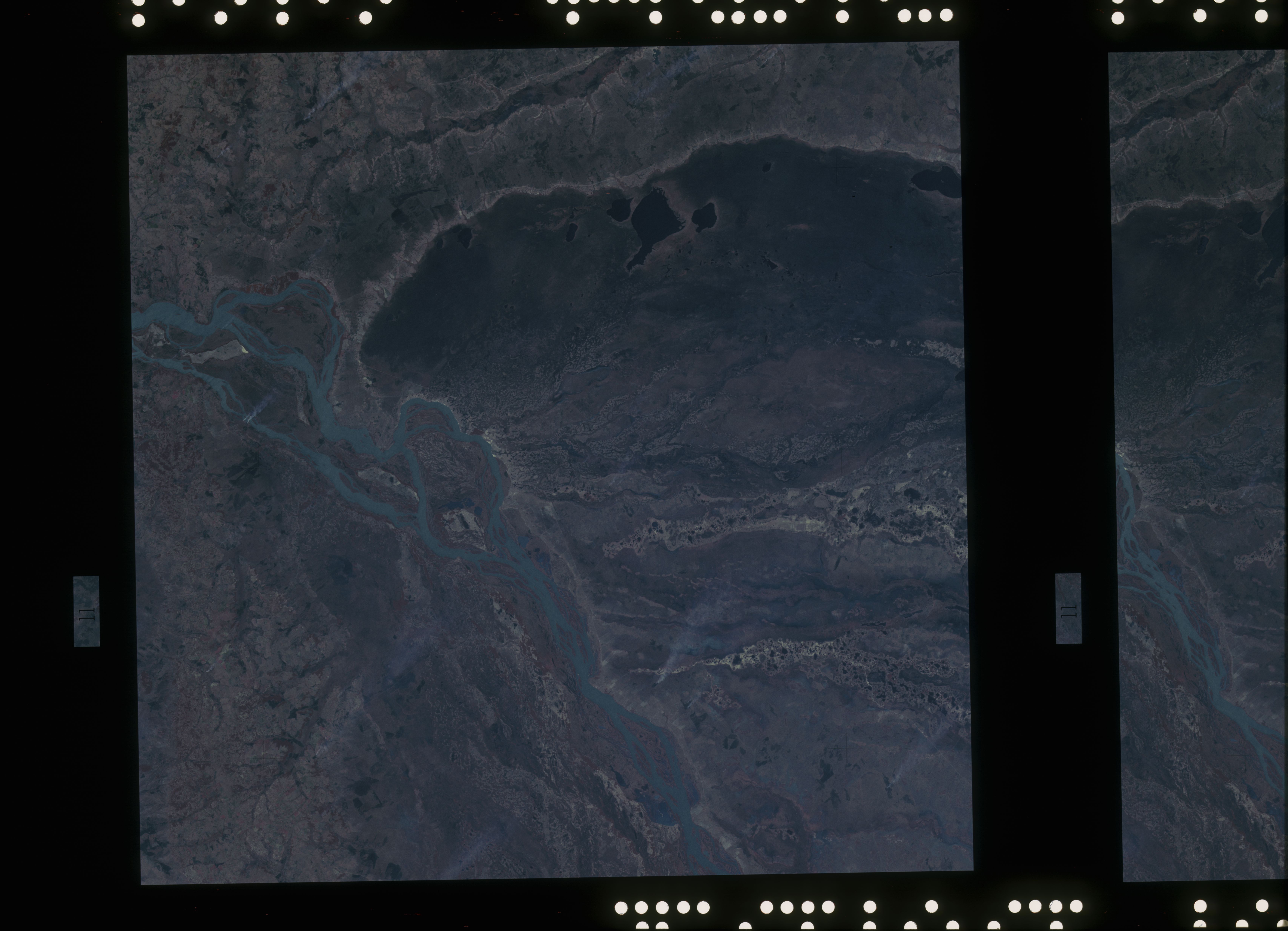
Image Caption: A vertical view of the Argentina-Paraguay border area of South America as photographed from Earth orbit by one of the six lenses of the Itek-furnished S190-A Multispectral Photographic Facility Experiment aboard the Skylab space station. This picture was taken with type 2443 infrared color film. The Parana River flows from east to west across the picture. This part of the Rio Parana is located between the towns of Posadas, Argentina, and Resitencia, Argentina. The major body of water in the large swamp area is Laguna Ibera. Note the several fires burning in this area. The largest land mass (Argentina) is south of the river. Paraguay is north of the river. Isla Apipe Grande is near the center of the photograph.
