NM23-764-245
| NASA Photo ID | NM23-764-245 |
| Focal Length | 100mm |
| Date taken | 1997.02.10 |
| Time taken | GMT |
Resolutions offered for this image:
4066 x 4066 pixels 640 x 640 pixels 5700 x 6000 pixels 500 x 526 pixels
4066 x 4066 pixels 640 x 640 pixels 5700 x 6000 pixels 500 x 526 pixels


Cloud masks available for this image:
Spacecraft nadir point:
Photo center point: 36.0° S, 71.5° W
Photo center point by machine learning:
Photo center point: 36.0° S, 71.5° W
Photo center point by machine learning:
Nadir to Photo Center: Southwest
Spacecraft Altitude: nautical miles (0km)
Country or Geographic Name: | CHILE |
Features: | CONCEPCION |
| Features Found Using Machine Learning: | |
Cloud Cover Percentage: | 0 (no clouds present) |
Sun Elevation Angle: | ° |
Sun Azimuth: | ° |
Camera: | Hasselblad |
Focal Length: | 100mm |
Camera Tilt: | Low Oblique |
Format: | 5046: Kodak, natural color positive, Lumiere 100/5046, ASA 100, standard base |
Film Exposure: | Normal |
| Additional Information | |
| Width | Height | Annotated | Cropped | Purpose | Links |
|---|---|---|---|---|---|
| 4066 pixels | 4066 pixels | No | No | Earth From Space collection | Download Image |
| 640 pixels | 640 pixels | No | No | Earth From Space collection | Download Image |
| 5700 pixels | 6000 pixels | No | No | Download Image | |
| 500 pixels | 526 pixels | No | No | Download Image |
Download Packaged File
Download a Google Earth KML for this Image
View photo footprint information
Download a GeoTIFF for this photo
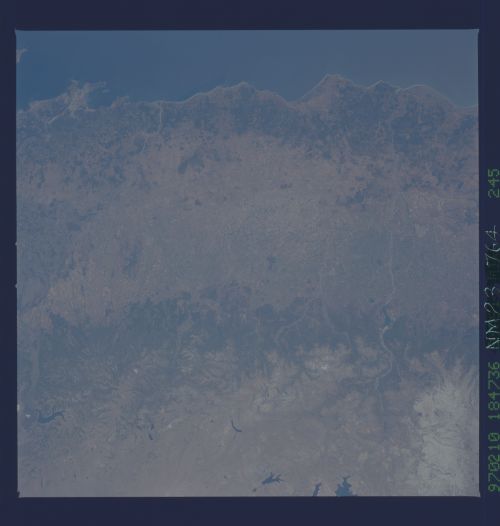
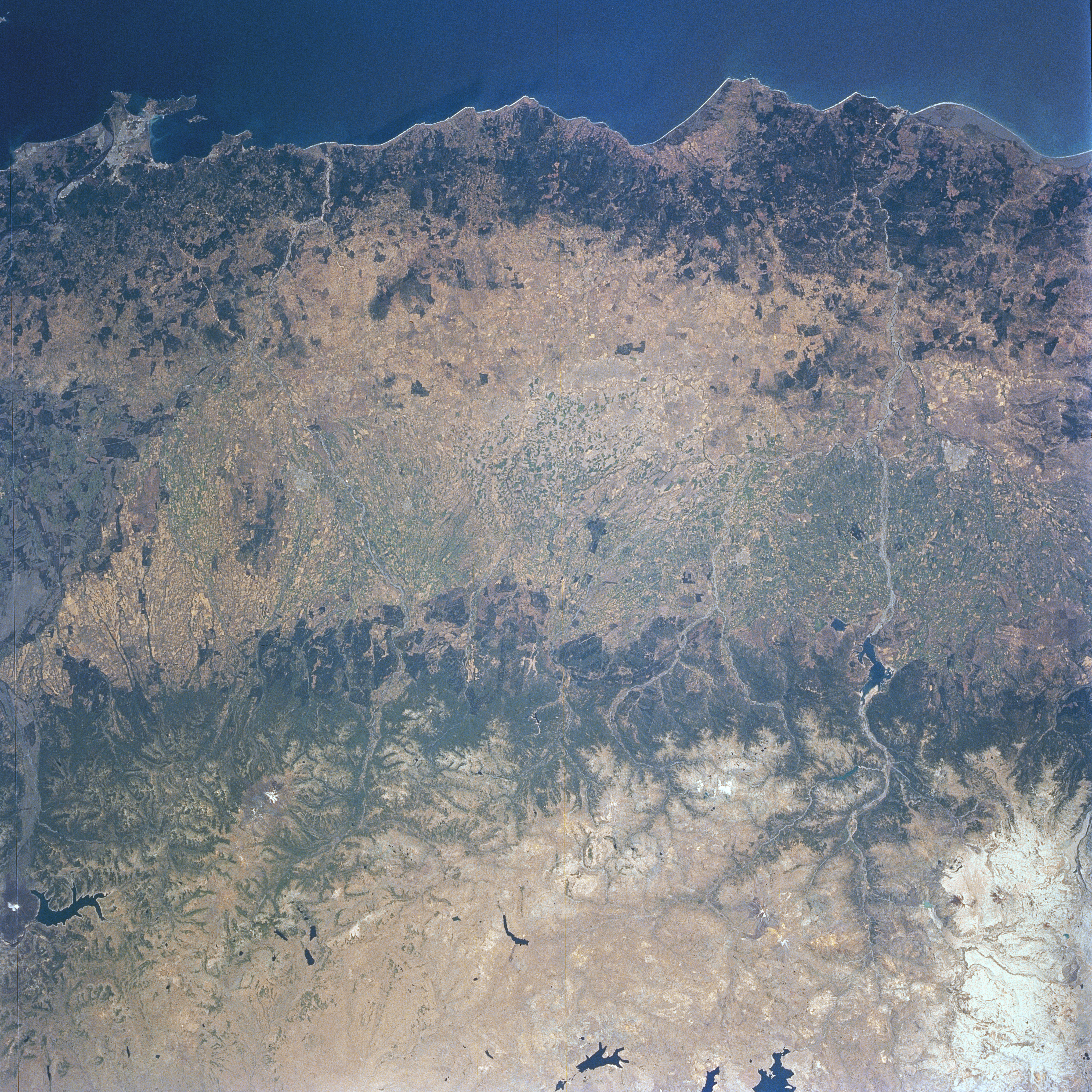
Image Caption: NM23-764-245 Central Valley; Concepcion, Chile Winter/Spring 1997
The darker forested slopes of the Andes Mountains cross the view. The central Valley, with its favorable climate, is the broad lighter colored swath between the mountains and the coastline. It has good soils that produce a variety of agricultural products including fruits, vegetables, and grains. In the upper left, the metropolitan region of Concepcion and its port cities of Talcahuano and Tome are visible occupying most of a large irregular headland. Concepcion is located on the banks of the Bio-Bio River, 6 miles (10 km) from the river's mouth. The city is an industrial and commercial center. The ports of Talcahuano and Tome ship the products of the surrounding rich agricultural and mining region. Coal is mined in the nearby hills. Since Concepcion was founded in 1550, it has been severely damaged or destroyed by earthquakes ten times, the last in 1960. The high, semi-arid Patagonian Plateau is visible along the bottom (right) portion of the image. The Varvarco Compos Lake is visible at the bottom center (right margin) of the image.
The darker forested slopes of the Andes Mountains cross the view. The central Valley, with its favorable climate, is the broad lighter colored swath between the mountains and the coastline. It has good soils that produce a variety of agricultural products including fruits, vegetables, and grains. In the upper left, the metropolitan region of Concepcion and its port cities of Talcahuano and Tome are visible occupying most of a large irregular headland. Concepcion is located on the banks of the Bio-Bio River, 6 miles (10 km) from the river's mouth. The city is an industrial and commercial center. The ports of Talcahuano and Tome ship the products of the surrounding rich agricultural and mining region. Coal is mined in the nearby hills. Since Concepcion was founded in 1550, it has been severely damaged or destroyed by earthquakes ten times, the last in 1960. The high, semi-arid Patagonian Plateau is visible along the bottom (right) portion of the image. The Varvarco Compos Lake is visible at the bottom center (right margin) of the image.
