NM23-762-210

| NASA Photo ID | NM23-762-210 |
| Focal Length | 100mm |
| Date taken | 1997.05.02 |
| Time taken | 13:36:09 GMT |
Resolutions offered for this image:
4072 x 4072 pixels 639 x 639 pixels 5700 x 6000 pixels 500 x 526 pixels
4072 x 4072 pixels 639 x 639 pixels 5700 x 6000 pixels 500 x 526 pixels


Cloud masks available for this image:
Spacecraft nadir point: 49.7° N, 2.2° E
Photo center point: 51.0° N, 1.0° W
Photo center point by machine learning:
Photo center point: 51.0° N, 1.0° W
Photo center point by machine learning:
Nadir to Photo Center: West
Spacecraft Altitude: 210 nautical miles (389km)
Country or Geographic Name: | UK-ENGLAND |
Features: | WIGHT ISLAND |
| Features Found Using Machine Learning: | |
Cloud Cover Percentage: | 0 (no clouds present) |
Sun Elevation Angle: | 50° |
Sun Azimuth: | 222° |
Camera: | Hasselblad |
Focal Length: | 100mm |
Camera Tilt: | 45 degrees |
Format: | 5046: Kodak, natural color positive, Lumiere 100/5046, ASA 100, standard base |
Film Exposure: | Normal |
| Additional Information | |
| Width | Height | Annotated | Cropped | Purpose | Links |
|---|---|---|---|---|---|
| 4072 pixels | 4072 pixels | No | No | Earth From Space collection | Download Image |
| 639 pixels | 639 pixels | No | No | Earth From Space collection | Download Image |
| 5700 pixels | 6000 pixels | No | No | Download Image | |
| 500 pixels | 526 pixels | No | No | Download Image |
Download Packaged File
Download a Google Earth KML for this Image
View photo footprint information
Download a GeoTIFF for this photo
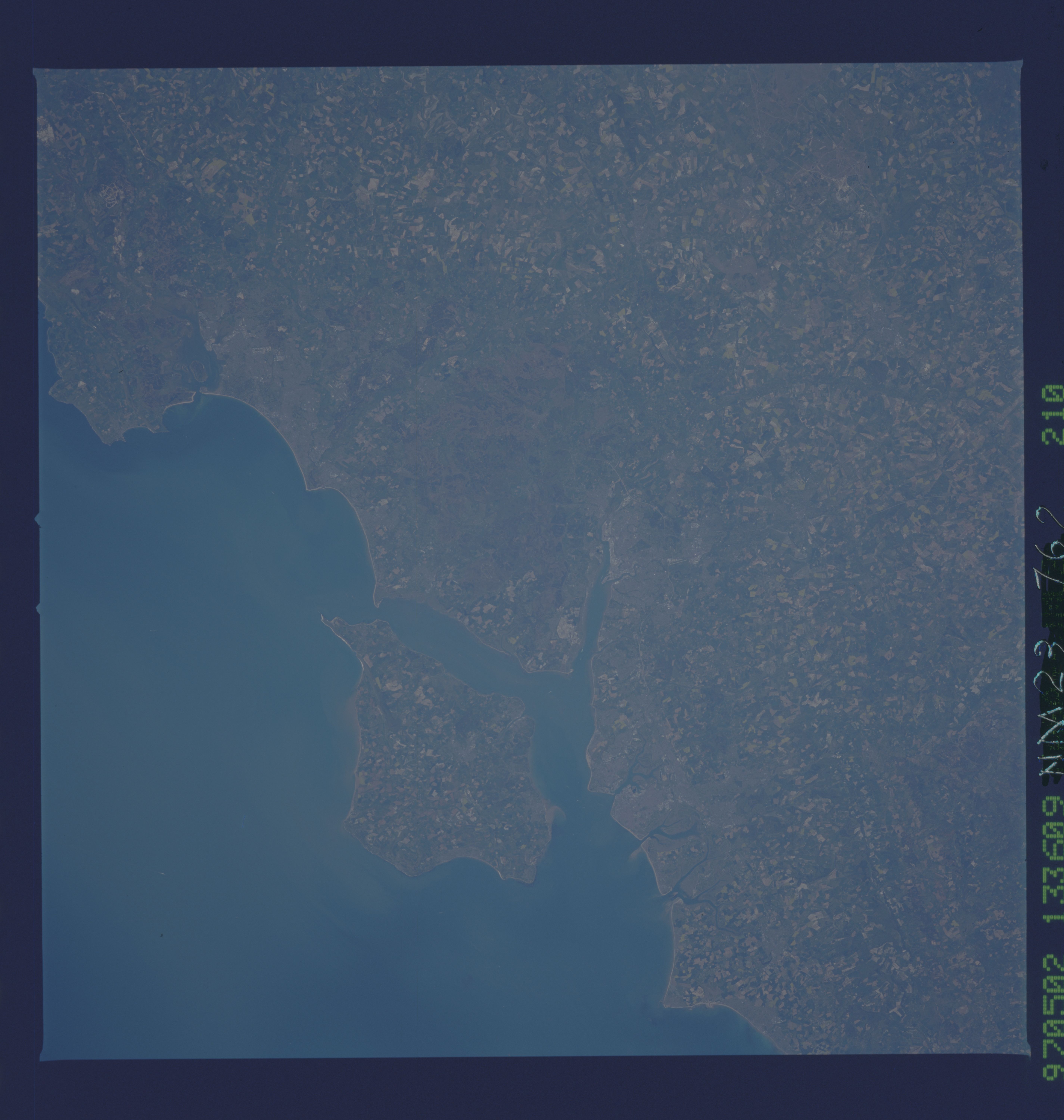
Image Caption: NM23-762-210 Isle of Wight, South Downs, Portsmouth, Great Britain Winter/Spring 1997
The south central coast of England and the Isle of Wight can be seen in this south-southwest-looking view. Situated on the image midway between the center and left center, the Isle of Wight is 23 miles (37km) long and 13 miles (21 km) wide and covers an area of 147 sq. miles (381 sq. km). The Solent and Spithead Channels separate the Isle of Wight from southern England. The mild climate, scenery, and beautiful coastline make the Isle of Wight a popular tourist resort. In the bottom left quadrant of the image and extending to near the center of the image, the parallel ranges of the South Downs and Chalk Hills, are visible. Along the coast just to the north of the Isle of Wight, is the city of Portsmouth. The city is the site of a major British naval base. Portsmouth is the birthplace of noted author Charles Dickens. Another port and ship building city, Southampton, can be identified at the northern end of the elongated estuary north of Solent Channel.
The south central coast of England and the Isle of Wight can be seen in this south-southwest-looking view. Situated on the image midway between the center and left center, the Isle of Wight is 23 miles (37km) long and 13 miles (21 km) wide and covers an area of 147 sq. miles (381 sq. km). The Solent and Spithead Channels separate the Isle of Wight from southern England. The mild climate, scenery, and beautiful coastline make the Isle of Wight a popular tourist resort. In the bottom left quadrant of the image and extending to near the center of the image, the parallel ranges of the South Downs and Chalk Hills, are visible. Along the coast just to the north of the Isle of Wight, is the city of Portsmouth. The city is the site of a major British naval base. Portsmouth is the birthplace of noted author Charles Dickens. Another port and ship building city, Southampton, can be identified at the northern end of the elongated estuary north of Solent Channel.
