NM23-761-679
| NASA Photo ID | NM23-761-679 |
| Focal Length | 100mm |
| Date taken | 1997.05.03 |
| Time taken | 15:30:43 GMT |
Resolutions offered for this image:
4030 x 4036 pixels 639 x 639 pixels 5700 x 6000 pixels 500 x 526 pixels 504 x 679 pixels 478 x 480 pixels 505 x 504 pixels
4030 x 4036 pixels 639 x 639 pixels 5700 x 6000 pixels 500 x 526 pixels 504 x 679 pixels 478 x 480 pixels 505 x 504 pixels

Cloud masks available for this image:
Spacecraft nadir point: 35.8° N, 110.1° W
Photo center point: 33.0° N, 105.5° W
Photo center point by machine learning:
Photo center point: 33.0° N, 105.5° W
Photo center point by machine learning:
Nadir to Photo Center: Southeast
Spacecraft Altitude: 207 nautical miles (383km)
Country or Geographic Name: | USA-NEW MEXICO |
Features: | WHITE SANDS |
| Features Found Using Machine Learning: | |
Cloud Cover Percentage: | 0 (no clouds present) |
Sun Elevation Angle: | 36° |
Sun Azimuth: | 96° |
Camera: | Hasselblad |
Focal Length: | 100mm |
Camera Tilt: | Low Oblique |
Format: | 5046: Kodak, natural color positive, Lumiere 100/5046, ASA 100, standard base |
Film Exposure: | Normal |
| Additional Information | |
| Width | Height | Annotated | Cropped | Purpose | Links |
|---|---|---|---|---|---|
| 4030 pixels | 4036 pixels | No | No | Earth From Space collection | Download Image |
| 639 pixels | 639 pixels | No | No | Earth From Space collection | Download Image |
| 5700 pixels | 6000 pixels | No | No | Download Image | |
| 500 pixels | 526 pixels | No | No | Download Image | |
| 504 pixels | 679 pixels | Earth From Space phase 2 | Download Image | ||
| 478 pixels | 480 pixels | Download Image | |||
| 505 pixels | 504 pixels | No | No | Download Image |
Download Packaged File
Download a Google Earth KML for this Image
View photo footprint information
Download a GeoTIFF for this photo
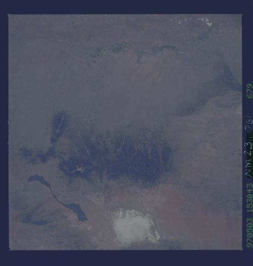
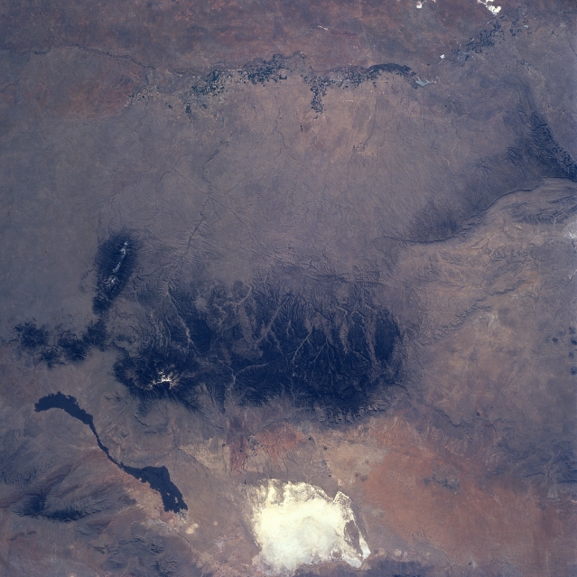
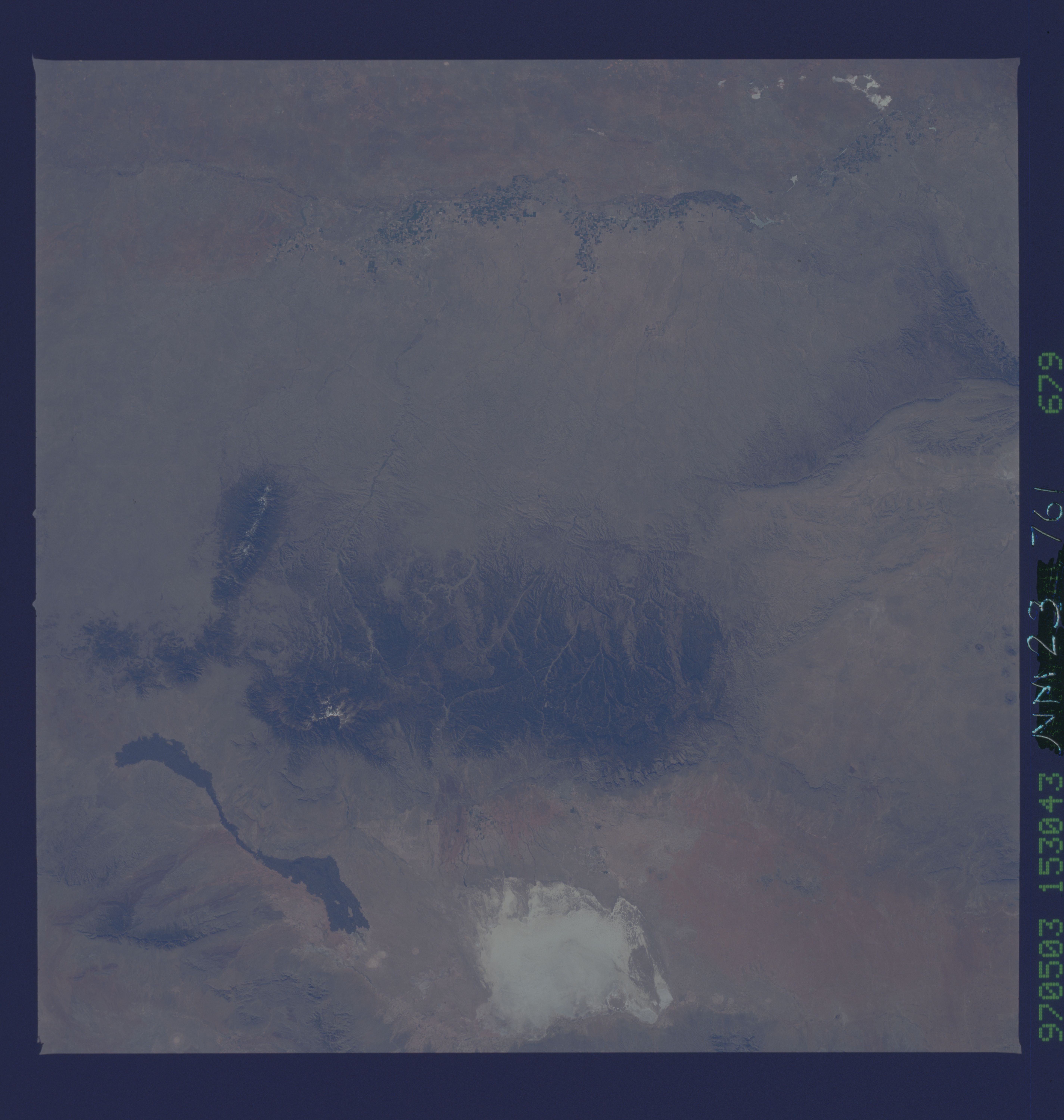
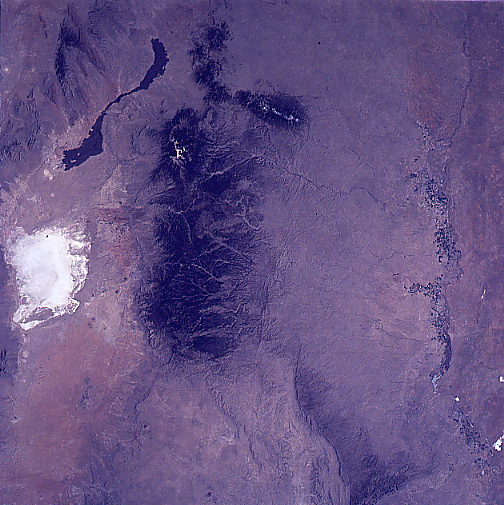
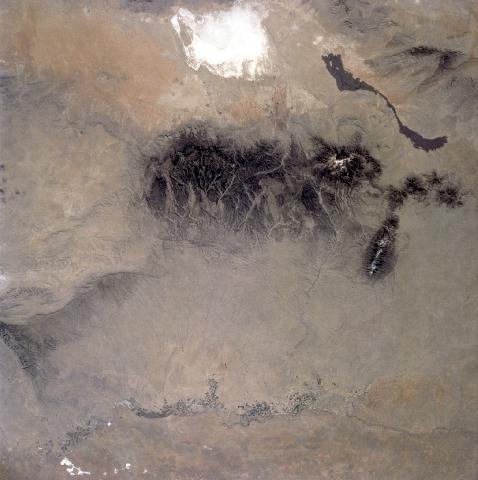
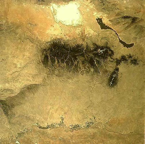
Image Caption: NM23-761-679 Sacramento Mountains, New Mexico, USA Winter-Spring 1997
The forested slopes of the Sacramento Mountains (large dark feature near center of the image) contrast against an otherwise arid environment (lighter colored terrain). The highly reflective White Sands National Monument, located in the Tularosa Valley is visible west of the Sacramento Mountains. The elongated, ribbon-like, dark feature northwest of the Sacramento Mountains is a basaltic lava flow that originated from a vent at the northern end of the valley. Two other mountain ranges, Capitan and Guadalupe, can be identified north, and southeast, respectively, of the Sacramento Mountains. The mottled looking landscape (north-south swath) towards the eastern edge of the image is the irrigated agriculture of the Pecos River Valley, where artesian wells are used to provide water. The main channel of the intermittently flowing Rio Hondo and many of its tributaries can be traced from the northeast slopes of the Sacramento Mountains to the point where the Rio Hondo merges with the Pecos River at the town of Roswell (barely discernible).
The forested slopes of the Sacramento Mountains (large dark feature near center of the image) contrast against an otherwise arid environment (lighter colored terrain). The highly reflective White Sands National Monument, located in the Tularosa Valley is visible west of the Sacramento Mountains. The elongated, ribbon-like, dark feature northwest of the Sacramento Mountains is a basaltic lava flow that originated from a vent at the northern end of the valley. Two other mountain ranges, Capitan and Guadalupe, can be identified north, and southeast, respectively, of the Sacramento Mountains. The mottled looking landscape (north-south swath) towards the eastern edge of the image is the irrigated agriculture of the Pecos River Valley, where artesian wells are used to provide water. The main channel of the intermittently flowing Rio Hondo and many of its tributaries can be traced from the northeast slopes of the Sacramento Mountains to the point where the Rio Hondo merges with the Pecos River at the town of Roswell (barely discernible).
