NM23-745-116

| NASA Photo ID | NM23-745-116 |
| Focal Length | 250mm |
| Date taken | 1997.04.27 |
| Time taken | 12:00:20 GMT |
Resolutions offered for this image:
1000 x 959 pixels 990 x 1000 pixels 540 x 540 pixels 540 x 617 pixels 5700 x 6000 pixels 500 x 526 pixels 4096 x 4139 pixels 628 x 630 pixels
1000 x 959 pixels 990 x 1000 pixels 540 x 540 pixels 540 x 617 pixels 5700 x 6000 pixels 500 x 526 pixels 4096 x 4139 pixels 628 x 630 pixels


Cloud masks available for this image:
Spacecraft nadir point: 51.5° N, 25.8° E
Photo center point: 51.0° N, 30.0° E
Photo center point by machine learning:
Photo center point: 51.0° N, 30.0° E
Photo center point by machine learning:
Nadir to Photo Center: East
Spacecraft Altitude: 210 nautical miles (389km)
Country or Geographic Name: | UKRAINE |
Features: | CHERNOBYL, PRIPYAT RIVER |
| Features Found Using Machine Learning: | |
Cloud Cover Percentage: | 10 (1-10)% |
Sun Elevation Angle: | 47° |
Sun Azimuth: | 219° |
Camera: | Hasselblad |
Focal Length: | 250mm |
Camera Tilt: | 50 degrees |
Format: | 5046: Kodak, natural color positive, Lumiere 100/5046, ASA 100, standard base |
Film Exposure: | Normal |
| Additional Information | |
| Width | Height | Annotated | Cropped | Purpose | Links |
|---|---|---|---|---|---|
| 1000 pixels | 959 pixels | No | No | NASA's Earth Observatory web site | Download Image |
| 990 pixels | 1000 pixels | No | No | NASA's Earth Observatory web site | Download Image |
| 540 pixels | 540 pixels | Yes | Yes | NASA's Earth Observatory web site | Download Image |
| 540 pixels | 617 pixels | Yes | Yes | NASA's Earth Observatory web site | Download Image |
| 5700 pixels | 6000 pixels | No | No | Download Image | |
| 500 pixels | 526 pixels | No | No | Download Image | |
| 4096 pixels | 4139 pixels | No | No | Download Image | |
| 628 pixels | 630 pixels | No | No | Download Image |
Download Packaged File
Download a Google Earth KML for this Image
View photo footprint information
Download a GeoTIFF for this photo
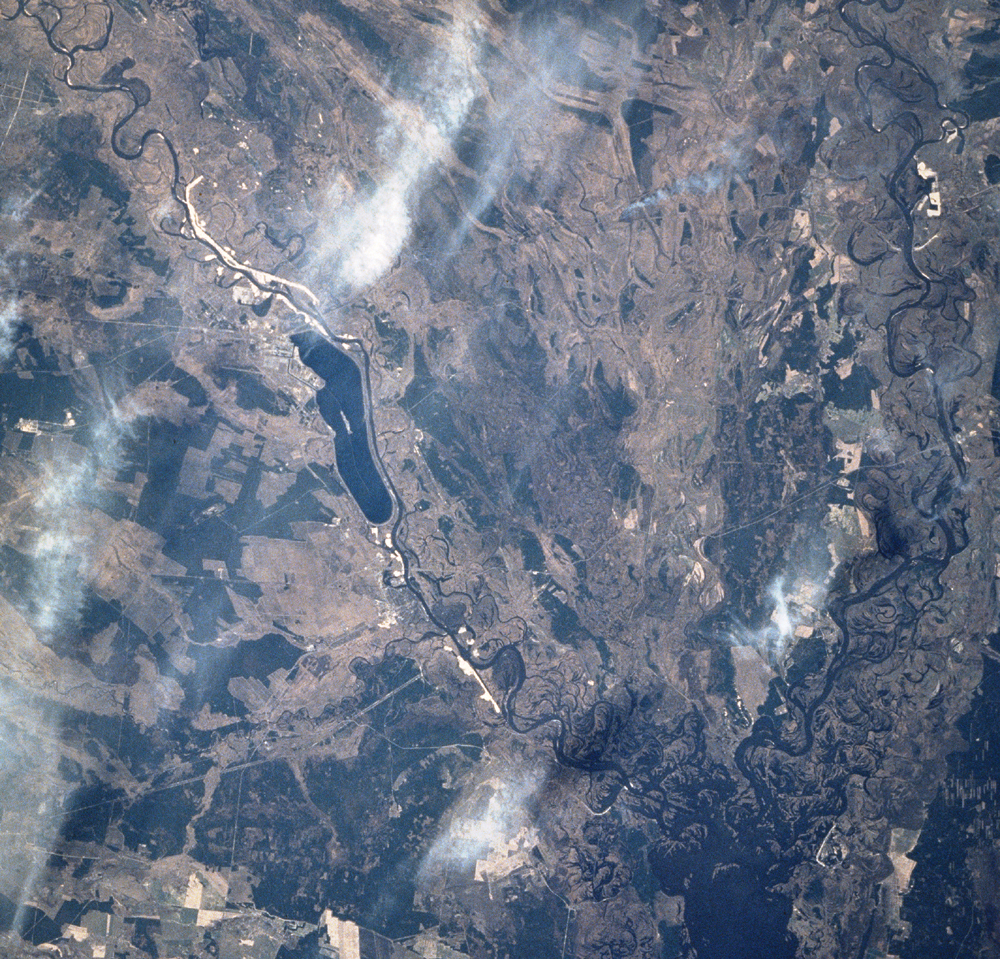
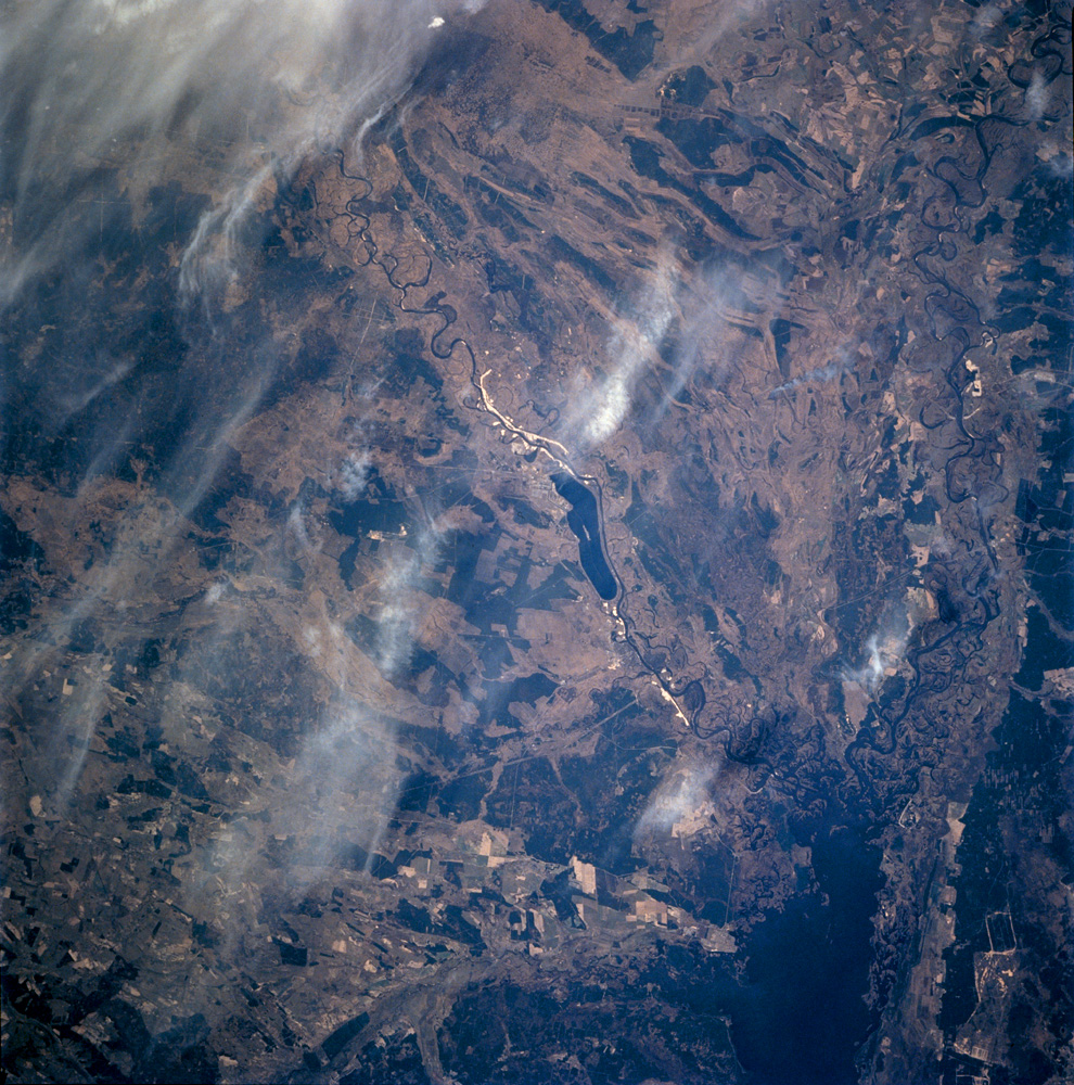
Image Caption: Chernobyl, Ukraine:
Eighteen years ago, on April 26 1986, the world's worst nuclear power accident occurred at the Chernobyl Nuclear Power Plant near the Ukrainian-Belarus border. Toxic radionuclides like Cs137 and Sr90 contaminated an area of 155,000 square kilometers in what is today Belarus, Ukraine and Russia. Hundreds of thousands of people were killed, sickened from radiation-induced illnesses, or resettled to uncontaminated land.
Today, the immediate area remains off limits to humans. The plant was permanently closed in 2000. The surrounding agricultural land has been abandoned, and the two nearby towns (Pripyat to the north and Chernobyl to the south) where plant workers lived are largely ghost towns. Instead of people, abundant wildlife--packs of wolves, deer, and birds--roam and live near Chernobyl.
This image, taken seven years ago from the Russian Mir spacecraft shows Chernobyl and the surrounding countryside. The power plant is situated on the northwest end of a cooling pond on the Pripyat River, which flows into the Dnepr River just 80 miles north of Kiev. The main features visible in the image are the massive concrete dams and levees that were constructed to contain elements of the power plant and prevent contaminated runoff from entering the local streams. The cooling water canals leading to the pond, and the levees in the middle of the pond that channeled the water circulation can also be seen. The darker green regions are forests and the light green areas are cleared land used for agriculture.
