NM23-743-51

| NASA Photo ID | NM23-743-51 |
| Focal Length | 250mm |
| Date taken | 1997.04.24 |
| Time taken | 11:17:05 GMT |
Resolutions offered for this image:
4096 x 4048 pixels 640 x 632 pixels 5700 x 6000 pixels 500 x 526 pixels
4096 x 4048 pixels 640 x 632 pixels 5700 x 6000 pixels 500 x 526 pixels

Cloud masks available for this image:
Spacecraft nadir point: 12.2° S, 35.9° W
Photo center point: 46.0° N, 8.5° E
Photo center point by machine learning:
Photo center point: 46.0° N, 8.5° E
Photo center point by machine learning:
Nadir to Photo Center: Northeast
Spacecraft Altitude: 209 nautical miles (387km)
Country or Geographic Name: | ITALY |
Features: | LAKE MAGGIORE, ALPS |
| Features Found Using Machine Learning: | |
Cloud Cover Percentage: | 0 (no clouds present) |
Sun Elevation Angle: | 38° |
Sun Azimuth: | 63° |
Camera: | Hasselblad |
Focal Length: | 250mm |
Camera Tilt: | Low Oblique |
Format: | 5046: Kodak, natural color positive, Lumiere 100/5046, ASA 100, standard base |
Film Exposure: | Normal |
| Additional Information | |
| Width | Height | Annotated | Cropped | Purpose | Links |
|---|---|---|---|---|---|
| 4096 pixels | 4048 pixels | No | No | Earth From Space collection | Download Image |
| 640 pixels | 632 pixels | No | No | Earth From Space collection | Download Image |
| 5700 pixels | 6000 pixels | No | No | Download Image | |
| 500 pixels | 526 pixels | No | No | Download Image |
Download Packaged File
Download a Google Earth KML for this Image
View photo footprint information
Download a GeoTIFF for this photo
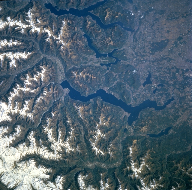
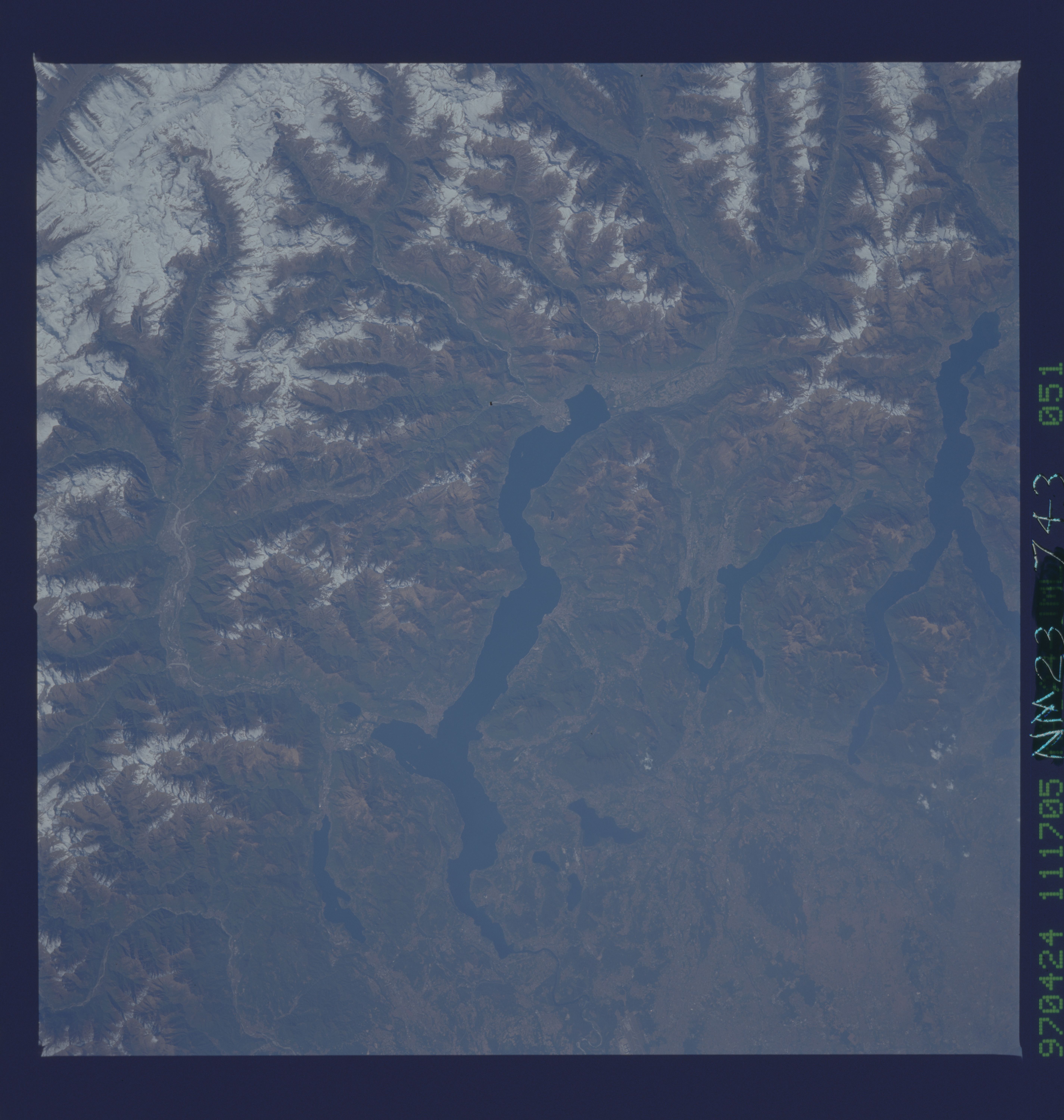
Image Caption: NM23-743-051 Glacial Lakes, Italy Winter/Spring 1997
Glaciated, U-shaped river valleys are visible as they provide melt-water runoff that flows into the elongated lakes (dark features) in northwest Italy. From east to west (top to center) the three larger lakes are Lake Como, Lake Lugano (smallest of the three), and Lake Maggiore (largest-center of image). Several smaller lakes (also dark features) can be identified east and west of the southern end of Lake Maggiore. Sufficient water flows through the Alpine valleys around the Po River Basin to place Italy among the leading nations of Europe in terms of generating hydroelectricity. The lakes are constantly re-charged by melting valley glaciers and snow from the Swiss and Italian Alps. While most of the scene covers northwest Italy, a small piece of Switzerland is visible, particularly in the northeast quadrant (upper left) of the image. The Ticimo River (winding valley feature--bottom of image), a tributary of the Po River, can be traced as it crosses a variety of landforms that includes the Swiss and Italian Alps, Lake Maggiore, and finally becomes part of the Padana Plain (middle, right edge of scene).
Glaciated, U-shaped river valleys are visible as they provide melt-water runoff that flows into the elongated lakes (dark features) in northwest Italy. From east to west (top to center) the three larger lakes are Lake Como, Lake Lugano (smallest of the three), and Lake Maggiore (largest-center of image). Several smaller lakes (also dark features) can be identified east and west of the southern end of Lake Maggiore. Sufficient water flows through the Alpine valleys around the Po River Basin to place Italy among the leading nations of Europe in terms of generating hydroelectricity. The lakes are constantly re-charged by melting valley glaciers and snow from the Swiss and Italian Alps. While most of the scene covers northwest Italy, a small piece of Switzerland is visible, particularly in the northeast quadrant (upper left) of the image. The Ticimo River (winding valley feature--bottom of image), a tributary of the Po River, can be traced as it crosses a variety of landforms that includes the Swiss and Italian Alps, Lake Maggiore, and finally becomes part of the Padana Plain (middle, right edge of scene).
