NM23-743-43
| NASA Photo ID | NM23-743-43 |
| Focal Length | 250mm |
| Date taken | 1997.04.24 |
| Time taken | 11:16:28 GMT |
Resolutions offered for this image:
4040 x 4096 pixels 631 x 640 pixels 5700 x 6000 pixels 500 x 526 pixels 2528 x 2516 pixels
4040 x 4096 pixels 631 x 640 pixels 5700 x 6000 pixels 500 x 526 pixels 2528 x 2516 pixels

Cloud masks available for this image:
Spacecraft nadir point: 14.0° S, 37.3° W
Photo center point: 43.5° N, 5.5° E
Photo center point by machine learning:
Photo center point: 43.5° N, 5.5° E
Photo center point by machine learning:
Nadir to Photo Center: Northeast
Spacecraft Altitude: 209 nautical miles (387km)
Country or Geographic Name: | FRANCE |
Features: | MARSEILLE, BERRE LAKE |
| Features Found Using Machine Learning: | |
Cloud Cover Percentage: | 0 (no clouds present) |
Sun Elevation Angle: | 36° |
Sun Azimuth: | 62° |
Camera: | Hasselblad |
Focal Length: | 250mm |
Camera Tilt: | Low Oblique |
Format: | 5046: Kodak, natural color positive, Lumiere 100/5046, ASA 100, standard base |
Film Exposure: | Normal |
| Additional Information | |
| Width | Height | Annotated | Cropped | Purpose | Links |
|---|---|---|---|---|---|
| 4040 pixels | 4096 pixels | No | No | Earth From Space collection | Download Image |
| 631 pixels | 640 pixels | No | No | Earth From Space collection | Download Image |
| 5700 pixels | 6000 pixels | No | No | Download Image | |
| 500 pixels | 526 pixels | No | No | Download Image | |
| 2528 pixels | 2516 pixels | Download Image |
Download Packaged File
Download a Google Earth KML for this Image
View photo footprint information
Download a GeoTIFF for this photo
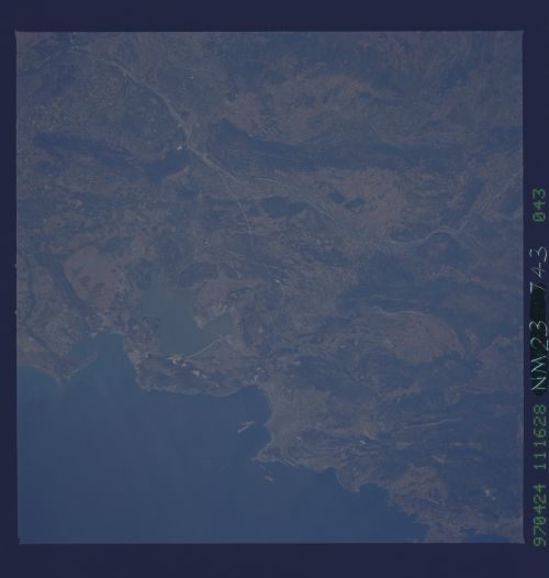
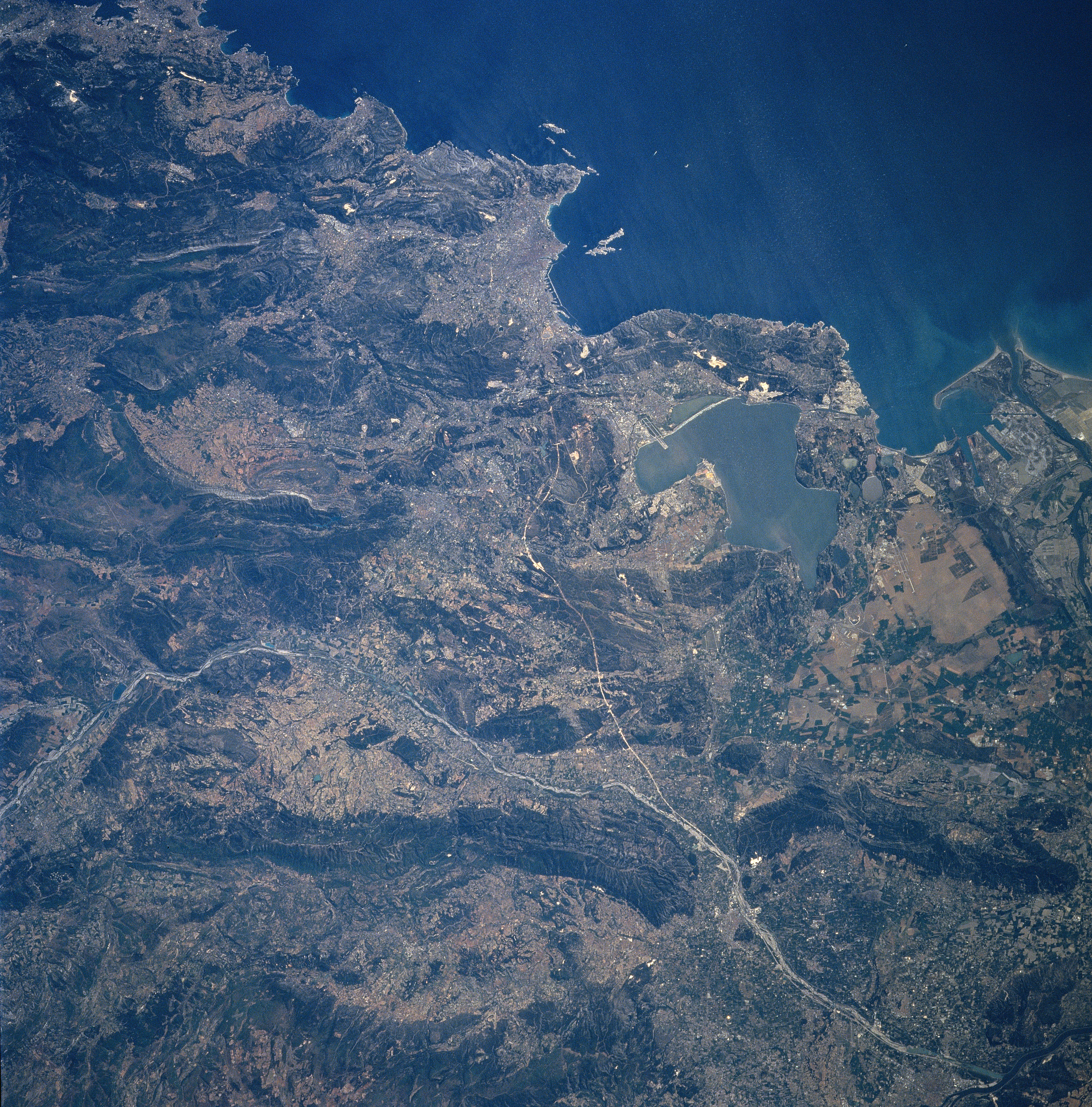
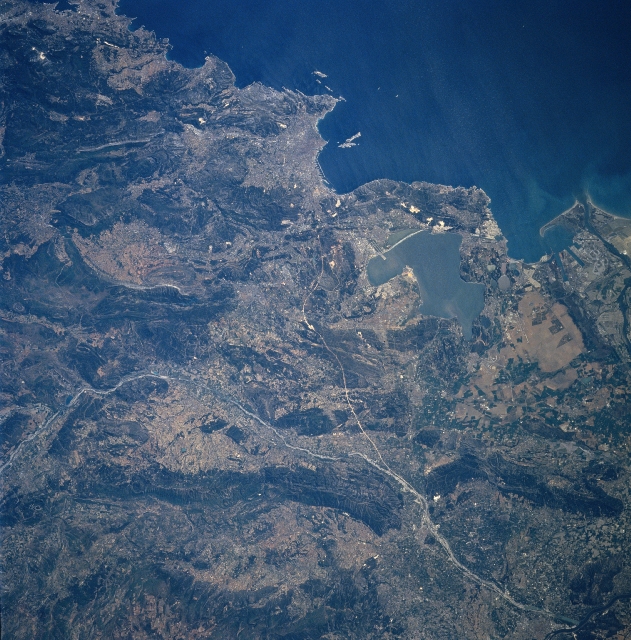
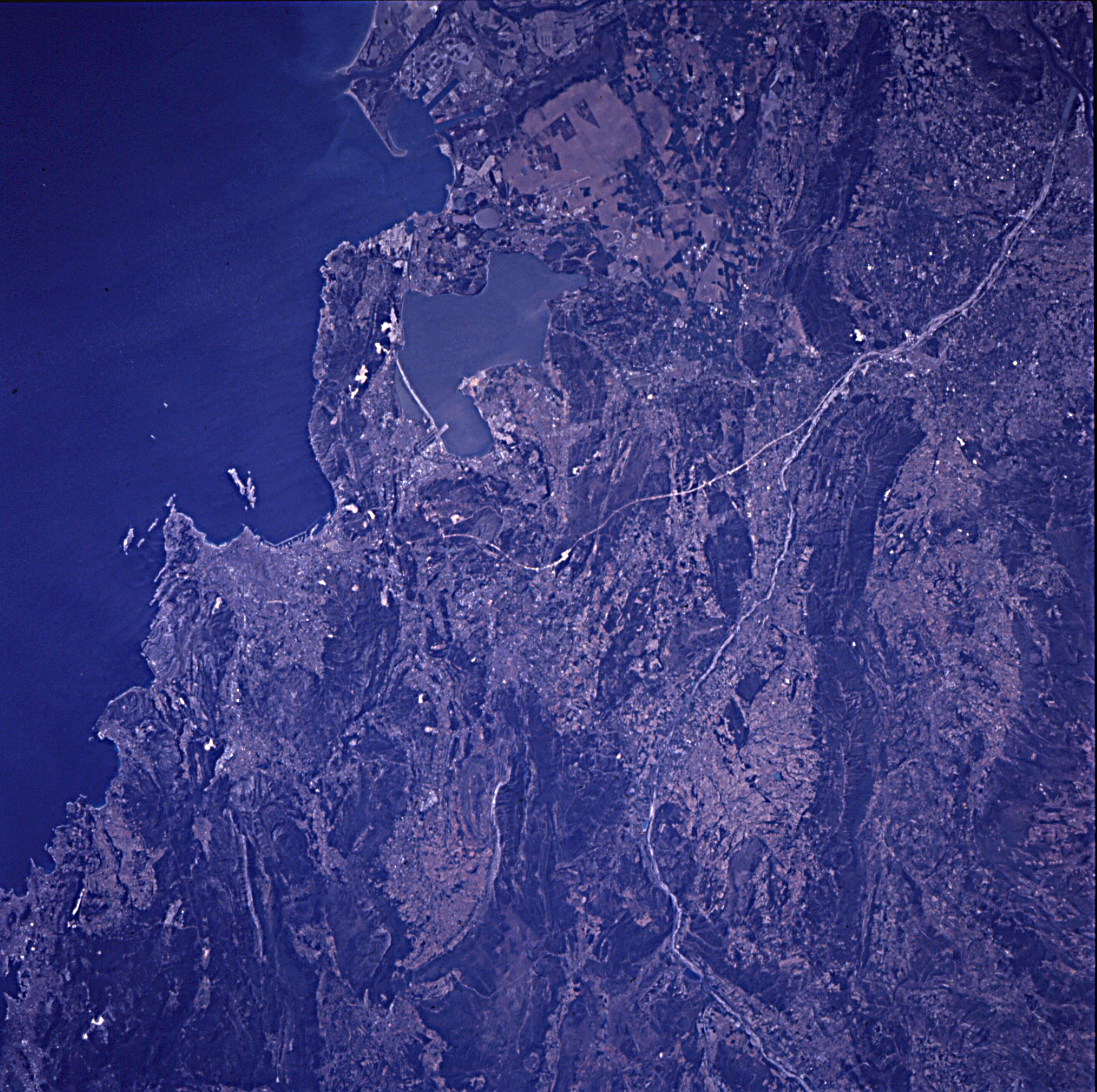
Image Caption: NM23-743-043 Marsielles, France Winter/Spring 1997
Midway between the upper center and center of the image, the port city of Marsielles is discernible in this south-looking view. Located on the Gulf of Lyons (upper right), an arm of the Mediterranean Sea, Marsielles is the second largest city in France and a very important commercial seaport. It is also the oldest city in France. Marsielles is a major industrial city and the site of an army and naval base. An underground canal connects the city with the Rhone River Valley to the northwest. Just below the left center of the image, the Durance River enters the scene. The river traverses the image generally east to west exiting the scene in the bottom right just before emptying into the Rhone River. The Berre Lagoon is visible just to the right of the center of the image. One of the runways of the Marsielles Marignane Airport is discernible extending out into the lagoon. The mouth of the Rhone River is visible at the right center of the image.
Midway between the upper center and center of the image, the port city of Marsielles is discernible in this south-looking view. Located on the Gulf of Lyons (upper right), an arm of the Mediterranean Sea, Marsielles is the second largest city in France and a very important commercial seaport. It is also the oldest city in France. Marsielles is a major industrial city and the site of an army and naval base. An underground canal connects the city with the Rhone River Valley to the northwest. Just below the left center of the image, the Durance River enters the scene. The river traverses the image generally east to west exiting the scene in the bottom right just before emptying into the Rhone River. The Berre Lagoon is visible just to the right of the center of the image. One of the runways of the Marsielles Marignane Airport is discernible extending out into the lagoon. The mouth of the Rhone River is visible at the right center of the image.
