NM23-729-782
| NASA Photo ID | NM23-729-782 |
| Focal Length | 100mm |
| Date taken | 1997.04.15 |
| Time taken | 18:53:08 GMT |
Resolutions offered for this image:
5700 x 6000 pixels 500 x 526 pixels 2586 x 2579 pixels 2622 x 2607 pixels 1902 x 1181 pixels 4044 x 3912 pixels 5112 x 5166 pixels 540 x 335 pixels
5700 x 6000 pixels 500 x 526 pixels 2586 x 2579 pixels 2622 x 2607 pixels 1902 x 1181 pixels 4044 x 3912 pixels 5112 x 5166 pixels 540 x 335 pixels


Cloud masks available for this image:
Spacecraft nadir point: 5.1° N, 88.0° E
Photo center point: 21.5° N, 77.0° W
Photo center point by machine learning:
Photo center point: 21.5° N, 77.0° W
Photo center point by machine learning:
Nadir to Photo Center: West
Spacecraft Altitude: 210 nautical miles (389km)
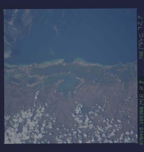
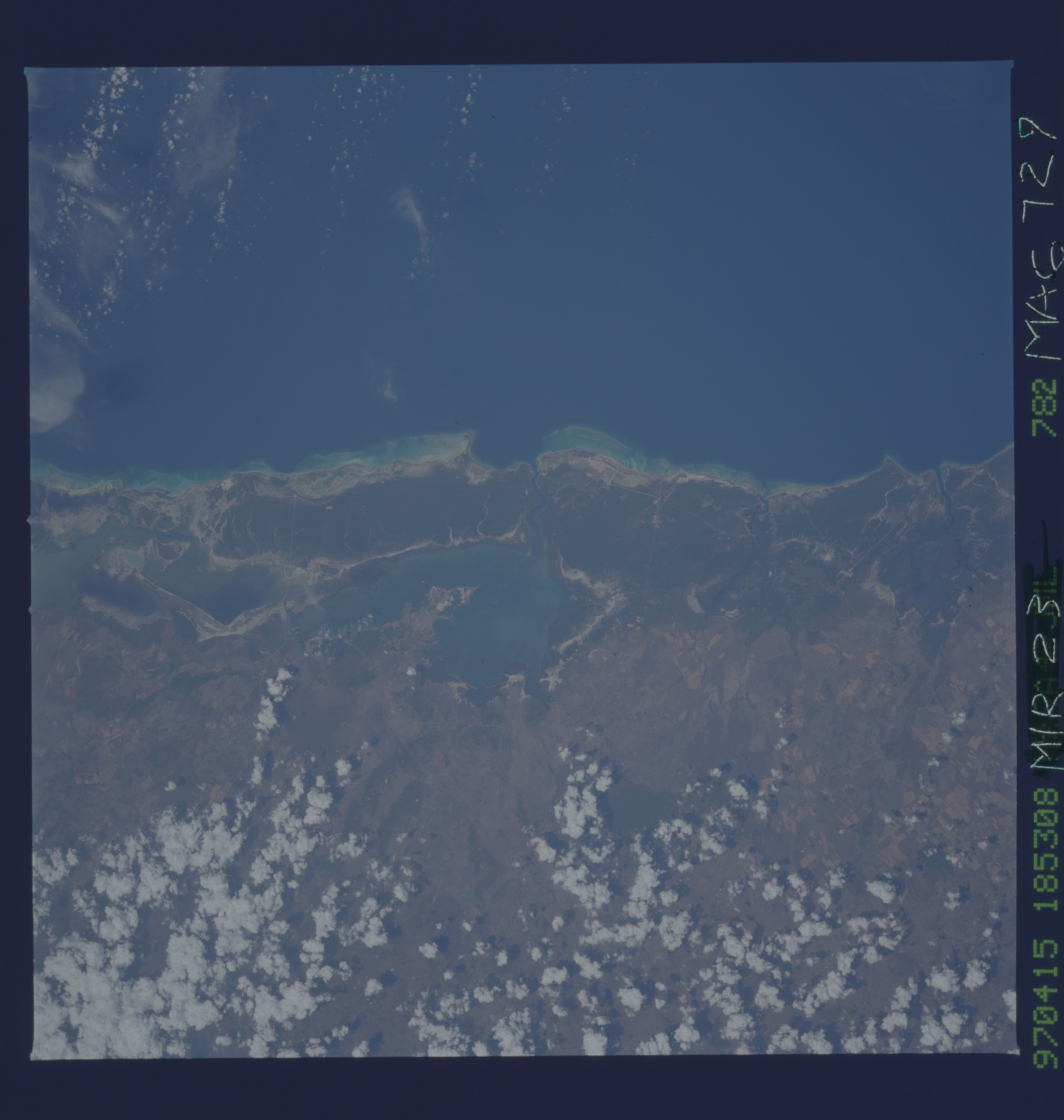
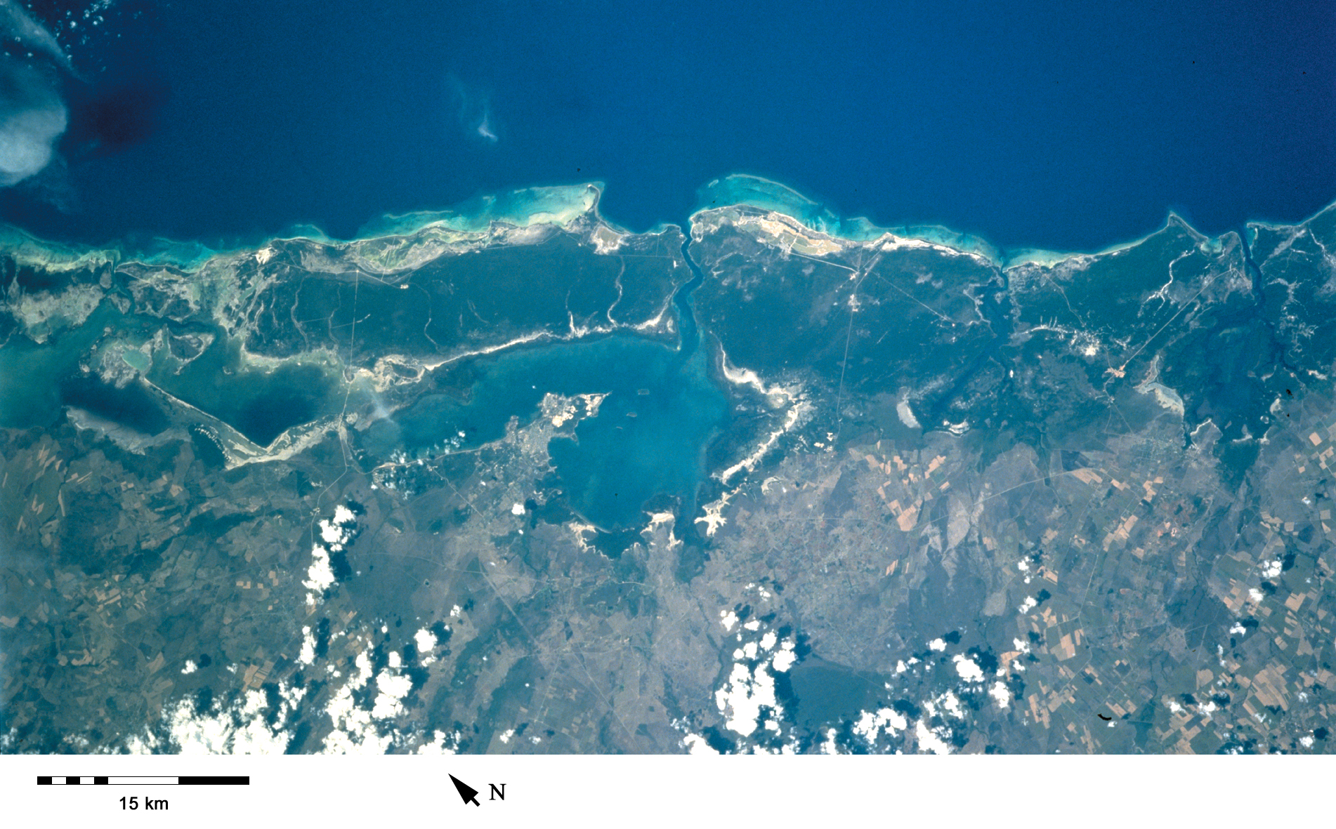
Country or Geographic Name: | CUBA |
Features: | NUEVITAS BAY |
| Features Found Using Machine Learning: | |
Cloud Cover Percentage: | 15 (11-25)% |
Sun Elevation Angle: | -71° |
Sun Azimuth: | 37° |
Camera: | Hasselblad |
Focal Length: | 100mm |
Camera Tilt: | Low Oblique |
Format: | 5046: Kodak, natural color positive, Lumiere 100/5046, ASA 100, standard base |
Film Exposure: | Normal |
| Additional Information | |
| Width | Height | Annotated | Cropped | Purpose | Links |
|---|---|---|---|---|---|
| 5700 pixels | 6000 pixels | No | No | Download Image | |
| 500 pixels | 526 pixels | No | No | Download Image | |
| 2586 pixels | 2579 pixels | No | Yes | ReefBase 1 | Download Image |
| 2622 pixels | 2607 pixels | Yes | ReefBase 1 | Download Image | |
| 1902 pixels | 1181 pixels | Yes | Yes | Publisher Request | Download Image |
| 4044 pixels | 3912 pixels | No | No | Download Image | |
| 5112 pixels | 5166 pixels | No | No | Download Image | |
| 540 pixels | 335 pixels | Yes | Yes | Publisher Request | Download Image |
Download Packaged File
Download a Google Earth KML for this Image
View photo footprint information
Download a GeoTIFF for this photo
Image Caption: Nuevitas Bay in northeast Cuba. The fringing reefs offshore are clearly visible, while there are important mangrove communities around the lagoon [NM23-729-782, 1997].
