NM23-718-501
| NASA Photo ID | NM23-718-501 |
| Focal Length | 250mm |
| Date taken | 1997.03.25 |
| Time taken | GMT |
Resolutions offered for this image:
4096 x 4079 pixels 640 x 637 pixels 5700 x 6000 pixels 500 x 526 pixels
4096 x 4079 pixels 640 x 637 pixels 5700 x 6000 pixels 500 x 526 pixels

Cloud masks available for this image:
Spacecraft nadir point:
Photo center point: 50.0° S, 73.0° W
Photo center point by machine learning:
Photo center point: 50.0° S, 73.0° W
Photo center point by machine learning:
Nadir to Photo Center: Southeast
Spacecraft Altitude: nautical miles (0km)
Country or Geographic Name: | ARGENTINA |
Features: | ANDES MOUNTAINS, GLACIERS |
| Features Found Using Machine Learning: | |
Cloud Cover Percentage: | 70 (51-75)% |
Sun Elevation Angle: | ° |
Sun Azimuth: | ° |
Camera: | Hasselblad |
Focal Length: | 250mm |
Camera Tilt: | Low Oblique |
Format: | 5046: Kodak, natural color positive, Lumiere 100/5046, ASA 100, standard base |
Film Exposure: | Normal |
| Additional Information | |
| Width | Height | Annotated | Cropped | Purpose | Links |
|---|---|---|---|---|---|
| 4096 pixels | 4079 pixels | No | No | Earth From Space collection | Download Image |
| 640 pixels | 637 pixels | No | No | Earth From Space collection | Download Image |
| 5700 pixels | 6000 pixels | No | No | Download Image | |
| 500 pixels | 526 pixels | No | No | Download Image |
Download Packaged File
Download a Google Earth KML for this Image
View photo footprint information
Download a GeoTIFF for this photo
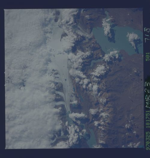
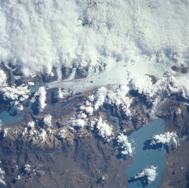
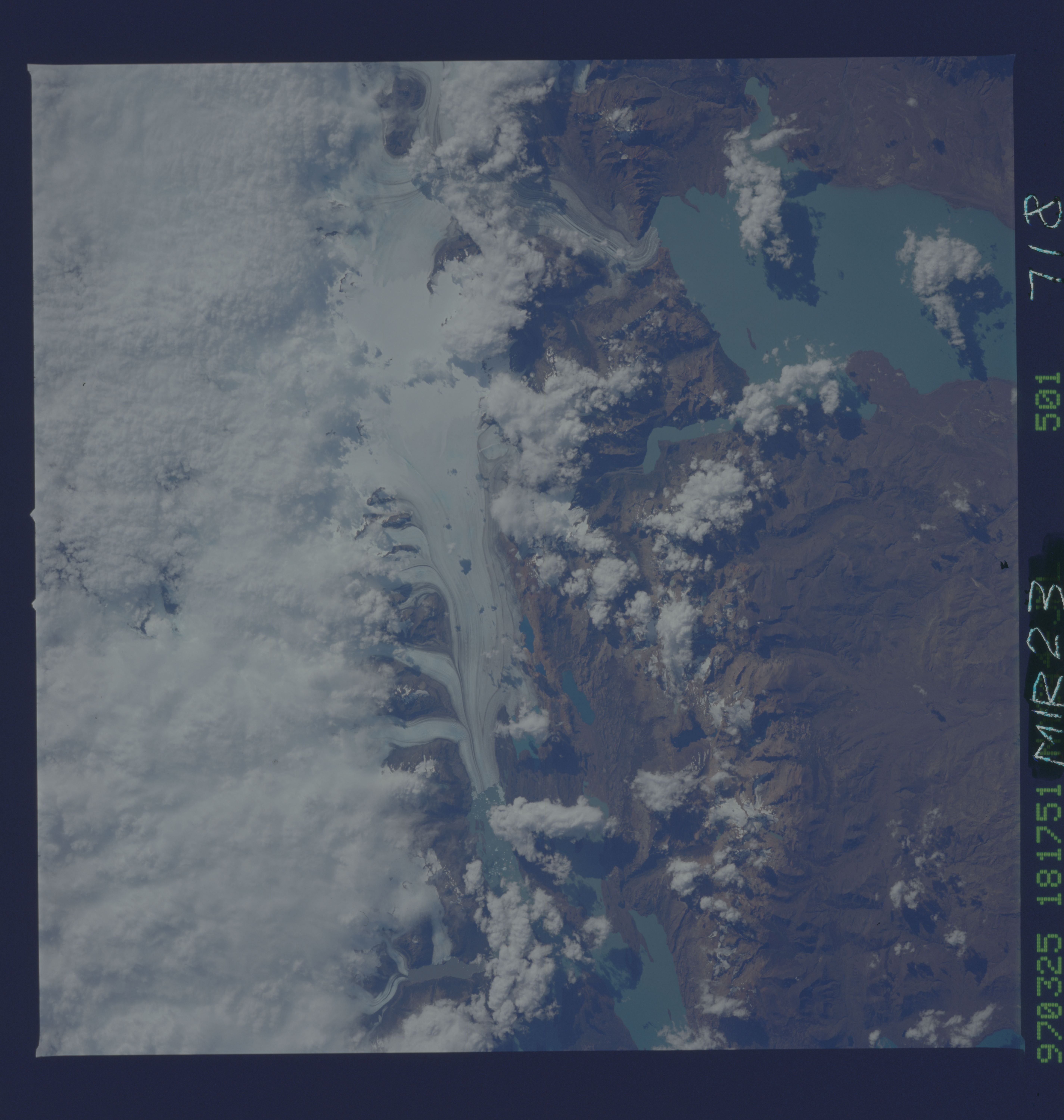
Image Caption: NM23-718-501 Lake Viedma, Darwin Range Glaciers, Argentina Winter/Spring 1997
Although clouds cover most of the upper image (west), a small part of the Darwin Range ice field can be seen near the center; meltwater from the glacier enters the grayish-blue waters of Lake Viedma (lower right). The lake color is a result of the water containing rock flour - finely ground rock particles that are carried into glacial lakes by meltwater and remain in suspension. The ice fields of the southern Andes are remnants of a much larger glacier that covered the area 15,000 years ago. Melting of that large glacier started 13,000 years ago. During a glacial advance erosion caused by entrained boulder under the ice as well as the weight of the glacier creates basins. As glaciers in Argentina retreated, these large basin or troughs filled with meltwater to form the lakes that currently dot the area. The smaller present-day glaciers or ice fields are fed by the cool, moist westerly winds off the Pacific Ocean. The melting glaciers feed the lakes with fresh water. The outlet of Lake Viedma flows into Lake Argentino to the south. Lake Argentino is the source for Santa Cruz River, which flows eastward across Patagonia and into the Atlantic Ocean.
Although clouds cover most of the upper image (west), a small part of the Darwin Range ice field can be seen near the center; meltwater from the glacier enters the grayish-blue waters of Lake Viedma (lower right). The lake color is a result of the water containing rock flour - finely ground rock particles that are carried into glacial lakes by meltwater and remain in suspension. The ice fields of the southern Andes are remnants of a much larger glacier that covered the area 15,000 years ago. Melting of that large glacier started 13,000 years ago. During a glacial advance erosion caused by entrained boulder under the ice as well as the weight of the glacier creates basins. As glaciers in Argentina retreated, these large basin or troughs filled with meltwater to form the lakes that currently dot the area. The smaller present-day glaciers or ice fields are fed by the cool, moist westerly winds off the Pacific Ocean. The melting glaciers feed the lakes with fresh water. The outlet of Lake Viedma flows into Lake Argentino to the south. Lake Argentino is the source for Santa Cruz River, which flows eastward across Patagonia and into the Atlantic Ocean.
