NM22-746-81

| NASA Photo ID | NM22-746-81 |
| Focal Length | 100mm |
| Date taken | 1996.12.13 |
| Time taken | 12:24:26 GMT |

Cloud masks available for this image:
Spacecraft nadir point: 4.0° N, 34.9° E
Photo center point: 4.5° N, 36.0° E
Photo center point by machine learning:
Photo center point: 4.5° N, 36.0° E
Photo center point by machine learning:
Nadir to Photo Center: East
Spacecraft Altitude: 209 nautical miles (387km)
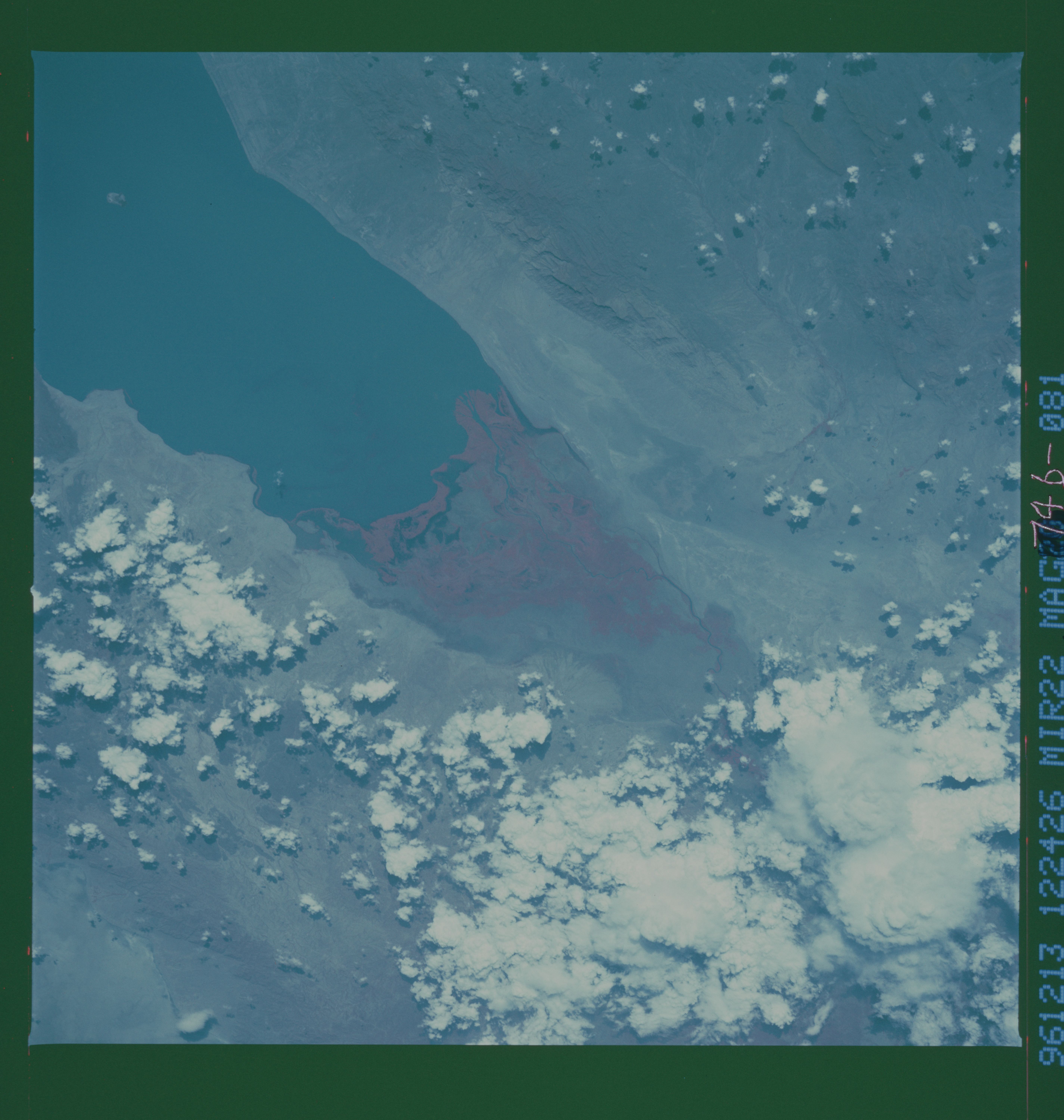
Country or Geographic Name: | ETHIOPIA |
Features: | LAKE TURKANA, SEDIMENT |
| Features Found Using Machine Learning: | |
Cloud Cover Percentage: | 20 (11-25)% |
Sun Elevation Angle: | 41° |
Sun Azimuth: | 235° |
Camera: | Hasselblad |
Focal Length: | 100mm |
Camera Tilt: | 19 degrees |
Format: | 2443: Kodak Aerochrome 2443, color IR, thin base, EA-5 process thru June 1999, E-6 process afterward |
Film Exposure: | Normal |
| Additional Information | |
| Width | Height | Annotated | Cropped | Purpose | Links |
|---|---|---|---|---|---|
| 5700 pixels | 6000 pixels | No | No | Download Image | |
| 500 pixels | 526 pixels | No | No | Download Image | |
| 948 pixels | 960 pixels | Yes | No | Download Image |
Download Packaged File
Download a Google Earth KML for this Image
View photo footprint information
Download a GeoTIFF for this photo
Image Caption: The Omo River drains southern Ethiopia and empties into Lake Turkana, Kenya. The delta has grown tremendously since the 1970s, in response to changes in landuse, resulting differences in sediment runoff, and lake level fluctuations. The growth continues to be rapid. The NM22 view is taken with Kodak color infrared film (Kodak 2443), and the red color highlights the thick vegetation growing on the delta. Compare with STS041-76-16 (1990) and note the new lobe of the delta which is building along the western edge of the main delta.
