NM22-737-63
| NASA Photo ID | NM22-737-63 |
| Focal Length | 100mm |
| Date taken | 1996.12.01 |
| Time taken | GMT |
Resolutions offered for this image:
4096 x 4096 pixels 640 x 640 pixels 5700 x 6000 pixels 500 x 526 pixels
4096 x 4096 pixels 640 x 640 pixels 5700 x 6000 pixels 500 x 526 pixels

Cloud masks available for this image:
Spacecraft nadir point:
Photo center point: 27.5° S, 56.5° W
Photo center point by machine learning:
Photo center point: 27.5° S, 56.5° W
Photo center point by machine learning:
Nadir to Photo Center: Northwest
Spacecraft Altitude: nautical miles (0km)
Camera: | Hasselblad |
Focal Length: | 100mm |
Camera Tilt: | Low Oblique |
Format: | 5046: Kodak, natural color positive, Lumiere 100/5046, ASA 100, standard base |
Film Exposure: | Normal |
| Additional Information | |
| Width | Height | Annotated | Cropped | Purpose | Links |
|---|---|---|---|---|---|
| 4096 pixels | 4096 pixels | No | No | Earth From Space collection | Download Image |
| 640 pixels | 640 pixels | No | No | Earth From Space collection | Download Image |
| 5700 pixels | 6000 pixels | No | No | Download Image | |
| 500 pixels | 526 pixels | No | No | Download Image |
Download Packaged File
Download a Google Earth KML for this Image
View photo footprint information
Download a GeoTIFF for this photo
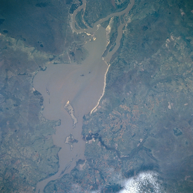
Image Caption: NM22-737-063 Yacyreta Dam, Argentina/Paraguay Winter/Spring 1997
The controversial Yacyreta Dam or Yacyreta hydroelectric project, named for an island in the Parana River, has been under construction since 1973. Additional engineering and environmental work remains before the project can be considered completed. The dam site is located west of Posadas, Argentina (city is not included in this picture) with Paraguay north of the reservoir and Argentina south of the reservoir. While the infrastructure of the two dam configuration is difficult to identify on this small-scale image, their actual locations can be ascertained by looking at the roughly triangular-shaped island in the Parana River (thin, slightly diagonal lines near top, center of the image). The 140 foot (43 meter) high Yacyreta Dam was built primarily to generate hydro-electricity for the shared benefit of Argentina and Paraguay. At the time that the photograph was acquired it appears that most of the reservoir has been filled and a considerable quantity of sediment can be observed in the reservoir. Wetlands exist on either side of the reservoir and the highly reflective, linear feature along the Paraguayan side of the image appears to be a levee.
The controversial Yacyreta Dam or Yacyreta hydroelectric project, named for an island in the Parana River, has been under construction since 1973. Additional engineering and environmental work remains before the project can be considered completed. The dam site is located west of Posadas, Argentina (city is not included in this picture) with Paraguay north of the reservoir and Argentina south of the reservoir. While the infrastructure of the two dam configuration is difficult to identify on this small-scale image, their actual locations can be ascertained by looking at the roughly triangular-shaped island in the Parana River (thin, slightly diagonal lines near top, center of the image). The 140 foot (43 meter) high Yacyreta Dam was built primarily to generate hydro-electricity for the shared benefit of Argentina and Paraguay. At the time that the photograph was acquired it appears that most of the reservoir has been filled and a considerable quantity of sediment can be observed in the reservoir. Wetlands exist on either side of the reservoir and the highly reflective, linear feature along the Paraguayan side of the image appears to be a levee.
