NM22-737-12
| NASA Photo ID | NM22-737-12 |
| Focal Length | 250mm |
| Date taken | 1996.11.25 |
| Time taken | GMT |
Resolutions offered for this image:
4088 x 4065 pixels 639 x 636 pixels 5700 x 6000 pixels 500 x 526 pixels
4088 x 4065 pixels 639 x 636 pixels 5700 x 6000 pixels 500 x 526 pixels

Cloud masks available for this image:
Spacecraft nadir point:
Photo center point: 20.5° S, 51.0° W
Photo center point by machine learning:
Photo center point: 20.5° S, 51.0° W
Photo center point by machine learning:
Nadir to Photo Center:
Spacecraft Altitude: nautical miles (0km)
Country or Geographic Name: | BRAZIL |
Features: | RES., RIO PARANA, R. TIETE |
| Features Found Using Machine Learning: | |
Cloud Cover Percentage: | 10 (1-10)% |
Sun Elevation Angle: | ° |
Sun Azimuth: | ° |
Camera: | Hasselblad |
Focal Length: | 250mm |
Camera Tilt: | Low Oblique |
Format: | 5046: Kodak, natural color positive, Lumiere 100/5046, ASA 100, standard base |
Film Exposure: | Normal |
| Additional Information | |
| Width | Height | Annotated | Cropped | Purpose | Links |
|---|---|---|---|---|---|
| 4088 pixels | 4065 pixels | No | No | Earth From Space collection | Download Image |
| 639 pixels | 636 pixels | No | No | Earth From Space collection | Download Image |
| 5700 pixels | 6000 pixels | No | No | Download Image | |
| 500 pixels | 526 pixels | No | No | Download Image |
Download Packaged File
Download a Google Earth KML for this Image
View photo footprint information
Download a GeoTIFF for this photo
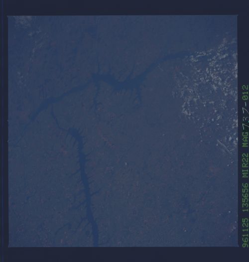
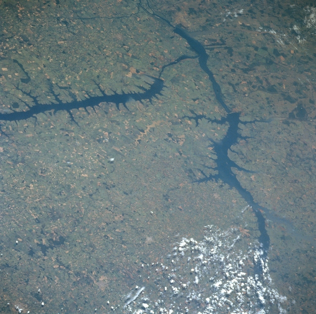
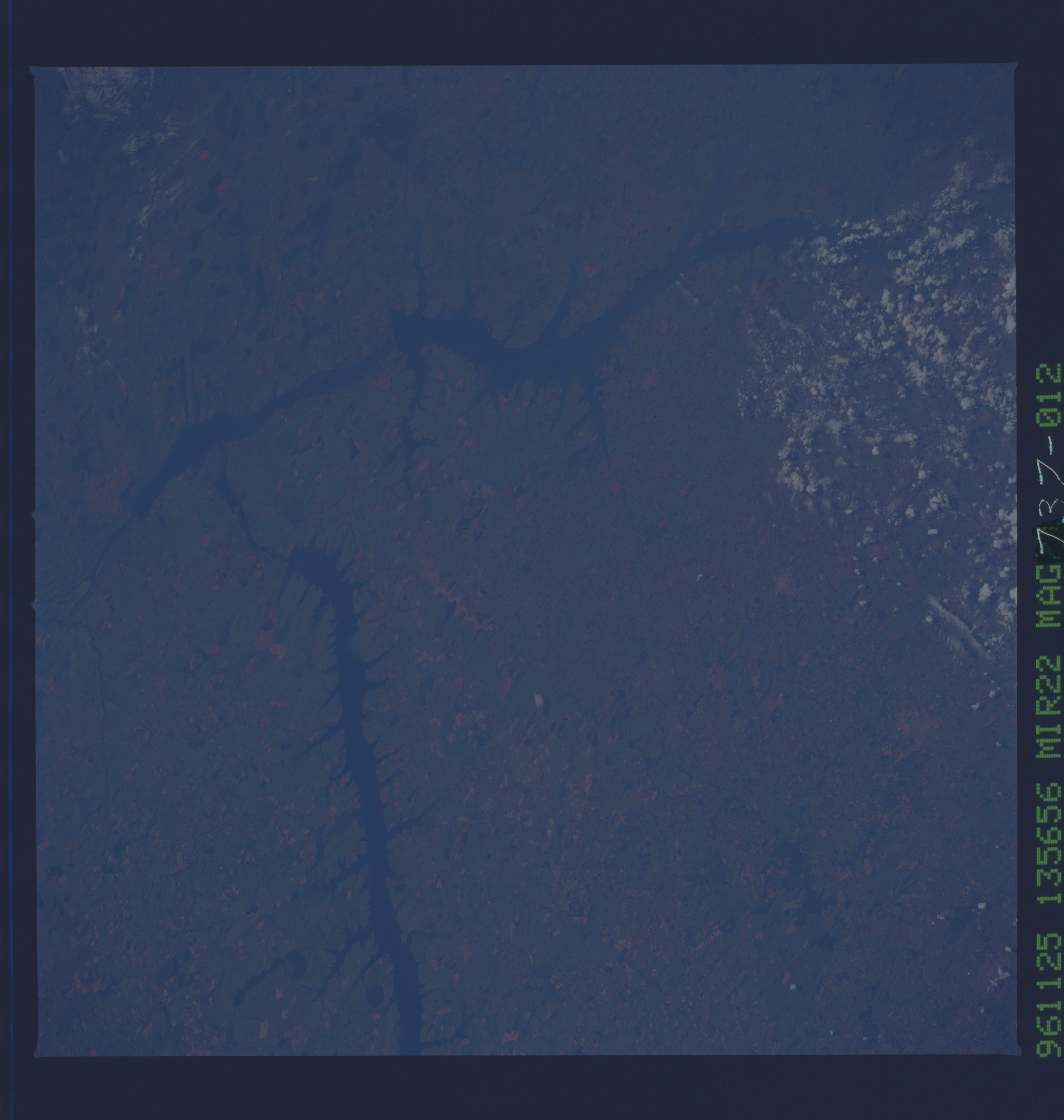
Image Caption: NM22-737-012 Tiete River, Ilha Solteira and the Jupia Reservoirs, Brazil Fall 1996
The Parana River, which has the second largest drainage system in South America behind the Amazon, can be seen exiting the scene at the top center of the image. Near the bottom right portion of the image, the Rio Grande and Paranaiba Rivers join together to form the Parana. The large reservoir seen extending from just above the left center of the image to just above the center of the image is a new reservoir built on the Tiete River, which joins the Parana in the DeJupia Reservoir. The landscape in this scene is hilly to flat terrain and is an extensive agricultural region in Brazil.
The Parana River, which has the second largest drainage system in South America behind the Amazon, can be seen exiting the scene at the top center of the image. Near the bottom right portion of the image, the Rio Grande and Paranaiba Rivers join together to form the Parana. The large reservoir seen extending from just above the left center of the image to just above the center of the image is a new reservoir built on the Tiete River, which joins the Parana in the DeJupia Reservoir. The landscape in this scene is hilly to flat terrain and is an extensive agricultural region in Brazil.
