NM21-774-49
| NASA Photo ID | NM21-774-49 |
| Focal Length | 250mm |
| Date taken | 1996.07.21 |
| Time taken | 15:15:39 GMT |
Resolutions offered for this image:
3904 x 3850 pixels 639 x 631 pixels 5700 x 6000 pixels 500 x 526 pixels
3904 x 3850 pixels 639 x 631 pixels 5700 x 6000 pixels 500 x 526 pixels
Cloud masks available for this image:
Spacecraft nadir point: 39.1° N, 76.8° W
Photo center point: 37.0° N, 76.5° W
Photo center point by machine learning:
Photo center point: 37.0° N, 76.5° W
Photo center point by machine learning:
Nadir to Photo Center: South
Spacecraft Altitude: 207 nautical miles (383km)
Country or Geographic Name: | USA-VIRGINIA |
Features: | NORFOLK, NEWPORT NEWS |
| Features Found Using Machine Learning: | |
Cloud Cover Percentage: | 0 (no clouds present) |
Sun Elevation Angle: | 58° |
Sun Azimuth: | 117° |
Camera: | Hasselblad |
Focal Length: | 250mm |
Camera Tilt: | 32 degrees |
Format: | 5046: Kodak, natural color positive, Lumiere 100/5046, ASA 100, standard base |
Film Exposure: | Normal |
| Additional Information | |
| Width | Height | Annotated | Cropped | Purpose | Links |
|---|---|---|---|---|---|
| 3904 pixels | 3850 pixels | No | No | Earth From Space collection | Download Image |
| 639 pixels | 631 pixels | No | No | Earth From Space collection | Download Image |
| 5700 pixels | 6000 pixels | No | No | Download Image | |
| 500 pixels | 526 pixels | No | No | Download Image |
Download Packaged File
Download a Google Earth KML for this Image
View photo footprint information
Download a GeoTIFF for this photo
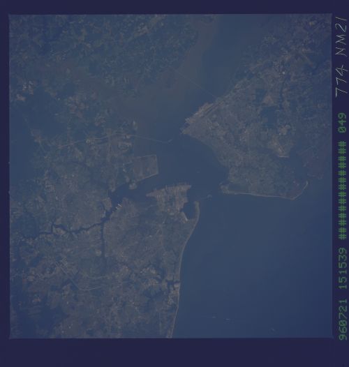
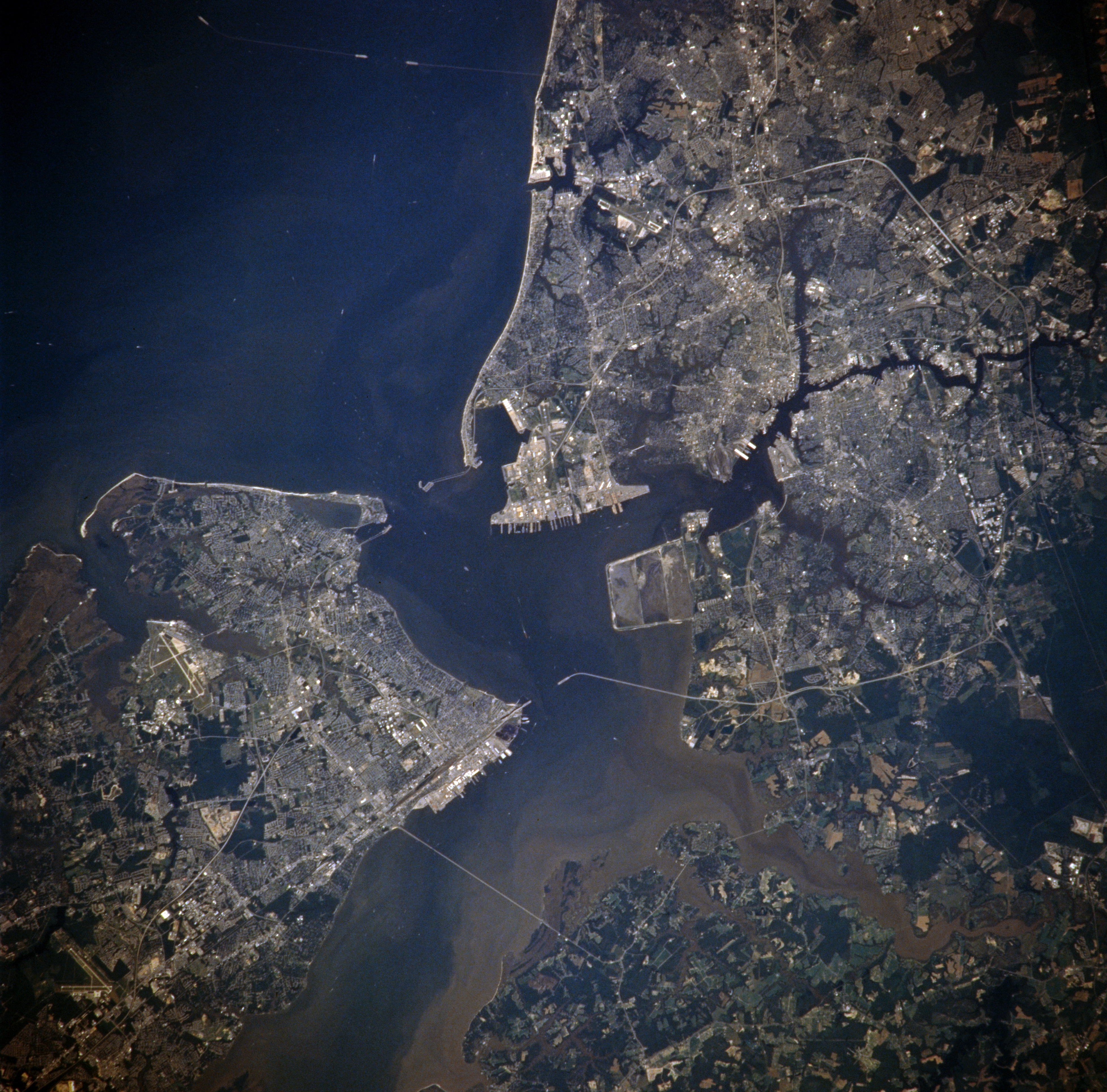
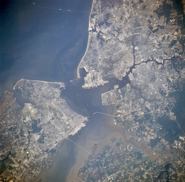
Image Caption: NM21-774-049 Newport News, Hampton, Portsmouth, And Norfolk, Virginia, U.S.A. Winter-Summer 1996
The Norfolk metropolitan area can be seen in this near vertical view. Vast amounts of sediment can be seen flowing into Hampton Roads from the James (bottom center) and Nasemond (bottom right) Rivers. Chesapeake Bay is visible in the upper right portion of the image. Barely discernible is the Chesapeake Bay bridge and tunnel road that connects mainland Virginia with the southern tip of the Delmarva Peninsula (upper right). The city of Norfolk is located on the south side of Hampton Roads on the Elizabeth River. Norfolk is a major port of entry in the eastern United States, and a major commercial, industrial, shipping, and distribution center. With the cities of Portsmouth and Newport News, Norfolk forms the port of Hampton Roads, one of the best natural harbors in the world. Norfolk and Portsmouth form an extensive naval complex and operations base (the largest in the United States). It is here in Hampton Roads in 1862 that a major Civil War battle between the ironclad ships Merrimack and Monitor was fought. It is also here in Norfolk that one of the United States most famous Army generals, Douglas MacArthur is buried.
The Norfolk metropolitan area can be seen in this near vertical view. Vast amounts of sediment can be seen flowing into Hampton Roads from the James (bottom center) and Nasemond (bottom right) Rivers. Chesapeake Bay is visible in the upper right portion of the image. Barely discernible is the Chesapeake Bay bridge and tunnel road that connects mainland Virginia with the southern tip of the Delmarva Peninsula (upper right). The city of Norfolk is located on the south side of Hampton Roads on the Elizabeth River. Norfolk is a major port of entry in the eastern United States, and a major commercial, industrial, shipping, and distribution center. With the cities of Portsmouth and Newport News, Norfolk forms the port of Hampton Roads, one of the best natural harbors in the world. Norfolk and Portsmouth form an extensive naval complex and operations base (the largest in the United States). It is here in Hampton Roads in 1862 that a major Civil War battle between the ironclad ships Merrimack and Monitor was fought. It is also here in Norfolk that one of the United States most famous Army generals, Douglas MacArthur is buried.
